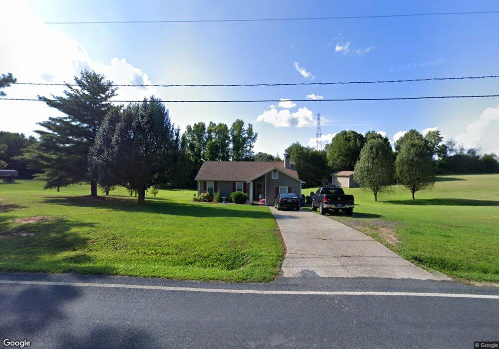
5349 Sapp Rd Kannapolis, NC 28083
Estimated Value: $278,000 - $291,000
4
Beds
2
Baths
1,534
Sq Ft
$185/Sq Ft
Est. Value
About This Home
This home is located at 5349 Sapp Rd, Kannapolis, NC 28083 and is currently estimated at $284,460, approximately $185 per square foot. 5349 Sapp Rd is a home located in Cabarrus County with nearby schools including Mount Pleasant Elementary School, Mount Pleasant Middle School, and Mount Pleasant High School.
Ownership History
Date
Name
Owned For
Owner Type
Purchase Details
Closed on
Jan 30, 1998
Sold by
Alan Thompson David and Alan Angela
Bought by
Blovsky James H and Blovsky Melissa S
Current Estimated Value
Home Financials for this Owner
Home Financials are based on the most recent Mortgage that was taken out on this home.
Original Mortgage
$87,000
Outstanding Balance
$15,497
Interest Rate
7.07%
Mortgage Type
Purchase Money Mortgage
Estimated Equity
$268,963
Purchase Details
Closed on
Mar 1, 1994
Purchase Details
Closed on
Oct 1, 1991
Create a Home Valuation Report for This Property
The Home Valuation Report is an in-depth analysis detailing your home's value as well as a comparison with similar homes in the area
Home Values in the Area
Average Home Value in this Area
Purchase History
| Date | Buyer | Sale Price | Title Company |
|---|---|---|---|
| Blovsky James H | $95,000 | -- | |
| -- | $83,000 | -- | |
| -- | $66,000 | -- |
Source: Public Records
Mortgage History
| Date | Status | Borrower | Loan Amount |
|---|---|---|---|
| Open | Blovsky James H | $87,000 |
Source: Public Records
Tax History
| Year | Tax Paid | Tax Assessment Tax Assessment Total Assessment is a certain percentage of the fair market value that is determined by local assessors to be the total taxable value of land and additions on the property. | Land | Improvement |
|---|---|---|---|---|
| 2025 | $1,600 | $236,640 | $51,710 | $184,930 |
| 2024 | $1,600 | $236,640 | $51,710 | $184,930 |
| 2023 | $1,143 | $136,090 | $27,220 | $108,870 |
| 2022 | $1,119 | $136,090 | $27,220 | $108,870 |
| 2021 | $1,119 | $136,090 | $27,220 | $108,870 |
| 2020 | $1,119 | $136,090 | $27,220 | $108,870 |
| 2019 | $969 | $117,750 | $24,490 | $93,260 |
| 2018 | $945 | $117,750 | $24,490 | $93,260 |
| 2017 | $922 | $117,750 | $24,490 | $93,260 |
| 2016 | $922 | $112,220 | $25,860 | $86,360 |
| 2015 | -- | $112,220 | $25,860 | $86,360 |
| 2014 | -- | $112,220 | $25,860 | $86,360 |
Source: Public Records
Map
Nearby Homes
- 5391 Sapp Rd
- 5875 Irish Potato Rd
- 3560 New Potato Dr
- 5295 Sapp Rd
- 4614 Irish Potato Rd
- 5027 Old Salisbury Concord Rd
- 11237 Old Concord Rd
- 3830 Old Salisbury Concord Rd
- 320 Tree Limb Ln
- 3397 Camp Julia Rd
- 3246 Camp Julia Rd
- 3241 Ian Patrick Ave
- 2707 Ireton Place
- 1103 Hastings Ct
- 145 Wellington Estates Dr
- 165 Wellington Estates Dr
- 1045 Churchfield Ln
- 2882 Centergrove Rd
- 4210 Old Beatty Ford Rd
- 2640 Centergrove Rd
- 5377 Sapp Rd
- 5300 Sapp Rd
- 5384 Sapp Rd
- 5311 Tanbark Ln
- 5307 Tanbark Ln
- 5319 Tanbark Ln
- 5323 Tanbark Ln
- 5310 Teakwood Dr
- 5423 Sapp Rd
- 5304 Teakwood Dr
- 5405 Sapp Rd
- 5306 Tanbark Ln
- 5397 Irish Potato Rd
- 5310 Tanbark Ln
- 5318 Tanbark Ln
- 5475 Irish Potato Rd
- 5322 Tanbark Ln
- 5327 Irish Potato Rd
- 5424 Irish Potato Rd
- 5480 Irish Potato Rd
Your Personal Tour Guide
Ask me questions while you tour the home.