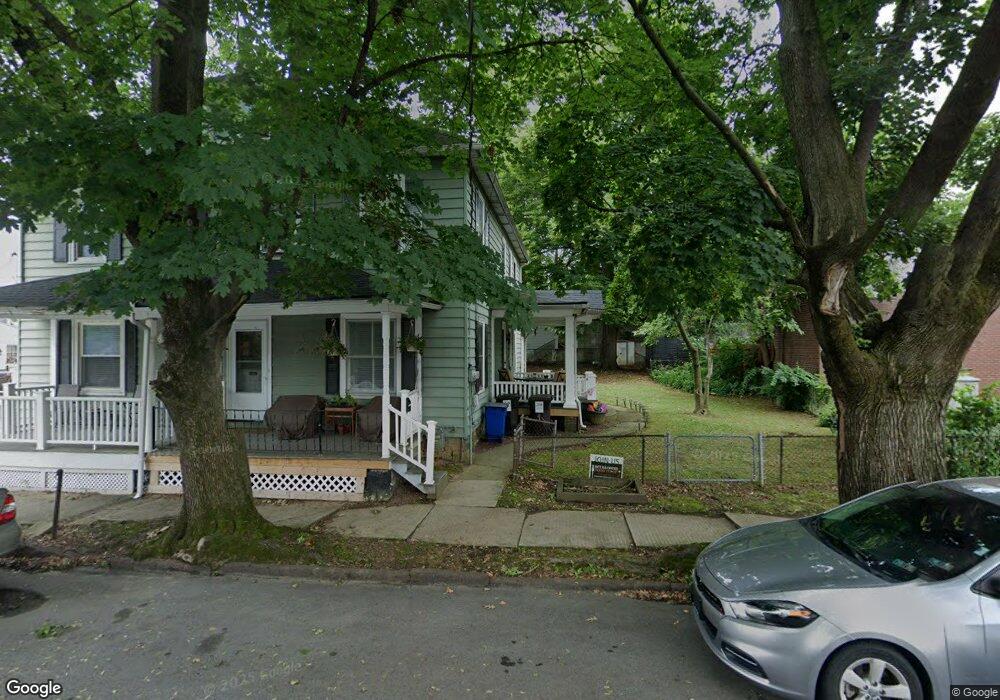
535 Maple St Bethlehem, PA 18018
Downtown Bethlehem NeighborhoodEstimated Value: $250,827 - $305,000
2
Beds
2
Baths
1,632
Sq Ft
$175/Sq Ft
Est. Value
About This Home
This home is located at 535 Maple St, Bethlehem, PA 18018 and is currently estimated at $285,457, approximately $174 per square foot. 535 Maple St is a home located in Northampton County with nearby schools including Thomas Jefferson Elementary School, Northeast Middle School, and Liberty High School.
Ownership History
Date
Name
Owned For
Owner Type
Purchase Details
Closed on
Apr 12, 2013
Sold by
Pereira Glen A and Pereira Glenn A
Bought by
Pereira Glenn A
Current Estimated Value
Home Financials for this Owner
Home Financials are based on the most recent Mortgage that was taken out on this home.
Original Mortgage
$93,000
Outstanding Balance
$65,883
Interest Rate
3.55%
Mortgage Type
New Conventional
Estimated Equity
$219,574
Purchase Details
Closed on
Jun 1, 2000
Bought by
Pereira Glen A
Create a Home Valuation Report for This Property
The Home Valuation Report is an in-depth analysis detailing your home's value as well as a comparison with similar homes in the area
Home Values in the Area
Average Home Value in this Area
Purchase History
| Date | Buyer | Sale Price | Title Company |
|---|---|---|---|
| Pereira Glenn A | -- | None Available | |
| Pereira Glen A | $79,500 | -- |
Source: Public Records
Mortgage History
| Date | Status | Borrower | Loan Amount |
|---|---|---|---|
| Open | Pereira Glenn A | $93,000 |
Source: Public Records
Tax History Compared to Growth
Tax History
| Year | Tax Paid | Tax Assessment Tax Assessment Total Assessment is a certain percentage of the fair market value that is determined by local assessors to be the total taxable value of land and additions on the property. | Land | Improvement |
|---|---|---|---|---|
| 2025 | $411 | $38,100 | $13,000 | $25,100 |
| 2024 | $3,368 | $38,100 | $13,000 | $25,100 |
| 2023 | $3,368 | $38,100 | $13,000 | $25,100 |
| 2022 | $3,341 | $38,100 | $13,000 | $25,100 |
| 2021 | $3,319 | $38,100 | $13,000 | $25,100 |
| 2020 | $3,287 | $38,100 | $13,000 | $25,100 |
| 2019 | $5,093 | $38,100 | $13,000 | $25,100 |
| 2018 | $3,197 | $38,100 | $13,000 | $25,100 |
| 2017 | $3,158 | $38,100 | $13,000 | $25,100 |
| 2016 | -- | $38,100 | $13,000 | $25,100 |
| 2015 | -- | $38,100 | $13,000 | $25,100 |
| 2014 | -- | $38,100 | $13,000 | $25,100 |
Source: Public Records
Map
Nearby Homes
- 533 Maple St
- 336 E Broad St
- 340 E Broad St
- 330 E Broad St
- 326 E Broad St
- 326 E Broad St Unit 2
- 326 E Broad St Unit 1-R
- 326 E Broad St Unit 2FF
- 326 E Broad St Unit 2R
- 328 E Broad St
- 525 Maple St
- 322 E Broad St
- 538 Maple St
- 535 Pulaski St
- 519 Maple St
- 536 Maple St
- 522 Pulaski St
- 316 E Broad St
- 531 Pulaski St
- 528 Maple St