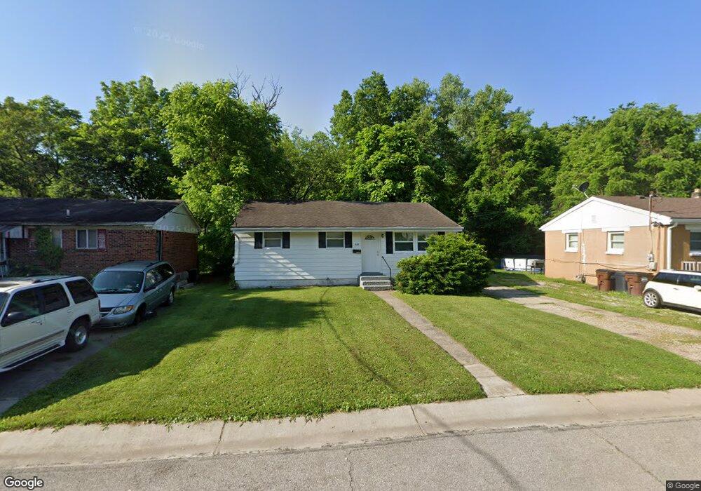
535 Matthews Dr Cincinnati, OH 45215
Estimated Value: $103,000 - $189,000
2
Beds
1
Bath
936
Sq Ft
$140/Sq Ft
Est. Value
About This Home
This home is located at 535 Matthews Dr, Cincinnati, OH 45215 and is currently estimated at $130,864, approximately $139 per square foot. 535 Matthews Dr is a home located in Hamilton County with nearby schools including Lincoln Heights Elementary School, Princeton Community Middle School, and Princeton High School.
Ownership History
Date
Name
Owned For
Owner Type
Purchase Details
Closed on
Jun 20, 2008
Sold by
Toran Lamon W
Bought by
Lot King Limited Partnership
Current Estimated Value
Purchase Details
Closed on
May 17, 2004
Sold by
Lot King Lp
Bought by
Toran Lamont W
Home Financials for this Owner
Home Financials are based on the most recent Mortgage that was taken out on this home.
Original Mortgage
$44,900
Interest Rate
5.85%
Mortgage Type
Seller Take Back
Purchase Details
Closed on
Apr 20, 2004
Sold by
Jacobs Edward E and Carter Sharon
Bought by
Lot King Ltd Pa
Home Financials for this Owner
Home Financials are based on the most recent Mortgage that was taken out on this home.
Original Mortgage
$44,900
Interest Rate
5.85%
Mortgage Type
Seller Take Back
Purchase Details
Closed on
Jan 7, 1999
Sold by
Estate Of Corbett Harvey
Bought by
Carter Sharon and Harvey Gregory
Create a Home Valuation Report for This Property
The Home Valuation Report is an in-depth analysis detailing your home's value as well as a comparison with similar homes in the area
Home Values in the Area
Average Home Value in this Area
Purchase History
| Date | Buyer | Sale Price | Title Company |
|---|---|---|---|
| Lot King Limited Partnership | $14,000 | None Available | |
| Toran Lamont W | $49,900 | -- | |
| Lot King Ltd Pa | $9,000 | -- | |
| Carter Sharon | -- | -- |
Source: Public Records
Mortgage History
| Date | Status | Borrower | Loan Amount |
|---|---|---|---|
| Previous Owner | Toran Lamont W | $44,900 |
Source: Public Records
Tax History Compared to Growth
Tax History
| Year | Tax Paid | Tax Assessment Tax Assessment Total Assessment is a certain percentage of the fair market value that is determined by local assessors to be the total taxable value of land and additions on the property. | Land | Improvement |
|---|---|---|---|---|
| 2024 | $1,419 | $20,552 | $1,652 | $18,900 |
| 2023 | $1,401 | $20,552 | $1,652 | $18,900 |
| 2022 | $909 | $8,687 | $1,652 | $7,035 |
| 2021 | $906 | $8,687 | $1,652 | $7,035 |
| 2020 | $899 | $8,687 | $1,652 | $7,035 |
| 2019 | $948 | $8,687 | $1,652 | $7,035 |
| 2018 | $918 | $8,687 | $1,652 | $7,035 |
| 2017 | $895 | $8,687 | $1,652 | $7,035 |
| 2016 | $898 | $9,986 | $2,097 | $7,889 |
| 2015 | $948 | $9,986 | $2,097 | $7,889 |
| 2014 | $954 | $9,986 | $2,097 | $7,889 |
| 2013 | $1,159 | $12,485 | $2,622 | $9,863 |
Source: Public Records
Map
Nearby Homes
- 10122 Grandview Ave
- 949 Adams St
- 502 Marion Rd
- 10164 Wayne Ave
- 1757 Woodruff Ln
- 1708 Harmon Dr
- 1271 Timberland Dr
- 112 W Leslie Ave
- 55 Bonham Rd
- 0 Adams St
- 505 Glendale Milford Rd
- 22 Ritchie Ave
- 964 Shepherd Ln
- 1239 Springfield Pike
- 11 Diplomat Dr
- 10110 Woodstock Dr
- 126 Riddle Rd
- 10060 Ronnie Rd
- 155 Bonham Rd
- 1337 Shepherd Ln
- 529 Matthews Dr
- 551 Matthews Dr
- 584 Hope Ave
- 534 Matthews Dr
- 556 Matthews Dr
- 558 Matthews Dr
- 530 Matthews Dr
- 9983 Chester Rd
- 572 Matthews Dr
- 9971 Chester Rd
- 584 Matthews Dr
- 550 Van Buren Ave
- 536 Van Buren Ave
- 9987 Chester Rd
- 500 Matthews Dr
- 9969 Chester Rd
- 493 Matthews Dr
- 600 Matthews Dr
- 9997 Chester Rd
- 492 Matthews Dr