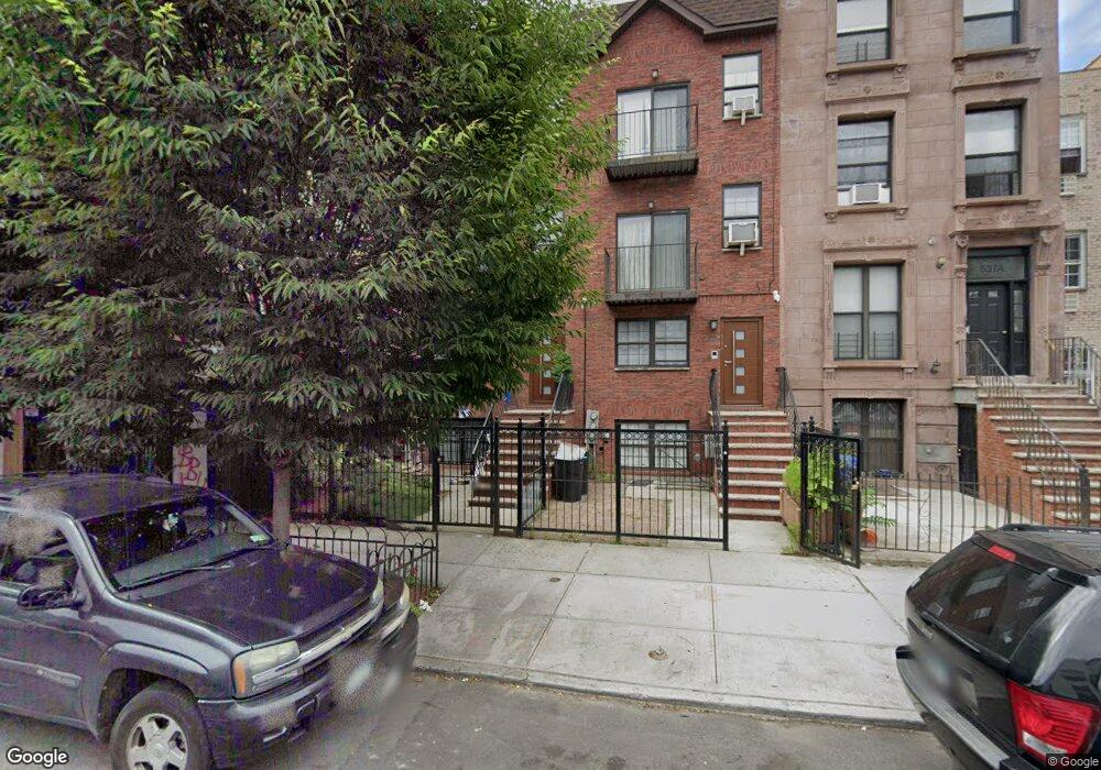
535 Quincy St Brooklyn, NY 11221
Bed-Stuy NeighborhoodEstimated Value: $1,603,000 - $2,502,106
--
Bed
--
Bath
3,668
Sq Ft
$543/Sq Ft
Est. Value
About This Home
This home is located at 535 Quincy St, Brooklyn, NY 11221 and is currently estimated at $1,992,777, approximately $543 per square foot. 535 Quincy St is a home located in Kings County with nearby schools including P.S. 308 Clara Cardwell, Success Academy Charter School-NYC 9, and Unity Preparatory Charter School of Brooklyn.
Ownership History
Date
Name
Owned For
Owner Type
Purchase Details
Closed on
Jan 3, 2012
Sold by
Ens Development Inc
Bought by
Robinson George and Robinson Trevor
Current Estimated Value
Home Financials for this Owner
Home Financials are based on the most recent Mortgage that was taken out on this home.
Original Mortgage
$576,710
Outstanding Balance
$395,375
Interest Rate
3.98%
Mortgage Type
New Conventional
Estimated Equity
$1,597,402
Create a Home Valuation Report for This Property
The Home Valuation Report is an in-depth analysis detailing your home's value as well as a comparison with similar homes in the area
Home Values in the Area
Average Home Value in this Area
Purchase History
| Date | Buyer | Sale Price | Title Company |
|---|---|---|---|
| Robinson George | $592,000 | -- |
Source: Public Records
Mortgage History
| Date | Status | Borrower | Loan Amount |
|---|---|---|---|
| Open | Robinson George | $576,710 |
Source: Public Records
Tax History Compared to Growth
Tax History
| Year | Tax Paid | Tax Assessment Tax Assessment Total Assessment is a certain percentage of the fair market value that is determined by local assessors to be the total taxable value of land and additions on the property. | Land | Improvement |
|---|---|---|---|---|
| 2025 | $9,213 | $151,680 | $13,020 | $138,660 |
| 2024 | $9,213 | $119,820 | $13,020 | $106,800 |
| 2023 | $9,245 | $124,860 | $13,020 | $111,840 |
| 2022 | $8,574 | $136,800 | $13,020 | $123,780 |
| 2021 | $8,527 | $105,600 | $13,020 | $92,580 |
| 2020 | $3,999 | $107,160 | $13,020 | $94,140 |
| 2019 | $7,996 | $106,320 | $13,020 | $93,300 |
| 2018 | $7,733 | $37,937 | $6,726 | $31,211 |
| 2017 | $7,296 | $35,790 | $10,008 | $25,782 |
| 2016 | $6,750 | $33,765 | $9,641 | $24,124 |
| 2015 | $71 | $31,854 | $621 | $31,233 |
| 2014 | $71 | $586 | $586 | $0 |
Source: Public Records
Map
Nearby Homes
- 554 Lexington Ave
- 220 Lewis Ave
- 609 Lexington Ave
- 491 Monroe St Unit 3A
- 521 Monroe St
- 514 Monroe St
- 0 Monroe St Unit KEYH6299681
- 532 Monroe St Unit TH
- 490A Monroe St
- 481 Madison St
- 554A Monroe St
- 284 Van Buren St
- 840 Greene Ave
- 686 Greene Ave
- 569 Monroe St
- 621 Putnam Ave
- 867 Lafayette Ave
- 184 Stuyvesant Ave Unit D5
- 299 Van Buren St Unit 4C
- 411 Monroe St Unit Multi-family 2 Units
- 533A Quincy St
- 537 Quincy St Unit 2
- 537 Quincy St Unit 3
- 537 Quincy St
- 533 Quincy St
- 537A Quincy St
- 537A Quincy St Unit 3
- 537A Quincy St Unit 2
- 531 Quincy St
- 539 Quincy St
- 539 Quincy St Unit 2
- 529A Quincy St
- 529A Quincy St Unit 1
- 541 Quincy St
- 541 Quincy St Unit Building
- 529 Quincy St
- 529 Quincy St Unit 1
- 541A Quincy St
- 552 Lexington Ave Unit 2
- 552 Lexington Ave