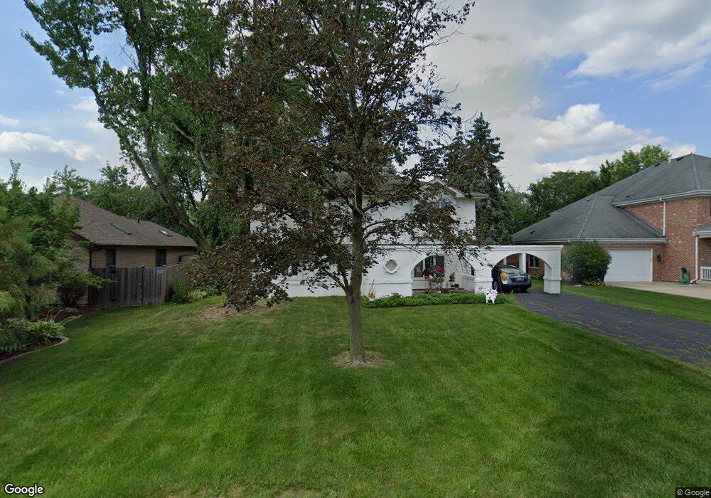
535 W 56th St Hinsdale, IL 60521
Estimated Value: $645,765 - $761,000
--
Bed
--
Bath
2,080
Sq Ft
$331/Sq Ft
Est. Value
About This Home
This home is located at 535 W 56th St, Hinsdale, IL 60521 and is currently estimated at $688,941, approximately $331 per square foot. 535 W 56th St is a home located in DuPage County with nearby schools including Holmes Elementary School, Maercker Elementary School, and Westview Hills Middle School.
Ownership History
Date
Name
Owned For
Owner Type
Purchase Details
Closed on
Oct 8, 2002
Sold by
Brennan Dennis A
Bought by
Brennan Dennis A and Brennan Mary J
Current Estimated Value
Purchase Details
Closed on
May 20, 1994
Sold by
Steger Cynthia L
Bought by
Brennan Dennis A
Home Financials for this Owner
Home Financials are based on the most recent Mortgage that was taken out on this home.
Original Mortgage
$151,125
Interest Rate
8.5%
Mortgage Type
FHA
Create a Home Valuation Report for This Property
The Home Valuation Report is an in-depth analysis detailing your home's value as well as a comparison with similar homes in the area
Home Values in the Area
Average Home Value in this Area
Purchase History
| Date | Buyer | Sale Price | Title Company |
|---|---|---|---|
| Brennan Dennis A | -- | -- | |
| Brennan Dennis A | $155,000 | Land Title Co |
Source: Public Records
Mortgage History
| Date | Status | Borrower | Loan Amount |
|---|---|---|---|
| Closed | Brennan Dennis A | $151,125 |
Source: Public Records
Tax History Compared to Growth
Tax History
| Year | Tax Paid | Tax Assessment Tax Assessment Total Assessment is a certain percentage of the fair market value that is determined by local assessors to be the total taxable value of land and additions on the property. | Land | Improvement |
|---|---|---|---|---|
| 2024 | $8,151 | $162,474 | $93,355 | $69,119 |
| 2023 | $7,813 | $149,360 | $85,820 | $63,540 |
| 2022 | $7,690 | $146,290 | $84,060 | $62,230 |
| 2021 | $7,452 | $144,620 | $83,100 | $61,520 |
| 2020 | $7,315 | $141,750 | $81,450 | $60,300 |
| 2019 | $7,076 | $136,010 | $78,150 | $57,860 |
| 2018 | $6,212 | $120,930 | $77,700 | $43,230 |
| 2017 | $5,499 | $109,440 | $74,770 | $34,670 |
| 2016 | $5,408 | $104,450 | $71,360 | $33,090 |
| 2015 | $5,347 | $98,270 | $67,140 | $31,130 |
| 2014 | $5,146 | $94,110 | $65,280 | $28,830 |
| 2013 | $5,011 | $93,660 | $64,970 | $28,690 |
Source: Public Records
Map
Nearby Homes
- 928 S Monroe St
- 5720 S Madison St
- 903 S Madison St
- 5524 S Bruner St
- 422 58th Place Unit 7
- 5701 Foxgate Ln
- 424 Ashbury Dr Unit 39
- 5545 S Stough St
- 494 Old Surrey Rd Unit C
- 80 W Kennedy Ln Unit 304
- 544 W 7th St
- 24 S Washington Cir
- 28 E 55th St
- 818 W 58th St
- 626 S Bodin St
- 946 S Garfield St
- 531 Carlysle Dr Unit 9
- 501 Carlysle Dr Unit 9
- 550 Chase Dr Unit 2
- 550 Chase Dr Unit 14
- 529 W 56th St
- 541 W 56th St
- 5539 S Monroe St
- 519 W 56th St
- 5535 S Monroe St
- 532 W 56th St
- 5547 S Monroe St
- 542 W 56th St
- 5529 S Monroe St
- 515 W 56th St
- 5610 S Thurlow St
- 5605 S Monroe St
- 520 W 56th St
- 5523 S Monroe St
- 5611 S Thurlow St
- 5613 S Monroe St
- 5618 S Thurlow St
- 5517 S Monroe St
- 602 Hillside Dr
- 508 W 56th St