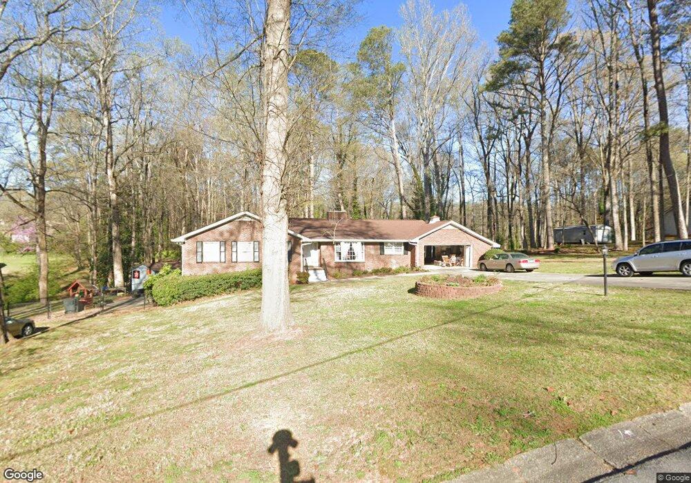
5350 Birdsong Ln Unit 2 Austell, GA 30106
Estimated Value: $300,000 - $357,000
3
Beds
2
Baths
1,911
Sq Ft
$166/Sq Ft
Est. Value
About This Home
This home is located at 5350 Birdsong Ln Unit 2, Austell, GA 30106 and is currently estimated at $317,426, approximately $166 per square foot. 5350 Birdsong Ln Unit 2 is a home located in Cobb County with nearby schools including Deerwood Elementary School, Austell Elementary School, and Garrett Middle School.
Ownership History
Date
Name
Owned For
Owner Type
Purchase Details
Closed on
Aug 31, 2022
Sold by
Huey Bratton Sr Richard
Bought by
D And R Bratton Family Trust
Current Estimated Value
Purchase Details
Closed on
Sep 9, 2020
Sold by
Bratton Richard H and Bratton Doris Olean
Bought by
Bratton Richard Huey and Bratton Doris Olean
Purchase Details
Closed on
May 9, 1994
Sold by
James Patricia N
Bought by
Bratton Richard H Doris
Create a Home Valuation Report for This Property
The Home Valuation Report is an in-depth analysis detailing your home's value as well as a comparison with similar homes in the area
Home Values in the Area
Average Home Value in this Area
Purchase History
| Date | Buyer | Sale Price | Title Company |
|---|---|---|---|
| D And R Bratton Family Trust | -- | -- | |
| D And R Bratton Family Trust | -- | -- | |
| Bratton Richard Huey | -- | None Available | |
| Bratton Richard H Doris | $94,000 | -- |
Source: Public Records
Mortgage History
| Date | Status | Borrower | Loan Amount |
|---|---|---|---|
| Closed | Bratton Richard H Doris | -- |
Source: Public Records
Tax History Compared to Growth
Tax History
| Year | Tax Paid | Tax Assessment Tax Assessment Total Assessment is a certain percentage of the fair market value that is determined by local assessors to be the total taxable value of land and additions on the property. | Land | Improvement |
|---|---|---|---|---|
| 2025 | $646 | $134,764 | $30,000 | $104,764 |
| 2024 | $649 | $134,764 | $30,000 | $104,764 |
| 2023 | $447 | $136,220 | $20,000 | $116,220 |
| 2022 | $555 | $103,592 | $10,000 | $93,592 |
| 2021 | $459 | $71,340 | $10,000 | $61,340 |
| 2020 | $459 | $71,340 | $10,000 | $61,340 |
| 2019 | $410 | $54,976 | $6,000 | $48,976 |
| 2018 | $410 | $54,976 | $6,000 | $48,976 |
| 2017 | $366 | $54,976 | $6,000 | $48,976 |
| 2016 | $322 | $40,276 | $6,000 | $34,276 |
| 2015 | $343 | $40,276 | $6,000 | $34,276 |
| 2014 | $206 | $26,084 | $0 | $0 |
Source: Public Records
Map
Nearby Homes
- 1971 Annette Ln
- 1803 Gherry Dr
- 1943 Arnold Dr
- 1 Perkerson Mill Rd SW
- 2136 Perkerson Mill Rd SW
- 5025 Bishops Row SW
- 5164 Medford Ln
- 5154 Medford Ln
- 1841 Mobley St
- 0 Harris St Unit 7661273
- 5466 Davis Dr
- 5410 Beth Dr
- 2070 Ravencliff Dr
- 2179 Warren Dr
- 5320 Beth Dr
- Bayberry Plan at Sawmill Creek - Bungalow Series
- Wisteria Plan at Sawmill Creek - Bungalow Series
- Redbud Plan at Sawmill Creek - Bungalow Series
- 5425 Davis Dr
- Laurel Plan at Avenbrook
- 5338 Birdsong Ln Unit 2
- 2020 Gherry Dr
- 2050 Gherry Dr
- 2033 Brannon Dr
- 2008 Gherry Dr
- 2060 Gherry Ct
- 2019 Brannon Dr
- 2041 Gherry Dr
- 0 Gherry Ct Unit 7037864
- 0 Gherry Ct Unit 7293856
- 2029 Gherry Dr
- 2051 Gherry Dr
- 2035 Brannon Dr
- 2017 Gherry Dr
- 1996 Gherry Dr
- 2070 Gherry Ct
- 2030 Brannon Dr
- 1997 Brannon Dr Unit 1
- 2005 Gherry Dr
- 2037 Brannon Dr