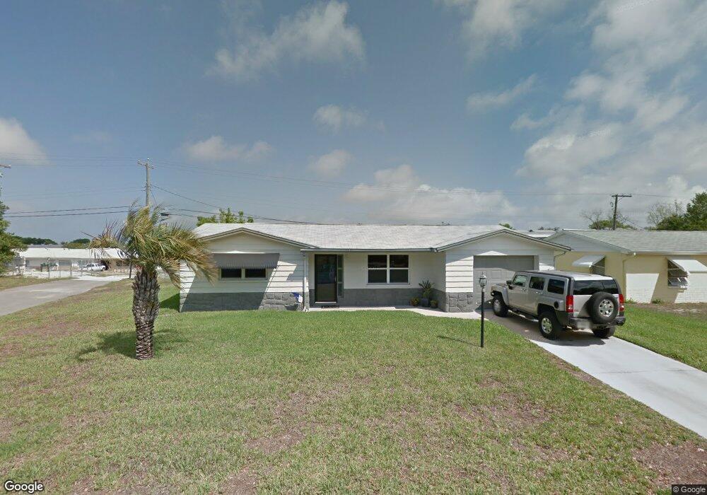
5351 Mac Arthur Ave New Port Richey, FL 34652
Estimated Value: $189,000 - $216,000
2
Beds
2
Baths
1,054
Sq Ft
$193/Sq Ft
Est. Value
About This Home
This home is located at 5351 Mac Arthur Ave, New Port Richey, FL 34652 and is currently estimated at $202,930, approximately $192 per square foot. 5351 Mac Arthur Ave is a home located in Pasco County with nearby schools including Mittye P. Locke Elementary School, Richey Elementary School, and Gulf Middle School.
Ownership History
Date
Name
Owned For
Owner Type
Purchase Details
Closed on
Sep 26, 1996
Sold by
Thergesen Margaret E
Bought by
Westmoreland Dennis R and Westmoreland Cathy L
Current Estimated Value
Home Financials for this Owner
Home Financials are based on the most recent Mortgage that was taken out on this home.
Original Mortgage
$35,665
Outstanding Balance
$2,968
Interest Rate
7.85%
Mortgage Type
New Conventional
Estimated Equity
$199,962
Create a Home Valuation Report for This Property
The Home Valuation Report is an in-depth analysis detailing your home's value as well as a comparison with similar homes in the area
Home Values in the Area
Average Home Value in this Area
Purchase History
| Date | Buyer | Sale Price | Title Company |
|---|---|---|---|
| Westmoreland Dennis R | $36,500 | -- |
Source: Public Records
Mortgage History
| Date | Status | Borrower | Loan Amount |
|---|---|---|---|
| Open | Westmoreland Dennis R | $35,665 |
Source: Public Records
Tax History Compared to Growth
Tax History
| Year | Tax Paid | Tax Assessment Tax Assessment Total Assessment is a certain percentage of the fair market value that is determined by local assessors to be the total taxable value of land and additions on the property. | Land | Improvement |
|---|---|---|---|---|
| 2025 | $1,387 | $112,510 | -- | -- |
| 2024 | $1,387 | $109,340 | -- | -- |
| 2023 | $1,479 | $106,160 | $0 | $0 |
| 2022 | $1,339 | $103,070 | $0 | $0 |
| 2021 | $1,303 | $100,077 | $16,952 | $83,125 |
| 2020 | $1,369 | $82,756 | $8,547 | $74,209 |
| 2019 | $1,299 | $73,955 | $8,547 | $65,408 |
| 2018 | $1,171 | $62,426 | $8,547 | $53,879 |
| 2017 | $875 | $41,177 | $8,547 | $32,630 |
| 2016 | $826 | $40,129 | $8,547 | $31,582 |
| 2015 | $819 | $38,867 | $8,547 | $30,320 |
| 2014 | $785 | $38,115 | $8,547 | $29,568 |
Source: Public Records
Map
Nearby Homes
- 4526 Annette St
- 4520 Iris Dr
- 4608 Kennedy Dr
- 4746 Azalea Dr Unit 107
- 4746 Azalea Dr Unit 209
- 4746 Azalea Dr Unit 201
- 4746 Azalea Dr Unit 105
- 4614 Croton Dr
- 4742 Azalea Dr Unit 103
- 4742 Azalea Dr Unit 106
- 4744 Azalea Dr Unit 203
- 4548 Somerset Place
- 5330 Poinsettia Dr
- 4453 Terry Loop
- 5419 Palm Dr Unit 130
- 5753 10th Ave
- 4923 Azalea Dr
- 4618 Pirate Place
- 5316 Drift Tide Dr
- 4424 Terry Loop
- 5407 Mac Arthur Ave
- 5352 Mac Arthur Ave
- 5337 Mac Arthur Ave
- 5336 Mac Arthur Ave
- 5406 Mac Arthur Ave
- 5413 Mac Arthur Ave
- 5345 Embassy Ave
- 5345 Embassy Ave Unit 102F
- 5349 Embassy Ave Unit 103F
- 5341 Embassy Ave
- 5353 Embassy Ave Unit 104F
- 5353 Embassy Ave
- 5403 Embassy Ave
- 5403 Embassy Ave
- 4547 Blanche St
- 4542 Grand Central Ave Unit B
- 4542 Grand Central Ave
- 5328 Mac Arthur Ave
- 5331 Mac Arthur Ave
- 4545 Grand Central Ave