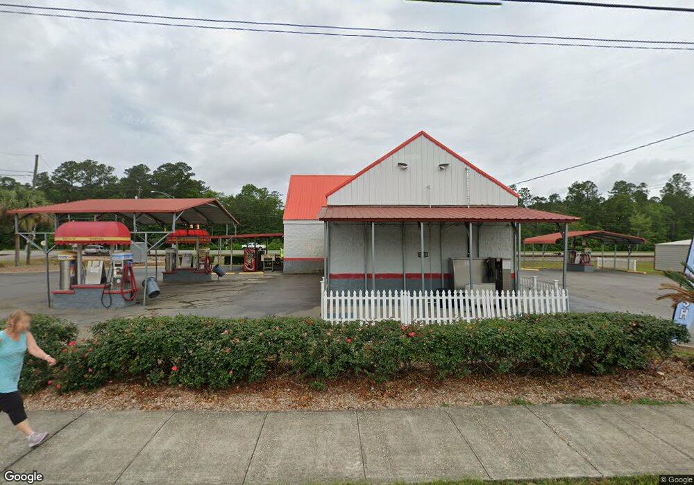
5351 Old Highway 43 Satsuma, AL 36572
Estimated Value: $441,640
--
Bed
--
Bath
--
Sq Ft
1.39
Acres
About This Home
This home is located at 5351 Old Highway 43, Satsuma, AL 36572 and is currently priced at $441,640. 5351 Old Highway 43 is a home located in Mobile County with nearby schools including Robert E. Lee Elementary School, Satsuma High School, and Satsuma Christian School.
Ownership History
Date
Name
Owned For
Owner Type
Purchase Details
Closed on
Aug 24, 2015
Sold by
Stevens Mildred R and Stevens Daniel A
Bought by
Palm Breeze Carwash Llc
Current Estimated Value
Purchase Details
Closed on
Feb 24, 2003
Sold by
Smith Aline B
Bought by
Stevens Daniel A and Stevens Mildred R
Purchase Details
Closed on
Jun 15, 1998
Sold by
Bayou Constr Co Inc
Bought by
Rolls Robert Wesley and Rolls Michelle Bradley
Home Financials for this Owner
Home Financials are based on the most recent Mortgage that was taken out on this home.
Original Mortgage
$10,200
Interest Rate
7.21%
Mortgage Type
Seller Take Back
Create a Home Valuation Report for This Property
The Home Valuation Report is an in-depth analysis detailing your home's value as well as a comparison with similar homes in the area
Home Values in the Area
Average Home Value in this Area
Purchase History
| Date | Buyer | Sale Price | Title Company |
|---|---|---|---|
| Palm Breeze Carwash Llc | -- | None Available | |
| Stevens Daniel A | -- | -- | |
| Rolls Robert Wesley | $11,000 | -- |
Source: Public Records
Mortgage History
| Date | Status | Borrower | Loan Amount |
|---|---|---|---|
| Previous Owner | Rolls Robert Wesley | $10,200 |
Source: Public Records
Tax History Compared to Growth
Tax History
| Year | Tax Paid | Tax Assessment Tax Assessment Total Assessment is a certain percentage of the fair market value that is determined by local assessors to be the total taxable value of land and additions on the property. | Land | Improvement |
|---|---|---|---|---|
| 2024 | $9,873 | $161,860 | $14,360 | $147,500 |
| 2023 | $9,873 | $164,640 | $60,540 | $104,100 |
| 2022 | $7,088 | $116,200 | $12,100 | $104,100 |
| 2021 | $7,088 | $116,200 | $12,100 | $104,100 |
| 2020 | $7,211 | $118,220 | $12,100 | $106,120 |
| 2019 | $6,205 | $101,720 | $0 | $0 |
| 2018 | $6,205 | $101,720 | $0 | $0 |
| 2017 | $5,786 | $94,860 | $0 | $0 |
| 2016 | $1,665 | $27,300 | $0 | $0 |
| 2013 | $1,596 | $26,160 | $0 | $0 |
Source: Public Records
Map
Nearby Homes
- 100 Baker Rd
- 39 Brice Ave
- 0 Willie Crook Ave
- 5503 Darring St
- 5509 Darring St
- 5303 U S 43
- 315 Thunderbird Dr
- 5454 Colony Trace Ct
- 150 Orange Ave E
- 0 Travellers Ct Unit 34 0653435
- 152 Dewitt Ave
- 336 Avondale Ct
- 5366 Scanlan Way E
- 5640 Orchard St
- 207 Maple Ave E
- 334 Avondale Ave
- 0 Orchard St
- 5463 Barbara Dr
- 0 Baldwin St
- 0 Travelers Ct Unit 34 315632
- 5352 Old Highway 43
- 5340 Old Highway 43
- 5358 Old Highway 43
- 5321 Old Highway 43
- 5364 Old Highway 43
- 5312 Old Highway 43
- 14 Oak Ave
- 16 Oak Ave
- 5308 Old Highway 43
- 5307 Old Highway 43
- 5368 Old Highway 43
- 17 Oak Ave
- 3 Lemans Dr N
- 24 Oak Ave
- 5 Lemans Dr N
- 6 Oak Ave
- 5289 Old Highway 43
- 21 Oak Ave
- 18 Willie Crook Ave
- 9 Lemans Dr N