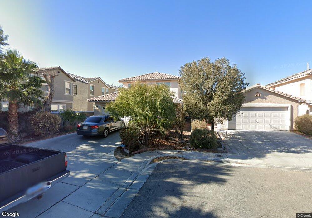
5351 Walcott Dr Las Vegas, NV 89118
Estimated Value: $398,000 - $544,000
3
Beds
3
Baths
1,727
Sq Ft
$258/Sq Ft
Est. Value
About This Home
This home is located at 5351 Walcott Dr, Las Vegas, NV 89118 and is currently estimated at $446,420, approximately $258 per square foot. 5351 Walcott Dr is a home located in Clark County with nearby schools including Helen Jydstrup Elementary School, Grant Sawyer Middle School, and Durango High School.
Ownership History
Date
Name
Owned For
Owner Type
Purchase Details
Closed on
Nov 22, 2000
Sold by
Kaufman & Broad Of Nevada Inc
Bought by
Han Ki Soo and Han Amy Y S
Current Estimated Value
Home Financials for this Owner
Home Financials are based on the most recent Mortgage that was taken out on this home.
Original Mortgage
$140,800
Outstanding Balance
$51,808
Interest Rate
7.86%
Mortgage Type
Purchase Money Mortgage
Estimated Equity
$394,612
Create a Home Valuation Report for This Property
The Home Valuation Report is an in-depth analysis detailing your home's value as well as a comparison with similar homes in the area
Home Values in the Area
Average Home Value in this Area
Purchase History
| Date | Buyer | Sale Price | Title Company |
|---|---|---|---|
| Han Ki Soo | $148,211 | First American Title Co |
Source: Public Records
Mortgage History
| Date | Status | Borrower | Loan Amount |
|---|---|---|---|
| Open | Han Ki Soo | $140,800 |
Source: Public Records
Tax History Compared to Growth
Tax History
| Year | Tax Paid | Tax Assessment Tax Assessment Total Assessment is a certain percentage of the fair market value that is determined by local assessors to be the total taxable value of land and additions on the property. | Land | Improvement |
|---|---|---|---|---|
| 2025 | $1,816 | $100,342 | $30,800 | $69,542 |
| 2024 | $1,764 | $100,342 | $30,800 | $69,542 |
| 2023 | $1,422 | $96,480 | $30,800 | $65,680 |
| 2022 | $1,712 | $85,246 | $25,200 | $60,046 |
| 2021 | $1,663 | $81,282 | $24,150 | $57,132 |
| 2020 | $1,611 | $78,273 | $21,700 | $56,573 |
| 2019 | $1,592 | $75,043 | $19,250 | $55,793 |
| 2018 | $1,519 | $68,886 | $15,400 | $53,486 |
| 2017 | $2,010 | $68,551 | $14,350 | $54,201 |
| 2016 | $1,422 | $65,666 | $11,550 | $54,116 |
| 2015 | $1,419 | $55,034 | $7,000 | $48,034 |
| 2014 | $1,377 | $45,567 | $7,000 | $38,567 |
Source: Public Records
Map
Nearby Homes
- 5404 Walcott Dr
- 5645 Warm Light St
- 5354 Silver Branch Ave
- 5607 W Dewey Dr
- 6210 W Quail Ave
- 5461 Dungaree St
- 5691 Leaning Oak Ave
- 5449 Dungaree St
- 0 Mohawk St Unit 2675414
- 5790 Westwind Rd
- 5434 Lost Ln
- 5508 Ness Ave
- 5055 W Hacienda Ave Unit 1046
- 5055 W Hacienda Ave Unit 2142
- 5055 W Hacienda Ave Unit 1095
- 5055 W Hacienda Ave Unit 2003
- 5055 W Hacienda Ave Unit 2102
- 5055 W Hacienda Ave Unit 2041
- 5055 W Hacienda Ave Unit 1136
- 5055 W Hacienda Ave Unit 1161
- 5351 Walcott Dr Unit n/a
- 5359 Walcott Dr
- 5384 Blustery Towns Ave
- 5388 Blustery Towns Ave
- 5380 Blustery Towns Ave
- 5371 Walcott Dr Unit 1
- 5376 Blustery Towns Ave
- 5384R Blustery Towns Ave
- 5396 Blustery Towns Ave
- 5372 Blustery Towns Ave
- 5383 Walcott Dr
- 5368 Blustery Towns Ave
- 5596 Doubleday St
- 5590 Doubleday St
- 5602 Doubleday St
- 5364 Blustery Towns Ave
- 5584 Doubleday St
- 5608 Doubleday St
- 5578 Doubleday St
- 5360 Blustery Towns Ave