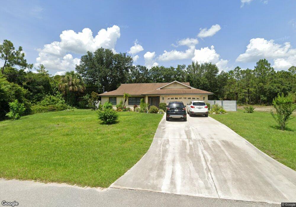
5352 Baker Rd North Port, FL 34288
Estimated Value: $264,000 - $335,000
3
Beds
2
Baths
1,443
Sq Ft
$214/Sq Ft
Est. Value
About This Home
This home is located at 5352 Baker Rd, North Port, FL 34288 and is currently estimated at $309,300, approximately $214 per square foot. 5352 Baker Rd is a home located in Sarasota County with nearby schools including Atwater Elementary School, North Port High School, and Woodland Middle School.
Ownership History
Date
Name
Owned For
Owner Type
Purchase Details
Closed on
Nov 20, 2009
Sold by
Ofano Stephen D
Bought by
Lindstrom Mark L
Current Estimated Value
Purchase Details
Closed on
Mar 21, 1997
Sold by
Veach Vernon W and Veach Reva
Bought by
Ofano Stephen D
Home Financials for this Owner
Home Financials are based on the most recent Mortgage that was taken out on this home.
Original Mortgage
$86,450
Interest Rate
7.69%
Create a Home Valuation Report for This Property
The Home Valuation Report is an in-depth analysis detailing your home's value as well as a comparison with similar homes in the area
Home Values in the Area
Average Home Value in this Area
Purchase History
| Date | Buyer | Sale Price | Title Company |
|---|---|---|---|
| Lindstrom Mark L | $120,000 | Attorney | |
| Ofano Stephen D | $91,000 | -- |
Source: Public Records
Mortgage History
| Date | Status | Borrower | Loan Amount |
|---|---|---|---|
| Previous Owner | Ofano Stephen D | $86,450 |
Source: Public Records
Tax History Compared to Growth
Tax History
| Year | Tax Paid | Tax Assessment Tax Assessment Total Assessment is a certain percentage of the fair market value that is determined by local assessors to be the total taxable value of land and additions on the property. | Land | Improvement |
|---|---|---|---|---|
| 2024 | $413 | $107,485 | -- | -- |
| 2023 | $1,686 | $100,154 | $0 | $0 |
| 2022 | $414 | $101,437 | $0 | $0 |
| 2021 | $1,634 | $98,483 | $0 | $0 |
| 2020 | $1,604 | $97,123 | $0 | $0 |
| 2019 | $1,555 | $94,939 | $0 | $0 |
| 2018 | $0 | $93,169 | $0 | $0 |
| 2017 | $1,400 | $91,253 | $0 | $0 |
| 2016 | $1,392 | $127,700 | $3,200 | $124,500 |
| 2015 | $1,401 | $107,200 | $2,900 | $104,300 |
| 2014 | $1,374 | $86,750 | $0 | $0 |
Source: Public Records
Map
Nearby Homes
- 5471 Baker
- 0 Belgrave Terrace Unit C7411714
- 1216 Barstow
- 13 Belcher Ave
- 0 Custer Lot #25 Cir Unit MFRC7512895
- 0 Cole Ct
- 9 Bannock Cir
- 0 Bannock Cir Unit MFRC7509520
- 0 Bannock Cir Unit 223029846
- 5769 E Price Blvd
- LOT 7 Clattleya Ave
- 0 Clattleya Ave Unit MFRD6140654
- 0 Clattleya Ave Unit MFRA4653702
- LOT 1 Dustin Rd
- 0 Sword St
- 0 Littlefield Ln Unit MFRA4579067
- 0 Bannock Cir Unit MFRC7492578
- 1123232630 Brolly St
- 5909 Bibb Ct
- 0 Guiana Dr
- 1111 Beatty Ave
- 0 Beatty Lot 14 Ave Unit D6115063
- Beatty Ave
- 5399 Baker Rd
- 0 Baker #23
- 5285 Barcelona Dr
- 1161 Baywood Ave
- 1187 Baywood Ave
- Barstow Ave
- Barstow Ave
- Barstow Ave
- Barstow Ave
- Baywood Ave
- Baywood Ave
- 5495 Baker Rd
- 1213 Baywood Ave
- 12 Baywood Ave
- 5382 Barcelona Dr
- Lot 6 Baywood Ave
- TBD Baywood Ave