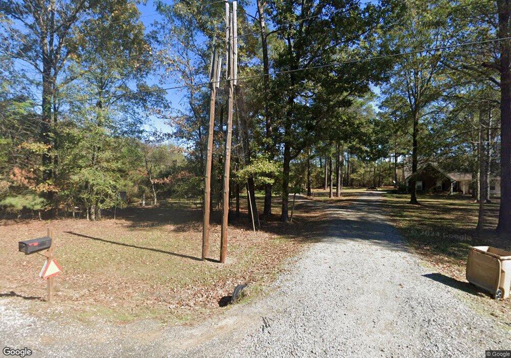
5352 Highway 139 Collinston, LA 71229
Estimated Value: $229,744 - $358,000
4
Beds
2
Baths
2,664
Sq Ft
$105/Sq Ft
Est. Value
About This Home
This home is located at 5352 Highway 139, Collinston, LA 71229 and is currently estimated at $280,581, approximately $105 per square foot. 5352 Highway 139 is a home located in Ouachita Parish with nearby schools including Swartz Lower Elementary School, Swartz Upper Elementary School, and Ouachita Junior High School.
Ownership History
Date
Name
Owned For
Owner Type
Purchase Details
Closed on
Aug 5, 2014
Sold by
Hart Phillip L and Hart Pamela L
Bought by
Carter John Paul
Current Estimated Value
Purchase Details
Closed on
Jun 26, 2013
Sold by
Hart Phillip L and Hart Pamela
Bought by
Heartland Investors and Us Bank
Create a Home Valuation Report for This Property
The Home Valuation Report is an in-depth analysis detailing your home's value as well as a comparison with similar homes in the area
Purchase History
| Date | Buyer | Sale Price | Title Company |
|---|---|---|---|
| Carter John Paul | $180,000 | None Available | |
| Heartland Investors | $1,381 | None Available |
Source: Public Records
Tax History
| Year | Tax Paid | Tax Assessment Tax Assessment Total Assessment is a certain percentage of the fair market value that is determined by local assessors to be the total taxable value of land and additions on the property. | Land | Improvement |
|---|---|---|---|---|
| 2024 | $1,880 | $13,536 | $664 | $12,872 |
| 2023 | $1,894 | $13,536 | $664 | $12,872 |
| 2022 | $1,853 | $13,536 | $664 | $12,872 |
| 2021 | $1,868 | $13,536 | $664 | $12,872 |
| 2020 | $1,868 | $13,536 | $664 | $12,872 |
| 2019 | $1,842 | $13,535 | $663 | $12,872 |
| 2018 | $1,760 | $13,535 | $663 | $12,872 |
| 2017 | $1,804 | $13,535 | $663 | $12,872 |
| 2016 | $1,760 | $15,622 | $2,750 | $12,872 |
| 2015 | $1,054 | $15,622 | $2,750 | $12,872 |
| 2014 | $1,064 | $15,622 | $2,750 | $12,872 |
| 2013 | $1,062 | $15,622 | $2,750 | $12,872 |
Source: Public Records
Map
Nearby Homes
- 4232 Highway 134
- TBD Louisiana 139
- 4025 Highway 134
- 0 Sivils Rd
- 0 Morgan Hare Rd Unit 11234661
- 4360 Hwy 134 Unit 1
- 6402 Paulette Pipes Rd
- 3585 Doss Hwy
- 000 Louisiana 134
- 0 Collinston Rd Hwy 593 Unit 169757
- 1172 Morgan Hare Rd
- 114 Wham Dr
- 109 Wham Dr
- 110 Wham Dr
- 102 Wham Dr
- 113 Wham Dr
- 106 Wham Dr
- 108 Wham Dr
- 107 Caroline Ln
- 103 Caroline Ln
- 5352 Highway 139
- 5352 Highway 139 Unit Ouachita Parish
- 5339 Highway 139
- 5313 Highway 139
- 5410 Highway 139
- 5410 Highway 139
- 5282 Highway 139
- 5282 Highway 139
- 5359 Highway 139
- 5299 Highway 139
- 5262 Highway 139
- 5433 Highway 139
- 5205 Highway 139
- 5451 Highway 139
- 5509 Highway 139
- 5537 Highway 139
- 5073 Highway 139
- 5059 Highway 139
- 5037 Highway 139
- 5037 Highway 139
