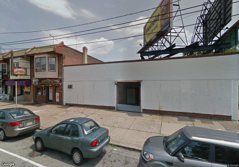
5353 Oxford Ave Philadelphia, PA 19124
Frankford NeighborhoodEstimated Value: $334,909
--
Bed
--
Bath
4,340
Sq Ft
$77/Sq Ft
Est. Value
About This Home
This home is located at 5353 Oxford Ave, Philadelphia, PA 19124 and is currently priced at $334,909, approximately $77 per square foot. 5353 Oxford Ave is a home located in Philadelphia County with nearby schools including Frankford High School, The Philadelphia Charter School for the Arts & Sciences, and St Martin Of Tours Catholic School.
Ownership History
Date
Name
Owned For
Owner Type
Purchase Details
Closed on
Jul 1, 2015
Sold by
Buttsy S Auto Parts Inc
Bought by
Lin Mao Wang and Gao Zhu Ying
Current Estimated Value
Home Financials for this Owner
Home Financials are based on the most recent Mortgage that was taken out on this home.
Original Mortgage
$119,000
Outstanding Balance
$92,301
Interest Rate
3.87%
Mortgage Type
Commercial
Purchase Details
Closed on
Aug 1, 1994
Sold by
Philadelphia Authority For Industrial De
Bought by
Blitsys Auto Parts Inc
Create a Home Valuation Report for This Property
The Home Valuation Report is an in-depth analysis detailing your home's value as well as a comparison with similar homes in the area
Home Values in the Area
Average Home Value in this Area
Purchase History
| Date | Buyer | Sale Price | Title Company |
|---|---|---|---|
| Lin Mao Wang | $170,000 | None Available | |
| Blitsys Auto Parts Inc | -- | -- |
Source: Public Records
Mortgage History
| Date | Status | Borrower | Loan Amount |
|---|---|---|---|
| Open | Lin Mao Wang | $119,000 |
Source: Public Records
Tax History Compared to Growth
Tax History
| Year | Tax Paid | Tax Assessment Tax Assessment Total Assessment is a certain percentage of the fair market value that is determined by local assessors to be the total taxable value of land and additions on the property. | Land | Improvement |
|---|---|---|---|---|
| 2026 | $10,248 | $712,600 | $225,480 | $487,120 |
| 2025 | $10,248 | $712,680 | $225,560 | $487,120 |
| 2024 | $10,248 | $712,680 | $225,560 | $487,120 |
| 2023 | $10,248 | $732,100 | $226,172 | $505,928 |
| 2022 | $10,248 | $732,100 | $226,172 | $505,928 |
| 2021 | $8,101 | $0 | $0 | $0 |
| 2020 | $8,101 | $0 | $0 | $0 |
| 2019 | $8,052 | $0 | $0 | $0 |
| 2018 | $8,063 | $0 | $0 | $0 |
| 2017 | $6,050 | $0 | $0 | $0 |
| 2016 | $5,962 | $0 | $0 | $0 |
| 2015 | $5,791 | $0 | $0 | $0 |
| 2014 | -- | $432,200 | $85,000 | $347,200 |
| 2012 | -- | $66,208 | $17,605 | $48,603 |
Source: Public Records
Map
Nearby Homes
- 1048 Bridge St
- 1137 Bridge St
- 5661 Miriam Rd
- 5659 Miriam Rd
- 1431 Rosalie St
- 5640 Miriam Rd
- 5347 Sylvester St
- 996 Anchor St
- 1244 E Sanger St
- 991 Carver St
- 5902 E Roosevelt Blvd
- 1204 Pratt St
- 1218 Pratt St
- 1220 Pratt St
- 1225 E Cheltenham Ave
- 972 Bridge St
- 5900 Loretto Ave
- 1211 E Cheltenham Ave
- 7753 E Roosevelt Blvd
- 5451 Oakland St
- 5355 Oxford Ave Unit B
- 5355 Oxford Ave Unit A
- 5355 Oxford Ave
- 5349 Oxford Ave
- 5359 Oxford Ave
- 1022 E Sanger St
- 1024 E Sanger St
- 1020 E Sanger St
- 1026 E Sanger St
- 1028 E Sanger St
- 1030 E Sanger St
- 1032 E Sanger St
- 5325 Oxford Ave
- 1034 E Sanger St
- 5323 Oxford Ave
- 5344 Large St
- 5400 Rutland St
- 5350 Large St
- 5321 Oxford Ave
- 5321 Oxford Ave Unit 2ND FLOOR