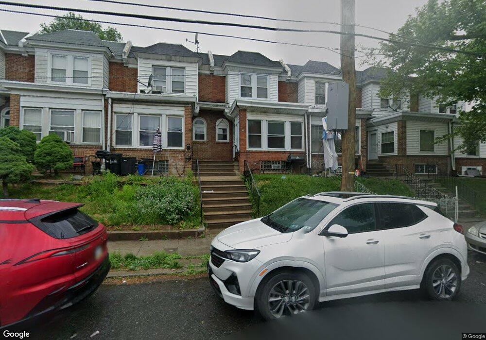
5354 Large St Philadelphia, PA 19124
Frankford NeighborhoodEstimated Value: $195,048 - $237,000
3
Beds
1
Bath
1,320
Sq Ft
$169/Sq Ft
Est. Value
About This Home
This home is located at 5354 Large St, Philadelphia, PA 19124 and is currently estimated at $223,262, approximately $169 per square foot. 5354 Large St is a home located in Philadelphia County with nearby schools including Frankford High School, The Philadelphia Charter School for the Arts & Sciences, and Northwood Academy Charter School.
Ownership History
Date
Name
Owned For
Owner Type
Purchase Details
Closed on
Jun 29, 2001
Sold by
Goldstein Fred J and Goldstein Tina M
Bought by
Muldor Janis
Current Estimated Value
Home Financials for this Owner
Home Financials are based on the most recent Mortgage that was taken out on this home.
Original Mortgage
$52,484
Outstanding Balance
$19,757
Interest Rate
7.14%
Mortgage Type
FHA
Estimated Equity
$203,505
Create a Home Valuation Report for This Property
The Home Valuation Report is an in-depth analysis detailing your home's value as well as a comparison with similar homes in the area
Home Values in the Area
Average Home Value in this Area
Purchase History
| Date | Buyer | Sale Price | Title Company |
|---|---|---|---|
| Muldor Janis | $52,900 | -- |
Source: Public Records
Mortgage History
| Date | Status | Borrower | Loan Amount |
|---|---|---|---|
| Open | Muldor Janis | $52,484 |
Source: Public Records
Tax History Compared to Growth
Tax History
| Year | Tax Paid | Tax Assessment Tax Assessment Total Assessment is a certain percentage of the fair market value that is determined by local assessors to be the total taxable value of land and additions on the property. | Land | Improvement |
|---|---|---|---|---|
| 2026 | $2,021 | $176,500 | $35,300 | $141,200 |
| 2025 | $2,021 | $176,500 | $35,300 | $141,200 |
| 2024 | $2,021 | $176,500 | $35,300 | $141,200 |
| 2023 | $2,021 | $144,400 | $28,800 | $115,600 |
| 2022 | $883 | $99,400 | $28,800 | $70,600 |
| 2021 | $1,513 | $0 | $0 | $0 |
| 2020 | $1,513 | $0 | $0 | $0 |
| 2019 | $1,452 | $0 | $0 | $0 |
| 2018 | $927 | $0 | $0 | $0 |
| 2017 | $1,347 | $0 | $0 | $0 |
| 2016 | $927 | $0 | $0 | $0 |
| 2015 | $887 | $0 | $0 | $0 |
| 2014 | -- | $96,200 | $14,880 | $81,320 |
| 2012 | -- | $13,344 | $1,317 | $12,027 |
Source: Public Records
Map
Nearby Homes
- 1137 Bridge St
- 1048 Bridge St
- 1431 Rosalie St
- 5347 Sylvester St
- 1244 E Sanger St
- 5661 Miriam Rd
- 5659 Miriam Rd
- 1204 Pratt St
- 5451 Oakland St
- 5422 Akron St
- 1218 Pratt St
- 5304 Akron St
- 1220 Pratt St
- 5902 E Roosevelt Blvd
- 5345 Akron St
- 5431 Akron St
- 1530 Van Kirk St
- 5640 Miriam Rd
- 5828 Akron St
- 5241 Akron St
- 5356 Large St
- 5352 Large St
- 5358 Large St
- 5350 Large St
- 5360 Large St
- 5348 Large St
- 1034 E Sanger St
- 5346 Large St
- 1032 E Sanger St
- 5344 Large St
- 1030 E Sanger St
- 5342 Large St
- 1028 E Sanger St
- 5340 Large St
- 1026 E Sanger St
- 5338 Large St
- 5400 Large St Unit 1ST FL
- 5400 Large St
- 5355 Large St
- 1024 E Sanger St