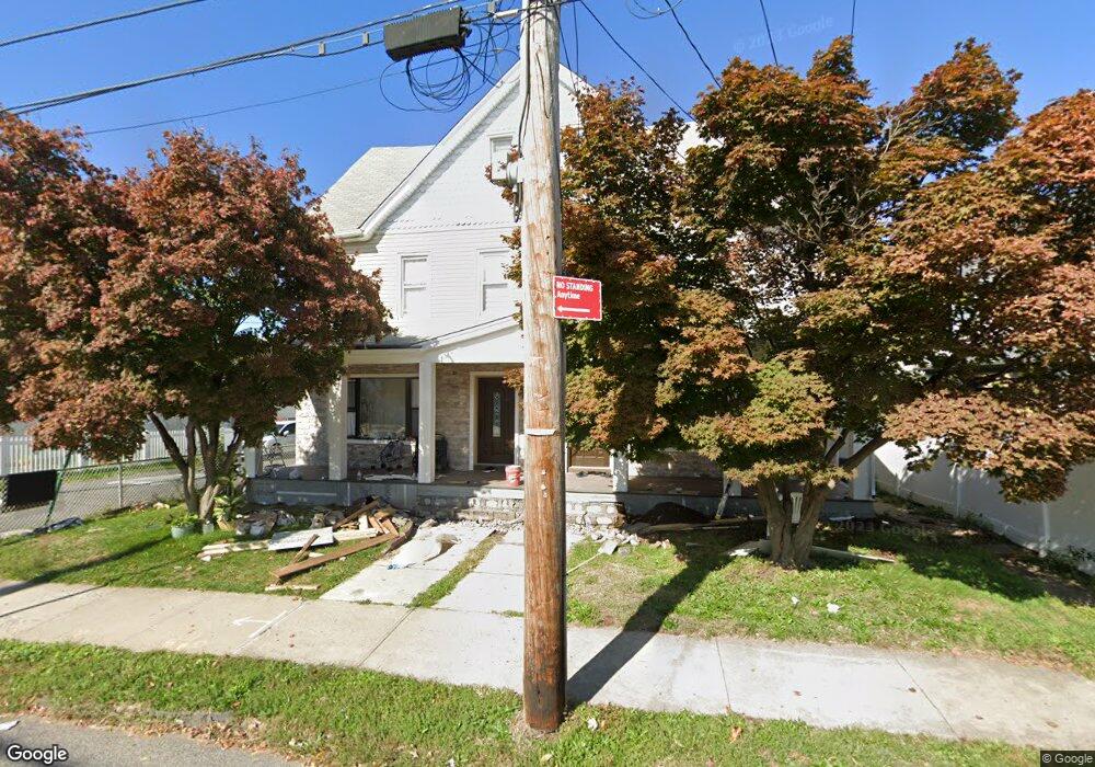
5355 Arthur Kill Rd Unit 5355-57 Staten Island, NY 10307
Tottenville NeighborhoodEstimated Value: $919,000 - $1,155,000
6
Beds
4
Baths
4,100
Sq Ft
$244/Sq Ft
Est. Value
About This Home
This home is located at 5355 Arthur Kill Rd Unit 5355-57, Staten Island, NY 10307 and is currently estimated at $999,734, approximately $243 per square foot. 5355 Arthur Kill Rd Unit 5355-57 is a home located in Richmond County with nearby schools including P.S. 1 Tottenville, Is 34 Tottenville, and Tottenville High School.
Ownership History
Date
Name
Owned For
Owner Type
Purchase Details
Closed on
Jan 19, 2021
Sold by
Cosgriff Michael
Bought by
Egamberdieva Makhsuda and Egamberdiev Farrukh
Current Estimated Value
Home Financials for this Owner
Home Financials are based on the most recent Mortgage that was taken out on this home.
Original Mortgage
$560,000
Interest Rate
2.7%
Mortgage Type
New Conventional
Purchase Details
Closed on
Mar 4, 2002
Sold by
Frankewich Michael and Frankewich Margaret
Bought by
Cosgriff Michael
Home Financials for this Owner
Home Financials are based on the most recent Mortgage that was taken out on this home.
Original Mortgage
$240,000
Interest Rate
7.18%
Mortgage Type
Purchase Money Mortgage
Create a Home Valuation Report for This Property
The Home Valuation Report is an in-depth analysis detailing your home's value as well as a comparison with similar homes in the area
Home Values in the Area
Average Home Value in this Area
Purchase History
| Date | Buyer | Sale Price | Title Company |
|---|---|---|---|
| Egamberdieva Makhsuda | $700,000 | None Listed On Document | |
| Cosgriff Michael | $300,000 | Fidelity National Title Ins |
Source: Public Records
Mortgage History
| Date | Status | Borrower | Loan Amount |
|---|---|---|---|
| Previous Owner | Egamberdieva Makhsuda | $560,000 | |
| Previous Owner | Cosgriff Michael | $240,000 |
Source: Public Records
Tax History Compared to Growth
Tax History
| Year | Tax Paid | Tax Assessment Tax Assessment Total Assessment is a certain percentage of the fair market value that is determined by local assessors to be the total taxable value of land and additions on the property. | Land | Improvement |
|---|---|---|---|---|
| 2025 | $8,290 | $69,720 | $9,028 | $60,692 |
| 2024 | $8,290 | $74,460 | $7,982 | $66,478 |
| 2023 | $7,945 | $39,122 | $8,136 | $30,986 |
| 2022 | $7,810 | $56,340 | $14,400 | $41,940 |
| 2021 | $7,781 | $57,360 | $14,400 | $42,960 |
| 2020 | $7,711 | $63,420 | $14,400 | $49,020 |
| 2019 | $7,195 | $55,140 | $14,400 | $40,740 |
| 2018 | $6,646 | $32,602 | $11,194 | $21,408 |
| 2017 | $6,646 | $32,602 | $13,947 | $18,655 |
| 2016 | $6,160 | $30,812 | $13,421 | $17,391 |
| 2015 | -- | $30,356 | $11,975 | $18,381 |
| 2014 | -- | $28,663 | $9,602 | $19,061 |
Source: Public Records
Map
Nearby Homes
- 5362 Arthur Kill Rd
- 42 Girard St
- 112 Johnson Ave
- 397 Ellis St
- 5265 Arthur Kill Rd
- 147 Wood Ave
- 133 Butler Ave
- 137 Butler Ave
- 141 Butler Ave
- 5463 Arthur Kill Rd Unit 5465
- 5463-5465 Arthur Kill Rd
- 133 Fisher Ave
- 151 Bentley St
- 197 Craig Ave
- 155 Bentley St
- 217-219 Fisher Ave
- 146 Bentley St
- 7546 Amboy Rd
- 162 Bentley St
- 233 Fisher Ave
- 5355 Arthur Kill Rd Unit 5357
- 5355-5357 Arthur Kill Rd
- 5351 Arthur Kill Rd
- 5363 Arthur Kill Rd
- 73 Girard St
- 5367 Arthur Kill Rd
- 18 Meagan Loop
- 22 Meagan Loop
- 8 Meagan Loop
- 69 Girard St
- 26 Meagan Loop
- 5371 Arthur Kill Rd
- 30 Meagan Loop
- 78 Girard St
- 5354 Arthur Kill Rd
- 5352 Arthur Kill Rd
- 5360 Arthur Kill Rd
- 5360-5362 Arthur Kill Rd
- 67 Girard St
- 5373 Arthur Kill Rd