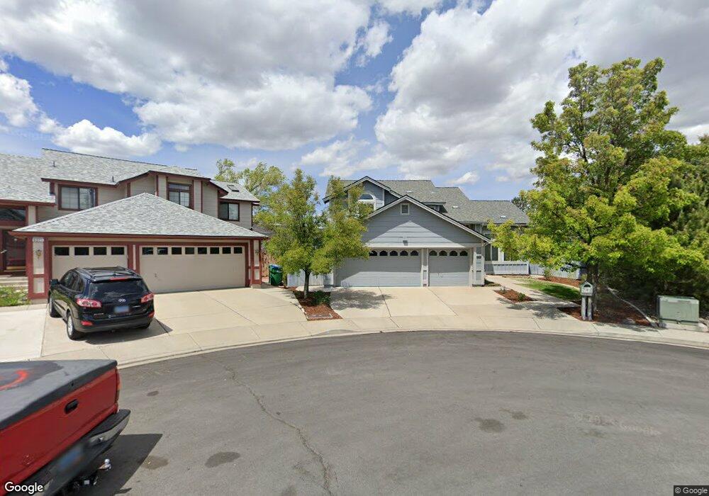
5355 Butterfly Ct Reno, NV 89523
Mae Anne Avenue NeighborhoodEstimated Value: $692,732 - $796,000
3
Beds
3
Baths
2,552
Sq Ft
$292/Sq Ft
Est. Value
About This Home
This home is located at 5355 Butterfly Ct, Reno, NV 89523 and is currently estimated at $744,933, approximately $291 per square foot. 5355 Butterfly Ct is a home located in Washoe County with nearby schools including Sarah Winnemucca Elementary School, B D Billinghurst Middle School, and Robert McQueen High School.
Ownership History
Date
Name
Owned For
Owner Type
Purchase Details
Closed on
Oct 13, 2017
Sold by
Wilkinson Lynn A
Bought by
Wilkinson Lynn A and The Willomark Trust
Current Estimated Value
Purchase Details
Closed on
Dec 22, 1997
Sold by
Wilkinson Lynn A
Bought by
Wilkinson Lynn A and Mast Emily M
Purchase Details
Closed on
Aug 15, 1997
Sold by
Mast Emily M
Bought by
Wilkinson Lynn A
Home Financials for this Owner
Home Financials are based on the most recent Mortgage that was taken out on this home.
Original Mortgage
$177,375
Outstanding Balance
$26,376
Interest Rate
7.45%
Estimated Equity
$718,557
Create a Home Valuation Report for This Property
The Home Valuation Report is an in-depth analysis detailing your home's value as well as a comparison with similar homes in the area
Home Values in the Area
Average Home Value in this Area
Purchase History
| Date | Buyer | Sale Price | Title Company |
|---|---|---|---|
| Wilkinson Lynn A | -- | None Available | |
| Wilkinson Lynn A | $11,500 | -- | |
| Wilkinson Lynn A | -- | Founders Title Co |
Source: Public Records
Mortgage History
| Date | Status | Borrower | Loan Amount |
|---|---|---|---|
| Open | Wilkinson Lynn A | $177,375 |
Source: Public Records
Tax History Compared to Growth
Tax History
| Year | Tax Paid | Tax Assessment Tax Assessment Total Assessment is a certain percentage of the fair market value that is determined by local assessors to be the total taxable value of land and additions on the property. | Land | Improvement |
|---|---|---|---|---|
| 2025 | $3,774 | $131,026 | $44,240 | $86,786 |
| 2024 | $3,662 | $129,719 | $41,300 | $88,419 |
| 2023 | $3,662 | $127,594 | $43,855 | $83,739 |
| 2022 | $3,555 | $106,218 | $36,120 | $70,098 |
| 2021 | $3,453 | $94,926 | $24,675 | $70,251 |
| 2020 | $3,350 | $96,812 | $25,795 | $71,017 |
| 2019 | $3,120 | $90,077 | $23,590 | $66,487 |
| 2018 | $3,031 | $82,602 | $17,220 | $65,382 |
| 2017 | $3,007 | $81,937 | $16,065 | $65,872 |
| 2016 | $2,947 | $84,564 | $15,680 | $68,884 |
| 2015 | $2,943 | $82,892 | $13,685 | $69,207 |
| 2014 | $2,854 | $78,495 | $11,060 | $67,435 |
| 2013 | -- | $75,538 | $9,065 | $66,473 |
Source: Public Records
Map
Nearby Homes
- 0 Simons Dr
- 1705 Sierra Highlands Dr
- 1708 Kristin Way
- 1659 Shadow Park Dr
- 1689 Shadow Park Dr
- 1500 Backer Way
- 5830 Blue Horizon Dr
- 5849 Morgan Horse St
- 1627 Prancer St Unit Lot 50
- 1627 Prancer St
- 1615 Prancer St Unit Lot 53
- Walker Plan at Monarch
- Humboldt Plan at Monarch
- 5721 Royal Vista Way
- 1639 Prancer St Unit Lot 47
- 5882 Grand Row Way Unit Lot 61
- 1618 Icelandic Way Unit Lot 67
- 1618 Icelandic Way
- 1626 Icelandic Way
- 5870 Blue Horizon Dr
- 5371 Butterfly Ct
- 5335 Butterfly Ct
- 1555 Butterfly Dr
- 5305 Butterfly Ct
- 5391 Butterfly Ct
- 5330 Butterfly Ct
- 5350 Butterfly Ct
- 1565 Butterfly Dr
- 1620 Pinecrest Ct
- 5370 Butterfly Ct
- 5310 Butterfly Ct
- 1600 Pinecrest Ct
- 5302 Butterfly Ct
- 1550 Butterfly Dr
- 1619 Pinecrest Ct
- 1540 Butterfly Dr
- 1490 Snow Summit Dr
- 1575 Butterfly Dr
- 1530 Butterfly Dr
- 1491 Snow Summit Dr