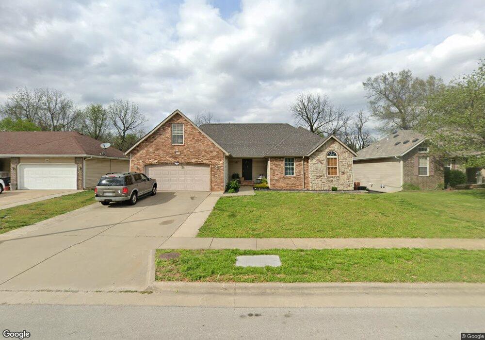
5355 W Harrison St Springfield, MO 65802
Estimated Value: $330,000 - $381,000
4
Beds
2
Baths
2,669
Sq Ft
$134/Sq Ft
Est. Value
About This Home
This home is located at 5355 W Harrison St, Springfield, MO 65802 and is currently estimated at $357,437, approximately $133 per square foot. 5355 W Harrison St is a home located in Greene County with nearby schools including Willard Orchard Hills Elementary School, Willard Intermediate-South, and Willard High School.
Ownership History
Date
Name
Owned For
Owner Type
Purchase Details
Closed on
Oct 29, 2024
Sold by
Matthews Ryan R and Matthews Joni D
Bought by
Matthews Trust and Matthews
Current Estimated Value
Purchase Details
Closed on
Aug 31, 2005
Sold by
Barnes Residential Inc
Bought by
Matthews Ryan R and Matthews Joni D
Home Financials for this Owner
Home Financials are based on the most recent Mortgage that was taken out on this home.
Original Mortgage
$148,824
Interest Rate
5.81%
Mortgage Type
FHA
Create a Home Valuation Report for This Property
The Home Valuation Report is an in-depth analysis detailing your home's value as well as a comparison with similar homes in the area
Home Values in the Area
Average Home Value in this Area
Purchase History
| Date | Buyer | Sale Price | Title Company |
|---|---|---|---|
| Matthews Trust | -- | None Listed On Document | |
| Matthews Ryan R | -- | None Available |
Source: Public Records
Mortgage History
| Date | Status | Borrower | Loan Amount |
|---|---|---|---|
| Previous Owner | Matthews Ryan R | $148,824 |
Source: Public Records
Tax History Compared to Growth
Tax History
| Year | Tax Paid | Tax Assessment Tax Assessment Total Assessment is a certain percentage of the fair market value that is determined by local assessors to be the total taxable value of land and additions on the property. | Land | Improvement |
|---|---|---|---|---|
| 2025 | $2,358 | $49,190 | $8,550 | $40,640 |
| 2024 | $2,358 | $42,050 | $3,800 | $38,250 |
| 2023 | $2,347 | $42,050 | $3,800 | $38,250 |
| 2022 | $2,073 | $36,800 | $3,800 | $33,000 |
| 2021 | $2,074 | $36,800 | $3,800 | $33,000 |
| 2020 | $1,726 | $33,270 | $3,800 | $29,470 |
| 2019 | $1,720 | $33,270 | $3,800 | $29,470 |
| 2018 | $1,648 | $31,710 | $3,800 | $27,910 |
| 2017 | $1,634 | $31,710 | $3,800 | $27,910 |
| 2016 | $1,626 | $31,710 | $3,800 | $27,910 |
| 2015 | $1,614 | $31,710 | $3,800 | $27,910 |
| 2014 | $1,611 | $31,430 | $3,800 | $27,630 |
Source: Public Records
Map
Nearby Homes
- 834 S Lester Rd
- 5163 W Sunstruck St
- 5175 W Sunstruck St
- 5131 W Sunstruck St
- 5134 W Sunstruck St
- 5721 W Alexa Ln
- 5353 Butternut Dr
- 995 S Natalie Ave
- 5441 Basswood Ct W
- 1069 S Red Cedar Ave
- 1128 S Brecklyn Rd
- 4966 W Tarkio St
- 5147 W Sunstruck St
- 5590 W Sunflower Dr
- 768 S Long Dr
- 5640 W Sunflower Dr
- 5610 W Sugar Pine Dr
- 452 S Dove Valley Ave
- 5170 W Sunstruck St
- 5182 W Sunstruck St
- 5367 W Harrison St
- 5343 W Harrison St
- 5379 W Harrison St
- 5331 W Harrison St
- 748 S Quade Rd
- 5319 W Harrison St
- 735 S Quade Rd
- 749 S Lester Rd
- 5403 W Harrison St
- 747 S Quade Rd
- 5303 W Harrison St
- 760 S Quade Rd
- 761 S Lester Rd
- 708 S Brecklyn Rd
- 759 S Quade Rd
- 5415 W Harrison St
- 720 S Brecklyn Rd
- 772 S Quade Rd
- 732 S Brecklyn Rd
- 773 S Lester Rd