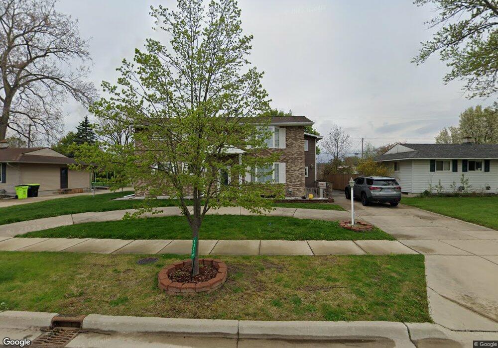
5356 Worchester Dr Swartz Creek, MI 48473
Estimated Value: $287,000 - $351,000
5
Beds
3
Baths
3,033
Sq Ft
$103/Sq Ft
Est. Value
About This Home
This home is located at 5356 Worchester Dr, Swartz Creek, MI 48473 and is currently estimated at $312,191, approximately $102 per square foot. 5356 Worchester Dr is a home located in Genesee County with nearby schools including Syring Elementary School, Elms Road Elementary School, and Dieck Elementary School.
Ownership History
Date
Name
Owned For
Owner Type
Purchase Details
Closed on
Sep 17, 2018
Sold by
Dover Jason M
Bought by
Long Steven R and Dorman Wayne L
Current Estimated Value
Purchase Details
Closed on
May 1, 2017
Sold by
Long Steven R and Dover Jason M
Bought by
Lang Steven R and Dorman Wayne L
Purchase Details
Closed on
Sep 5, 2008
Sold by
Dover Jason M
Bought by
Dover Jason M and Long Steven R
Purchase Details
Closed on
Oct 10, 2003
Sold by
Long Denise L
Bought by
Long Steven R and Long Nancy
Purchase Details
Closed on
Sep 26, 2001
Sold by
Long Nancy E and Long Steven R
Bought by
Dover Jason M
Create a Home Valuation Report for This Property
The Home Valuation Report is an in-depth analysis detailing your home's value as well as a comparison with similar homes in the area
Home Values in the Area
Average Home Value in this Area
Purchase History
| Date | Buyer | Sale Price | Title Company |
|---|---|---|---|
| Long Steven R | -- | None Available | |
| Lang Steven R | -- | None Available | |
| Dover Jason M | -- | None Available | |
| Long Steven R | -- | -- | |
| Dover Jason M | -- | First American Title Ins Co |
Source: Public Records
Tax History Compared to Growth
Tax History
| Year | Tax Paid | Tax Assessment Tax Assessment Total Assessment is a certain percentage of the fair market value that is determined by local assessors to be the total taxable value of land and additions on the property. | Land | Improvement |
|---|---|---|---|---|
| 2025 | $4,226 | $172,500 | $0 | $0 |
| 2024 | $3,419 | $165,600 | $0 | $0 |
| 2023 | $3,261 | $153,400 | $0 | $0 |
| 2022 | $3,830 | $125,000 | $0 | $0 |
| 2021 | $3,743 | $123,300 | $0 | $0 |
| 2020 | $2,992 | $121,300 | $0 | $0 |
| 2019 | $2,952 | $113,100 | $0 | $0 |
| 2018 | $3,469 | $109,400 | $0 | $0 |
| 2017 | $3,384 | $109,400 | $0 | $0 |
| 2016 | $3,354 | $106,600 | $0 | $0 |
| 2015 | $2,587 | $97,200 | $0 | $0 |
| 2014 | $1,977 | $89,300 | $0 | $0 |
| 2012 | -- | $81,100 | $81,100 | $0 |
Source: Public Records
Map
Nearby Homes
- 5177 Durwood Dr
- 5409 Durwood Dr
- 5150 Oxford Ct
- 8415 Cappy Ln
- 9091 Miller Rd
- 5108 Mclain St
- 5050 Fairchild St
- 8247 Miller Rd
- 72 Ashley Cir
- 9312 Sue Ct
- 138 Ashley Cir
- 4320 Seymour Rd
- 9356 Elaine Dr
- 5032 Brady St
- 162 Brookfield
- 0 S Seymour Rd
- 6260 Hidden Forrest Dr
- 6265 Hidden Forrest Dr
- V/L Morrish Rd
- 5200 Morrish Rd
- 5348 Worchester Dr
- 5364 Worchester Dr
- 5323 Oakview Dr
- 5340 Worchester Dr
- 5372 Worchester Dr
- 5315 Oakview Dr
- 5351 Worchester Dr
- 5329 Oakview Dr
- 5309 Oakview Dr
- 5359 Worchester Dr
- 5332 Worchester Dr
- 5303 Oakview Dr
- 5345 Worchester Dr
- 5365 Worchester Dr
- 5289 Durwood Dr
- 5283 Durwood Dr
- 5339 Worchester Dr Unit Bldg-Unit
- 5339 Worchester Dr
- 5371 Worchester Dr
- 5275 Durwood Dr