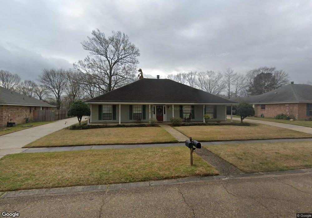
5357 Kennesaw Dr Baton Rouge, LA 70817
Shenandoah NeighborhoodEstimated Value: $322,000 - $387,000
4
Beds
3
Baths
3,100
Sq Ft
$113/Sq Ft
Est. Value
About This Home
This home is located at 5357 Kennesaw Dr, Baton Rouge, LA 70817 and is currently estimated at $350,334, approximately $113 per square foot. 5357 Kennesaw Dr is a home located in East Baton Rouge Parish with nearby schools including Shenandoah Elementary School, Woodlawn Middle School, and Woodlawn High School.
Ownership History
Date
Name
Owned For
Owner Type
Purchase Details
Closed on
Jan 28, 2009
Sold by
Furnish Timothy C
Bought by
Mcgee Helen B
Current Estimated Value
Home Financials for this Owner
Home Financials are based on the most recent Mortgage that was taken out on this home.
Original Mortgage
$196,000
Outstanding Balance
$123,829
Interest Rate
5.09%
Mortgage Type
New Conventional
Estimated Equity
$226,505
Create a Home Valuation Report for This Property
The Home Valuation Report is an in-depth analysis detailing your home's value as well as a comparison with similar homes in the area
Home Values in the Area
Average Home Value in this Area
Purchase History
| Date | Buyer | Sale Price | Title Company |
|---|---|---|---|
| Mcgee Helen B | $245,000 | -- |
Source: Public Records
Mortgage History
| Date | Status | Borrower | Loan Amount |
|---|---|---|---|
| Open | Mcgee Helen B | $196,000 |
Source: Public Records
Tax History Compared to Growth
Tax History
| Year | Tax Paid | Tax Assessment Tax Assessment Total Assessment is a certain percentage of the fair market value that is determined by local assessors to be the total taxable value of land and additions on the property. | Land | Improvement |
|---|---|---|---|---|
| 2024 | $2,541 | $28,738 | $2,000 | $26,738 |
| 2023 | $2,541 | $24,500 | $2,000 | $22,500 |
| 2022 | $2,856 | $24,500 | $2,000 | $22,500 |
| 2021 | $2,802 | $24,500 | $2,000 | $22,500 |
| 2020 | $2,837 | $24,500 | $2,000 | $22,500 |
| 2019 | $2,950 | $24,500 | $2,000 | $22,500 |
| 2018 | $2,913 | $24,500 | $2,000 | $22,500 |
| 2017 | $2,913 | $24,500 | $2,000 | $22,500 |
| 2016 | $1,100 | $16,625 | $2,000 | $14,625 |
| 2015 | $1,978 | $24,500 | $2,000 | $22,500 |
| 2014 | $1,937 | $24,500 | $2,000 | $22,500 |
| 2013 | -- | $24,500 | $2,000 | $22,500 |
Source: Public Records
Map
Nearby Homes
- 16039 Haynes Bluff Ave
- 16825 Chadsford Ave
- 16756 Merrimac Ave
- 15844 Chantilly Ave
- 16225 Chadsford Ave
- 4830 Kennesaw Dr Unit A
- Lot 41A Carnifix Ct
- 5821 Fort Sumpter Dr
- 5534 Round Forrest Dr
- 15946 Ferrell Ave
- 16849 Monitor Ave
- 5111 Paducah Ct
- 5101 Paducah Ct
- 16025 Parkside Ct
- 15933 Shenandoah Ave
- 15738 Woodland Trail Ave
- 16849 Mill Grove Ln
- 6335 Antioch Blvd
- 15719 Parkside Ct
- 17237 Monitor Ave
- 5347 Kennesaw Dr
- 5347 Kennesaw Dr
- 5347 Kennesaw Dr
- 5347 Kennesaw Dr
- 5347 Kennesaw Dr
- 5347 Kennesaw Dr
- 5347 Kennesaw Dr
- 5347 Kennesaw Dr
- 5347 Kennesaw Dr
- 5347 Kennesaw Dr
- 5347 Kennesaw Dr
- 5347 Kennesaw Dr
- 5347 Kennesaw Dr
- 5347 Kennesaw Dr
- 5347 Kennesaw Dr
- 5347 Kennesaw Dr
- 5347 Kennesaw Dr
- 5347 Kennesaw Dr
- 5347 Kennesaw Dr
- 5347 Kennesaw Dr