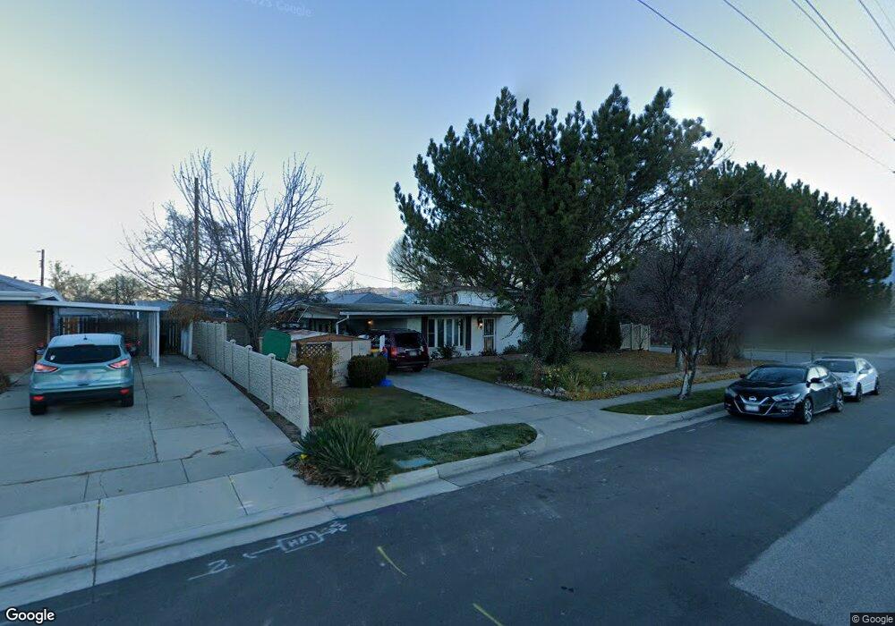
536 Anderson Ave Salt Lake City, UT 84123
Estimated Value: $445,000 - $487,000
4
Beds
2
Baths
1,080
Sq Ft
$434/Sq Ft
Est. Value
About This Home
This home is located at 536 Anderson Ave, Salt Lake City, UT 84123 and is currently estimated at $468,369, approximately $433 per square foot. 536 Anderson Ave is a home located in Salt Lake County with nearby schools including Viewmont Elementary School, Riverview Junior High School, and Murray High School.
Ownership History
Date
Name
Owned For
Owner Type
Purchase Details
Closed on
May 1, 2024
Sold by
Parkin Lorraine C
Bought by
Lorraine Parkin Family Trust and Parkin
Current Estimated Value
Home Financials for this Owner
Home Financials are based on the most recent Mortgage that was taken out on this home.
Original Mortgage
$15,000
Outstanding Balance
$14,511
Interest Rate
6.87%
Mortgage Type
Credit Line Revolving
Estimated Equity
$453,858
Purchase Details
Closed on
Apr 25, 2016
Sold by
Parkin Lorraine C
Bought by
Parkin Lorraine C and The Lorraine Parkin Family Trust
Home Financials for this Owner
Home Financials are based on the most recent Mortgage that was taken out on this home.
Original Mortgage
$10,000
Interest Rate
3.73%
Mortgage Type
Future Advance Clause Open End Mortgage
Purchase Details
Closed on
Aug 8, 2014
Sold by
Parkin Lorraine C
Bought by
Parkin Lorraine C and The Lorraine Parkin Family Trust
Purchase Details
Closed on
Jul 2, 2012
Sold by
Parkin Lorraine C
Bought by
Parkin Lorraine C and Quick Karen L
Home Financials for this Owner
Home Financials are based on the most recent Mortgage that was taken out on this home.
Original Mortgage
$151,600
Interest Rate
3.74%
Mortgage Type
New Conventional
Purchase Details
Closed on
Apr 19, 1999
Sold by
Parkin Lorraine Q
Bought by
Parkin Lorraine C
Home Financials for this Owner
Home Financials are based on the most recent Mortgage that was taken out on this home.
Original Mortgage
$100,000
Interest Rate
7.1%
Mortgage Type
Purchase Money Mortgage
Purchase Details
Closed on
Dec 22, 1993
Sold by
Parkin Lorraine Q
Bought by
Parkin Lorraine Q
Home Financials for this Owner
Home Financials are based on the most recent Mortgage that was taken out on this home.
Original Mortgage
$57,000
Interest Rate
6.59%
Mortgage Type
Purchase Money Mortgage
Create a Home Valuation Report for This Property
The Home Valuation Report is an in-depth analysis detailing your home's value as well as a comparison with similar homes in the area
Home Values in the Area
Average Home Value in this Area
Purchase History
| Date | Buyer | Sale Price | Title Company |
|---|---|---|---|
| Lorraine Parkin Family Trust | -- | Titan Title Insurance Agency I | |
| Parkin Lorraine C | -- | Titan Title Insurance Agency I | |
| Parkin Lorraine C | -- | Titan Title Ins Agcy Inc | |
| Parkin Lorraine C | -- | Titan Title Ins Agcy Inc | |
| Parkin Lorraine C | -- | None Available | |
| Parkin Lorraine C | -- | None Available | |
| Parkin Lorraine C | -- | Sutherland Title | |
| Parkin Lorraine Q | -- | -- |
Source: Public Records
Mortgage History
| Date | Status | Borrower | Loan Amount |
|---|---|---|---|
| Open | Parkin Lorraine C | $15,000 | |
| Previous Owner | Parkin Lorraine C | $10,000 | |
| Previous Owner | Parkin Lorraine C | $151,600 | |
| Previous Owner | Parkin Lorraine C | $100,000 | |
| Previous Owner | Parkin Lorraine Q | $57,000 |
Source: Public Records
Tax History Compared to Growth
Tax History
| Year | Tax Paid | Tax Assessment Tax Assessment Total Assessment is a certain percentage of the fair market value that is determined by local assessors to be the total taxable value of land and additions on the property. | Land | Improvement |
|---|---|---|---|---|
| 2025 | $1,923 | $443,100 | $107,900 | $335,200 |
| 2024 | $1,923 | $426,500 | $104,100 | $322,400 |
| 2023 | $1,821 | $386,800 | $97,300 | $289,500 |
| 2022 | $1,952 | $394,200 | $95,400 | $298,800 |
| 2021 | $1,683 | $299,800 | $71,600 | $228,200 |
| 2020 | $1,568 | $264,300 | $71,600 | $192,700 |
| 2019 | $1,599 | $260,400 | $71,600 | $188,800 |
| 2018 | $1,446 | $240,300 | $69,600 | $170,700 |
| 2017 | $1,316 | $220,400 | $69,600 | $150,800 |
| 2016 | $1,222 | $197,700 | $69,600 | $128,100 |
| 2015 | $1,336 | $196,200 | $67,900 | $128,300 |
| 2014 | $1,266 | $184,400 | $64,700 | $119,700 |
Source: Public Records
Map
Nearby Homes
- 5730 S 590 W
- 5689 S Spacerama Dr
- 5513 S 670 W
- Huntington Towns Plan at Murray Heights
- Santa Monica Towns Plan at Murray Heights
- 5517 S White Springs Dr
- 5495 S White Springs Dr
- 143 W Washington Ave
- 5981 S Sultan Cir
- 910 W Brandermill Cove
- 5313 S Ben Davis Park
- 5332 S Ben Davis Park
- 909 W Bullion St Unit 11
- 912 W Bellshill Dr Unit 15
- 43 W Wilson Ave
- 924 Coalburn Way Unit 8-26
- 923 Coalburn Way Unit 103
- 931 Coalburn Way Unit 102
- 28 W Stauffer Ln
- 937 Coalburn Way Unit 102
- 5700 Sanford Dr
- 552 W Anderson Ave
- 552 Anderson Ave
- 5688 S Sanford Dr
- 5688 Sanford Dr
- 5732 Sanford Dr
- 568 Anderson Ave
- 524 Anderson Ave
- 549 Anderson Ave
- 549 W Anderson Ave
- 5699 Sanford Dr
- 5733 Sanford Dr
- 545 W Spacerama Dr
- 580 W Anderson Ave
- 545 Spacerama Dr
- 580 Anderson Ave
- 5687 Sanford Dr
- 5687 S Sanford Dr
- 5725 S 590 W
- 535 W Spacerama Dr