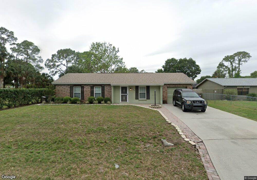
536 Atlantic Ave NE Palm Bay, FL 32907
Estimated Value: $221,000 - $313,000
3
Beds
2
Baths
1,680
Sq Ft
$161/Sq Ft
Est. Value
About This Home
This home is located at 536 Atlantic Ave NE, Palm Bay, FL 32907 and is currently estimated at $270,132, approximately $160 per square foot. 536 Atlantic Ave NE is a home located in Brevard County with nearby schools including Lockmar Elementary School, Southwest Middle School, and Palm Bay Magnet Senior High School.
Ownership History
Date
Name
Owned For
Owner Type
Purchase Details
Closed on
Jul 14, 2022
Sold by
Hammond Vicki A
Bought by
Stevens Vincent
Current Estimated Value
Home Financials for this Owner
Home Financials are based on the most recent Mortgage that was taken out on this home.
Original Mortgage
$160,000
Outstanding Balance
$152,405
Interest Rate
5.23%
Mortgage Type
New Conventional
Estimated Equity
$117,727
Create a Home Valuation Report for This Property
The Home Valuation Report is an in-depth analysis detailing your home's value as well as a comparison with similar homes in the area
Home Values in the Area
Average Home Value in this Area
Purchase History
| Date | Buyer | Sale Price | Title Company |
|---|---|---|---|
| Stevens Vincent | $200,000 | Peninsula Title Services |
Source: Public Records
Mortgage History
| Date | Status | Borrower | Loan Amount |
|---|---|---|---|
| Open | Stevens Vincent | $160,000 |
Source: Public Records
Tax History Compared to Growth
Tax History
| Year | Tax Paid | Tax Assessment Tax Assessment Total Assessment is a certain percentage of the fair market value that is determined by local assessors to be the total taxable value of land and additions on the property. | Land | Improvement |
|---|---|---|---|---|
| 2025 | $3,005 | $195,780 | -- | -- |
| 2024 | $3,584 | $201,010 | -- | -- |
| 2023 | $3,584 | $230,270 | $47,000 | $183,270 |
| 2022 | $2,863 | $195,340 | $0 | $0 |
| 2021 | $2,573 | $143,450 | $25,500 | $117,950 |
| 2020 | $2,318 | $126,470 | $21,000 | $105,470 |
| 2019 | $2,387 | $122,950 | $18,500 | $104,450 |
| 2018 | $2,181 | $110,430 | $12,500 | $97,930 |
| 2017 | $2,059 | $97,980 | $11,000 | $86,980 |
| 2016 | $1,760 | $87,840 | $7,500 | $80,340 |
| 2015 | $1,617 | $66,360 | $7,000 | $59,360 |
| 2014 | $1,476 | $60,330 | $5,400 | $54,930 |
Source: Public Records
Map
Nearby Homes
- 589 Janus Rd NE
- 781 Dinner St NE
- 849 Americana Blvd NE
- 687 Americana Blvd NW
- 826 Hunan St NE
- 418 Empire Ave NE
- 818 Boeing St NE
- 711 Hunan St NE
- 618 Americana Blvd NE
- 901 Emerson Dr NE
- 627 Firestone St NE
- 890 Emerson Dr NE Unit 45
- 873 Ripley Terrace NE
- Tbd Dinner St NE
- 366 Bordeaux Ave NE
- 1195 Emerson Dr NE
- 343 Holiday Park Blvd NE
- 835 Emerson Dr NE
- 784 Emerson Dr NE
- 816 Hawser St NE
- 546 Atlantic Ave NE
- 760 Antilles Rd NE
- 766 Antilles Rd NE
- 535 Atlantic Ave NE
- 556 Atlantic Ave NE
- 516 Atlantic Ave NE
- 545 Atlantic Ave NE
- 754 Antilles Rd NE
- 525 Atlantic Ave NE
- 772 Antilles Rd NE
- 555 Atlantic Ave NE
- 566 Atlantic Ave NE
- 506 Atlantic Ave NE
- 771 Americana Blvd NE
- 761 Antilles Rd NE
- 540 Janus Rd NE
- 565 Atlantic Ave NE
- 748 Antilles Rd NE
- 761 Americana Blvd NE
- 791 Americana Blvd NE