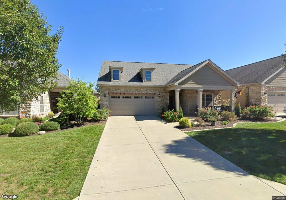
536 Bridgestone Dr Mooresville, IN 46158
Estimated Value: $357,569 - $442,000
2
Beds
3
Baths
1,889
Sq Ft
$203/Sq Ft
Est. Value
About This Home
This home is located at 536 Bridgestone Dr, Mooresville, IN 46158 and is currently estimated at $384,392, approximately $203 per square foot. 536 Bridgestone Dr is a home located in Morgan County with nearby schools including Mooresville High School and Mooresville Christian Academy.
Ownership History
Date
Name
Owned For
Owner Type
Purchase Details
Closed on
May 29, 2024
Sold by
Cooper Randy G and Cooper Kimberly S
Bought by
Smith Cheryl W and Smith Tommy D
Current Estimated Value
Purchase Details
Closed on
May 19, 2014
Sold by
Bridgemor Village Llc
Bought by
Cooper Randy G and Cooper Kimberly S
Home Financials for this Owner
Home Financials are based on the most recent Mortgage that was taken out on this home.
Original Mortgage
$130,000
Interest Rate
4.34%
Mortgage Type
New Conventional
Create a Home Valuation Report for This Property
The Home Valuation Report is an in-depth analysis detailing your home's value as well as a comparison with similar homes in the area
Home Values in the Area
Average Home Value in this Area
Purchase History
| Date | Buyer | Sale Price | Title Company |
|---|---|---|---|
| Smith Cheryl W | $365,000 | Meridian Title Corp | |
| Cooper Randy G | -- | Chicago Title Co Llc |
Source: Public Records
Mortgage History
| Date | Status | Borrower | Loan Amount |
|---|---|---|---|
| Previous Owner | Cooper Randy G | $130,000 |
Source: Public Records
Tax History Compared to Growth
Tax History
| Year | Tax Paid | Tax Assessment Tax Assessment Total Assessment is a certain percentage of the fair market value that is determined by local assessors to be the total taxable value of land and additions on the property. | Land | Improvement |
|---|---|---|---|---|
| 2024 | $2,409 | $334,800 | $0 | $334,800 |
| 2023 | $2,277 | $338,500 | $0 | $338,500 |
| 2022 | $2,330 | $323,900 | $0 | $323,900 |
| 2021 | $1,710 | $258,300 | $0 | $258,300 |
| 2020 | $1,741 | $261,000 | $0 | $261,000 |
| 2019 | $1,753 | $263,800 | $0 | $263,800 |
| 2018 | $1,753 | $266,600 | $0 | $266,600 |
| 2017 | $1,724 | $264,300 | $0 | $264,300 |
| 2016 | $1,811 | $270,300 | $0 | $270,300 |
| 2014 | $1,200 | $242,400 | $0 | $242,400 |
Source: Public Records
Map
Nearby Homes
- 5406 E Commons North Dr
- 5414 Collett Dr E
- 241 Liberty Blvd
- 5375 E Commons West Dr
- 12756 N Commons East Dr
- 12754 N Commons East Dr
- 512 Redwood Dr
- 200 Liberty Blvd
- Sheffield Plan at Villages at Eastmoore - Villages of Eastmoore
- Pembrooke Plan at Villages at Eastmoore - Villages of Eastmoore
- Hartford Plan at Villages at Eastmoore - Villages of Eastmoore
- Elmstead Plan at Villages at Eastmoore - Villages of Eastmoore
- Waveland Plan at Villages at Eastmoore - Villages of Eastmoore
- Eastland Plan at Villages at Eastmoore - Villages of Eastmoore
- 5650 Donald Ct E
- 5645 E Donald Ct
- 436 Tavistock Dr
- 13755 George Ct
- 349 N Post Oak Dr
- 13847 N Settle Way
- 538 Bridgestone Dr
- 532 Bridgestone Dr
- 540 Bridgestone Dr
- 537 Bridgestone Dr
- 544 Bridgestone Dr
- 130 Bridgemor Ln
- 528 Bridgestone Dr
- 5054 E Landersdale Rd
- 533 Bridgestone Dr
- 13173 N Landersdale Ln
- 177 Bridgemor Ln
- 175 Bridgemor Ln
- 522 Bridgestone Dr
- 173 Bridgemor Ln
- 515 Bridgestone Dr
- 169 Bridgemor Ln
- 13207 N Landersdale Ln
- 513 Bridgestone Dr
- 118 Bridgemor Ln