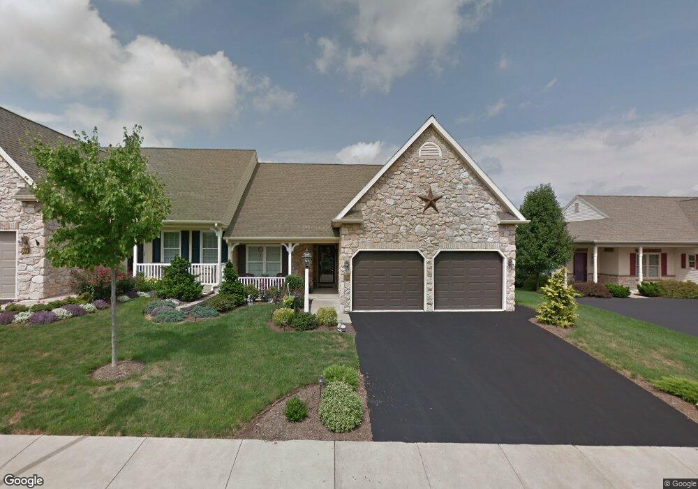
536 Brookshire Ave Unit 211 Manheim, PA 17545
Estimated Value: $293,466 - $314,000
2
Beds
2
Baths
1,438
Sq Ft
$211/Sq Ft
Est. Value
About This Home
This home is located at 536 Brookshire Ave Unit 211, Manheim, PA 17545 and is currently estimated at $303,367, approximately $210 per square foot. 536 Brookshire Ave Unit 211 is a home located in Lancaster County with nearby schools including Manheim Central Senior High School, Manheim Christian Day School, and Sporting Hill Christian School.
Ownership History
Date
Name
Owned For
Owner Type
Purchase Details
Closed on
May 13, 2014
Sold by
Fellenbaum Nancy L
Bought by
Martin James D and Martin Lucille J
Current Estimated Value
Purchase Details
Closed on
Nov 22, 2013
Sold by
Fellenbaum Nancy L
Bought by
Fellenbaum Nancy L
Home Financials for this Owner
Home Financials are based on the most recent Mortgage that was taken out on this home.
Original Mortgage
$42,000
Interest Rate
4.17%
Mortgage Type
Credit Line Revolving
Purchase Details
Closed on
Dec 2, 2005
Sold by
Brookshire Properties Llp
Bought by
Fellenbaum Gerald E and Fellenbaum Nancy L
Create a Home Valuation Report for This Property
The Home Valuation Report is an in-depth analysis detailing your home's value as well as a comparison with similar homes in the area
Home Values in the Area
Average Home Value in this Area
Purchase History
| Date | Buyer | Sale Price | Title Company |
|---|---|---|---|
| Martin James D | $150,000 | None Available | |
| Fellenbaum Nancy L | -- | None Available | |
| Fellenbaum Gerald E | $129,322 | First American Title Ins Co |
Source: Public Records
Mortgage History
| Date | Status | Borrower | Loan Amount |
|---|---|---|---|
| Previous Owner | Fellenbaum Nancy L | $42,000 |
Source: Public Records
Tax History Compared to Growth
Tax History
| Year | Tax Paid | Tax Assessment Tax Assessment Total Assessment is a certain percentage of the fair market value that is determined by local assessors to be the total taxable value of land and additions on the property. | Land | Improvement |
|---|---|---|---|---|
| 2025 | $3,046 | $149,400 | -- | $149,400 |
| 2024 | $3,046 | $149,400 | -- | $149,400 |
| 2023 | $2,982 | $149,400 | $0 | $149,400 |
| 2022 | $2,905 | $149,400 | $0 | $149,400 |
| 2021 | $2,839 | $149,400 | $0 | $149,400 |
| 2020 | $2,839 | $149,400 | $0 | $149,400 |
| 2019 | $2,790 | $149,400 | $0 | $149,400 |
| 2018 | $2,025 | $149,400 | $0 | $149,400 |
| 2017 | $2,862 | $122,800 | $0 | $122,800 |
| 2016 | $2,862 | $122,800 | $0 | $122,800 |
| 2015 | $680 | $122,800 | $0 | $122,800 |
| 2014 | $2,110 | $122,800 | $0 | $122,800 |
Source: Public Records
Map
Nearby Homes
- 538 Brookshire Ave
- 421 Rosewood Dr
- 981 Cambridge Dr
- 732 Heather Ridge Unit 147
- 554 Mallard Dr
- 609 Hamaker Rd
- 655 White Oak Rd
- 239 E High St
- 90 Penn Valley Village
- 8 Penn Valley Village
- 121 Mill St
- 27 Penn Valley Village
- 188 N Main St
- 123 S Main St
- 125 S Main St
- 108 110 S Main St
- 27 W Ferdinand St
- 33 W Ferdinand St
- 37 W Ferdinand St
- 43 W Ferdinand St
- 536 Brookshire Ave
- 534 Brookshire Ave
- 534 Brookshire Ave Unit 210
- 538 Brookshire Ave Unit 212
- 532 Brookshire Ave Unit 209
- 635 Auburn Dr Unit 195
- 631 Auburn Dr Unit 196
- 401 Rosewood Dr
- 627 Auburn Dr
- 533 Brookshire Ave Unit 227
- 753 Heather Ridge Unit 174
- 757 Heather Ridge Unit 173
- 530 Brookshire Ave
- 761 Heather Ridge Unit 172
- 623 Auburn Dr Unit 198
- 529 Brookshire Ave Unit 228
- 400 Rosewood Dr Unit 213
- 139 Heather Ridge
- 154 Heather Ridge
- 526 Brookshire Ave