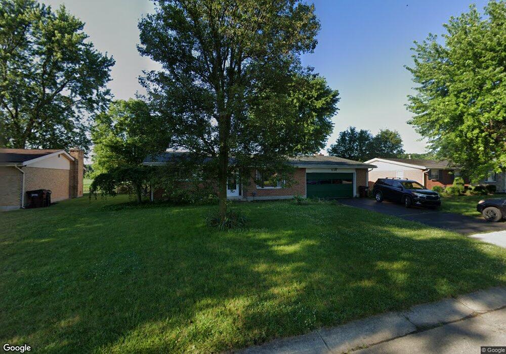
536 Burgess Ave Dayton, OH 45415
Estimated Value: $196,595 - $213,000
4
Beds
2
Baths
1,805
Sq Ft
$114/Sq Ft
Est. Value
About This Home
This home is located at 536 Burgess Ave, Dayton, OH 45415 and is currently estimated at $205,399, approximately $113 per square foot. 536 Burgess Ave is a home located in Montgomery County with nearby schools including Valerie Elementary School, North Dayton School of Science & Discovery, and Imagine Klepinger Road Community School.
Ownership History
Date
Name
Owned For
Owner Type
Purchase Details
Closed on
Jul 31, 2020
Sold by
Clawson Margaret J
Bought by
Crum Lonnie J and Crum Tamara L
Current Estimated Value
Home Financials for this Owner
Home Financials are based on the most recent Mortgage that was taken out on this home.
Original Mortgage
$121,505
Outstanding Balance
$107,783
Interest Rate
3%
Mortgage Type
New Conventional
Estimated Equity
$97,616
Purchase Details
Closed on
Sep 24, 2019
Sold by
Clawson Harold Eugene
Bought by
Clawson Margaret Jane
Purchase Details
Closed on
May 31, 2000
Sold by
Corbett Richard J
Bought by
Clawson Harold E and Clawson Margaret J
Create a Home Valuation Report for This Property
The Home Valuation Report is an in-depth analysis detailing your home's value as well as a comparison with similar homes in the area
Home Values in the Area
Average Home Value in this Area
Purchase History
| Date | Buyer | Sale Price | Title Company |
|---|---|---|---|
| Crum Lonnie J | $127,900 | Sterling Land Title Agcy Inc | |
| Clawson Margaret Jane | -- | None Available | |
| Clawson Harold E | $104,900 | -- |
Source: Public Records
Mortgage History
| Date | Status | Borrower | Loan Amount |
|---|---|---|---|
| Open | Crum Lonnie J | $121,505 |
Source: Public Records
Tax History Compared to Growth
Tax History
| Year | Tax Paid | Tax Assessment Tax Assessment Total Assessment is a certain percentage of the fair market value that is determined by local assessors to be the total taxable value of land and additions on the property. | Land | Improvement |
|---|---|---|---|---|
| 2024 | $4,004 | $53,830 | $14,060 | $39,770 |
| 2023 | $4,004 | $53,830 | $14,060 | $39,770 |
| 2022 | $3,329 | $32,830 | $8,580 | $24,250 |
| 2021 | $3,240 | $32,830 | $8,580 | $24,250 |
| 2020 | $2,382 | $32,830 | $8,580 | $24,250 |
| 2019 | $2,287 | $29,470 | $7,720 | $21,750 |
| 2018 | $2,289 | $29,470 | $7,720 | $21,750 |
| 2017 | $2,276 | $29,470 | $7,720 | $21,750 |
| 2016 | $2,318 | $29,100 | $8,580 | $20,520 |
| 2015 | $2,022 | $29,100 | $8,580 | $20,520 |
| 2014 | $2,022 | $29,100 | $8,580 | $20,520 |
| 2012 | -- | $30,980 | $8,570 | $22,410 |
Source: Public Records
Map
Nearby Homes
- 701 Fredericksburg Dr
- 270 Pamela Ave
- 5653 Philadelphia Dr
- 159 Burgess Ave
- 8090 Dog Leg Rd
- 455 Shiloh Dr
- 266 Briarcliff Rd
- 5129 Rivers Edge Blvd
- 5563 Fair Valley Rd
- 5473 Fair Valley Rd
- 0 Tall Hickory Trail
- 6029 Imperial Hills Dr
- 6012 Imperial Hills Dr
- 6552 Stillcrest Way
- 42 Swallow Dr
- 4763 Shaunee Creek Dr Unit 31
- 4743 Shaunee Creek Dr Unit 21
- 4553 Lansmore Dr Unit 37
- 4507 Lansmore Dr Unit 83
- 2625 Secretariat Ct
- 542 Burgess Ave
- 530 Burgess Ave
- 524 Burgess Ave
- 548 Burgess Ave
- 537 Burgess Ave
- 543 Burgess Ave
- 525 Burgess Ave
- 518 Burgess Ave
- 554 Burgess Ave
- 549 Burgess Ave
- 519 Burgess Ave
- 512 Burgess Ave
- 560 Burgess Ave
- 612 Fredericksburg Dr
- 555 Burgess Ave
- 600 Fredericksburg Dr
- 513 Burgess Ave
- 618 Fredericksburg Dr
- 518 Fredericksburg Dr
- 506 Burgess Ave