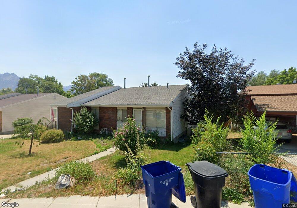
536 Delno Cir Unit 538 Salt Lake City, UT 84107
Estimated Value: $700,000 - $809,000
7
Beds
4
Baths
1,842
Sq Ft
$408/Sq Ft
Est. Value
About This Home
This home is located at 536 Delno Cir Unit 538, Salt Lake City, UT 84107 and is currently estimated at $750,979, approximately $407 per square foot. 536 Delno Cir Unit 538 is a home located in Salt Lake County with nearby schools including James E Moss Elementary School, Bonneville Junior High School, and Cottonwood High School.
Ownership History
Date
Name
Owned For
Owner Type
Purchase Details
Closed on
May 29, 1998
Sold by
Hunsaker Conrad L and Hunsaker Diane
Bought by
Hunsaker Conrad L
Current Estimated Value
Home Financials for this Owner
Home Financials are based on the most recent Mortgage that was taken out on this home.
Original Mortgage
$207,000
Outstanding Balance
$41,592
Interest Rate
7.1%
Mortgage Type
Purchase Money Mortgage
Estimated Equity
$709,387
Create a Home Valuation Report for This Property
The Home Valuation Report is an in-depth analysis detailing your home's value as well as a comparison with similar homes in the area
Home Values in the Area
Average Home Value in this Area
Purchase History
| Date | Buyer | Sale Price | Title Company |
|---|---|---|---|
| Hunsaker Conrad L | -- | -- |
Source: Public Records
Mortgage History
| Date | Status | Borrower | Loan Amount |
|---|---|---|---|
| Open | Hunsaker Conrad L | $207,000 |
Source: Public Records
Tax History Compared to Growth
Tax History
| Year | Tax Paid | Tax Assessment Tax Assessment Total Assessment is a certain percentage of the fair market value that is determined by local assessors to be the total taxable value of land and additions on the property. | Land | Improvement |
|---|---|---|---|---|
| 2025 | $2,389 | $720,400 | $184,900 | $535,500 |
| 2024 | $2,389 | $647,700 | $175,000 | $472,700 |
| 2023 | $2,210 | $593,500 | $168,300 | $425,200 |
| 2022 | $3,031 | $613,300 | $165,000 | $448,300 |
| 2021 | $2,556 | $485,500 | $127,000 | $358,500 |
| 2020 | $2,387 | $444,100 | $113,400 | $330,700 |
| 2019 | $2,391 | $434,800 | $106,000 | $328,800 |
| 2018 | $1,921 | $365,800 | $106,000 | $259,800 |
| 2017 | $1,814 | $360,500 | $106,000 | $254,500 |
| 2016 | $2,688 | $331,500 | $89,100 | $242,400 |
| 2015 | $2,384 | $275,100 | $87,300 | $187,800 |
| 2014 | $2,314 | $261,400 | $85,500 | $175,900 |
Source: Public Records
Map
Nearby Homes
- 568 E Dolores Cove Unit 4
- 607 E 4030 S
- 602 E Betsey Cove Unit 20
- 599 E Betsey Cove Unit 23
- 3812 S 500 E
- 651 E 4025 S Unit G
- Type B3 Plan at The Monroe - theMONROE
- 657 E 4065 S Unit C
- 4040 S 685 E Unit F
- 4040 S 685 E Unit F
- 4003 S 300 E Unit 19
- 3935 S 300 E
- 289 E Park Hill Way
- 689 E 4149 S
- 779 E 4070 S
- 4175 S 590 E
- 3938 S 805 E Unit A
- 3924 S 805 E Unit B
- 265 E Hill Ave Unit 5
- 495 E Mary Rose Dr
- 864 E 3955 S Unit 66
- 864 E 3955 S
- 542 Delno Cir Unit 544
- 528 E 3955 S Unit 5
- 532 E 3955 S Unit 6
- 522 E 3955 S
- 525 E Delno Cir
- 525 Delno Cir
- 518 E 3955 S
- 537 E Delno Dr
- 537 Delno Dr
- 552 E Delno Cir
- 527 Delno Cir
- 550 Delno Cir Unit 552
- 550 E Delno Cir
- 543 E Delno Dr
- 529 E Delno Cir
- 3964 S 565 E
- 531 E Delno Cir Unit 1
- 531 E Delno Cir