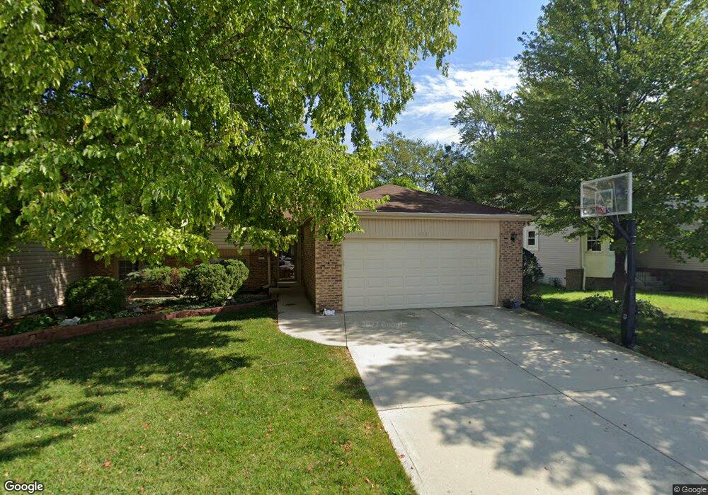
536 Dunsten Cir Northbrook, IL 60062
Estimated Value: $414,000 - $581,000
3
Beds
3
Baths
1,417
Sq Ft
$340/Sq Ft
Est. Value
About This Home
This home is located at 536 Dunsten Cir, Northbrook, IL 60062 and is currently estimated at $482,405, approximately $340 per square foot. 536 Dunsten Cir is a home located in Cook County with nearby schools including Westmoor Elementary School, Northbrook Junior High School, and Glenbrook North High School.
Ownership History
Date
Name
Owned For
Owner Type
Purchase Details
Closed on
Dec 12, 2025
Sold by
Simkin Vadim and Simkin Margarita
Bought by
Vadim Simkin Living Trust and Margarita Simkin Living Trust
Current Estimated Value
Purchase Details
Closed on
Mar 28, 1995
Sold by
Chicago Title & Trust Company
Bought by
Simkin Vadim and Simkin Margarita
Home Financials for this Owner
Home Financials are based on the most recent Mortgage that was taken out on this home.
Original Mortgage
$203,000
Interest Rate
8.42%
Purchase Details
Closed on
May 16, 1994
Sold by
Golding David M and Golding Lynne S
Bought by
Chicago Title & Trust Company
Create a Home Valuation Report for This Property
The Home Valuation Report is an in-depth analysis detailing your home's value as well as a comparison with similar homes in the area
Home Values in the Area
Average Home Value in this Area
Purchase History
| Date | Buyer | Sale Price | Title Company |
|---|---|---|---|
| Vadim Simkin Living Trust | -- | None Listed On Document | |
| Simkin Vadim | $227,000 | -- | |
| Chicago Title & Trust Company | -- | -- |
Source: Public Records
Mortgage History
| Date | Status | Borrower | Loan Amount |
|---|---|---|---|
| Previous Owner | Simkin Vadim | $203,000 |
Source: Public Records
Tax History
| Year | Tax Paid | Tax Assessment Tax Assessment Total Assessment is a certain percentage of the fair market value that is determined by local assessors to be the total taxable value of land and additions on the property. | Land | Improvement |
|---|---|---|---|---|
| 2025 | $7,318 | $39,000 | $8,794 | $30,206 |
| 2024 | $7,318 | $38,001 | $7,002 | $30,999 |
| 2023 | $7,943 | $38,001 | $7,002 | $30,999 |
| 2022 | $7,943 | $42,000 | $7,000 | $35,000 |
| 2021 | $5,323 | $27,302 | $5,221 | $22,081 |
| 2020 | $5,924 | $27,302 | $5,221 | $22,081 |
| 2019 | $5,748 | $30,003 | $5,221 | $24,782 |
| 2018 | $5,699 | $27,770 | $4,534 | $23,236 |
| 2017 | $5,565 | $27,770 | $4,534 | $23,236 |
| 2016 | $5,422 | $27,770 | $4,534 | $23,236 |
| 2015 | $4,518 | $21,693 | $3,847 | $17,846 |
| 2014 | $4,328 | $21,693 | $3,847 | $17,846 |
| 2013 | $4,181 | $21,693 | $3,847 | $17,846 |
Source: Public Records
Map
Nearby Homes
- 580 Greenwood Rd
- 2535 Stonebridge Ln
- 640 Pfingsten Rd
- 818 Bach St
- 847 Division St
- 2506 Peachtree Ln
- 3030 Pheasant Creek Dr Unit 405
- 3030 Pheasant Creek Dr Unit 102
- 2700 Crabtree Ln
- 3050 Pheasant Creek Dr Unit 407
- 2348 Ash Ln
- 3070 Pheasant Creek Dr Unit 207
- 3085 Pheasant Creek Dr Unit 212
- 925 Spring Hill Dr Unit 101
- 3110 Pheasant Creek Dr Unit 101
- 3110 Pheasant Creek Dr Unit 104
- 3110 Pheasant Creek Dr Unit 206
- 3110 Pheasant Creek Dr Unit 318
- 2140 Beechnut Rd
- 2065 Walnut Cir
- 538 Dunsten Cir
- 534 Dunsten Cir
- 540 Dunsten Cir
- 532 Dunsten Cir
- 646 Dunsten Cir
- 535 Dunsten Cir
- 533 Dunsten Cir
- 539 Dunsten Cir
- 530 Dunsten Cir
- 568 Greenwood Rd
- 556 Greenwood Rd
- 541 Dunsten Cir
- 644 Dunsten Cir
- 528 Dunsten Cir
- 523 Dunsten Cir
- 544 Greenwood Rd
- 526 Dunsten Cir
- 642 Dunsten Cir
- 645 Dunsten Cir
- 592 Greenwood Rd
Your Personal Tour Guide
Ask me questions while you tour the home.