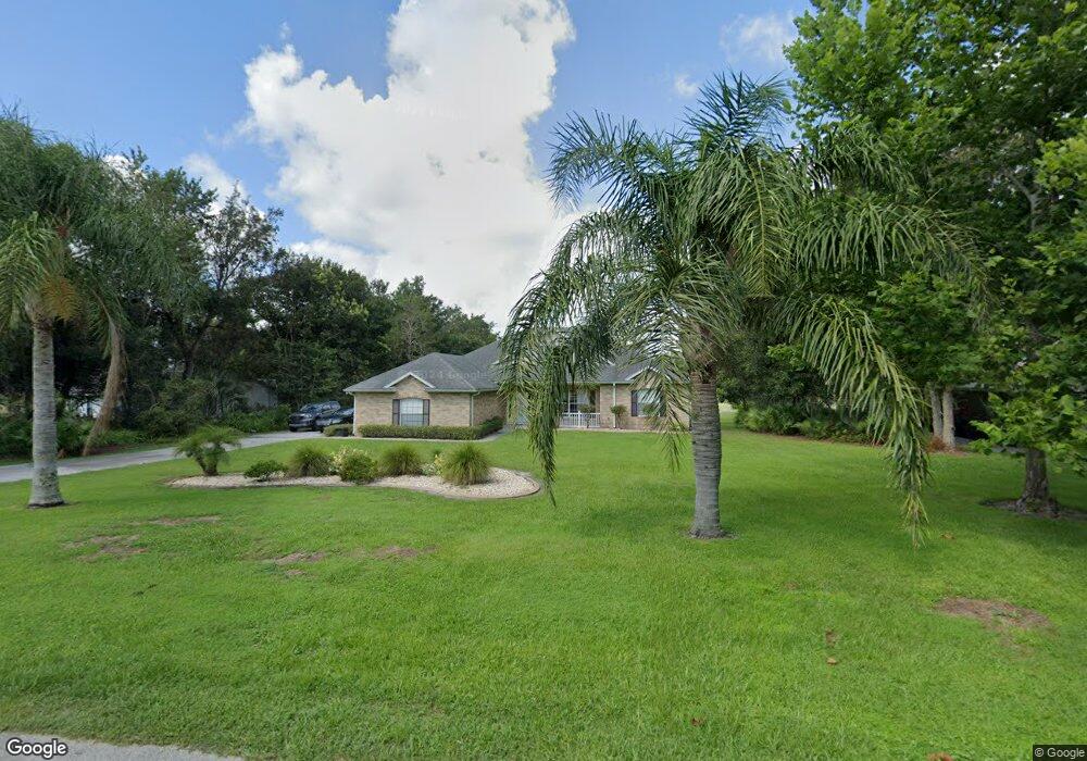
536 E Lehigh Dr Deltona, FL 32738
Estimated Value: $481,000 - $596,811
5
Beds
4
Baths
3,130
Sq Ft
$180/Sq Ft
Est. Value
About This Home
This home is located at 536 E Lehigh Dr, Deltona, FL 32738 and is currently estimated at $563,703, approximately $180 per square foot. 536 E Lehigh Dr is a home located in Volusia County with nearby schools including Forest Lake Elementary School, Heritage Middle School, and Pine Ridge High School.
Ownership History
Date
Name
Owned For
Owner Type
Purchase Details
Closed on
Apr 16, 2004
Sold by
Garcia Karen D
Bought by
Ford Michael A and Ford Diane E
Current Estimated Value
Purchase Details
Closed on
Mar 9, 1997
Sold by
Formoso Giacinto and Formoso Vita
Bought by
Garcia Karen D
Purchase Details
Closed on
Jul 15, 1988
Bought by
Ford Michael A and Ford Diane E
Purchase Details
Closed on
May 15, 1986
Bought by
Ford Michael A and Ford Diane E
Purchase Details
Closed on
Oct 15, 1985
Bought by
Ford Michael A and Ford Diane E
Purchase Details
Closed on
Apr 15, 1984
Bought by
Ford Michael A and Ford Diane E
Create a Home Valuation Report for This Property
The Home Valuation Report is an in-depth analysis detailing your home's value as well as a comparison with similar homes in the area
Home Values in the Area
Average Home Value in this Area
Purchase History
| Date | Buyer | Sale Price | Title Company |
|---|---|---|---|
| Ford Michael A | $59,900 | B D R Title Corporation | |
| Garcia Karen D | $41,000 | -- | |
| Ford Michael A | $100 | -- | |
| Ford Michael A | $31,000 | -- | |
| Ford Michael A | $27,000 | -- | |
| Ford Michael A | $25,000 | -- |
Source: Public Records
Tax History
| Year | Tax Paid | Tax Assessment Tax Assessment Total Assessment is a certain percentage of the fair market value that is determined by local assessors to be the total taxable value of land and additions on the property. | Land | Improvement |
|---|---|---|---|---|
| 2026 | $3,819 | $223,221 | -- | -- |
| 2025 | $3,819 | $223,221 | -- | -- |
| 2024 | $3,617 | $216,931 | -- | -- |
| 2023 | $3,617 | $210,613 | $0 | $0 |
| 2022 | $3,441 | $197,485 | $0 | $0 |
| 2021 | $3,539 | $191,733 | $0 | $0 |
| 2020 | $3,493 | $189,086 | $0 | $0 |
| 2019 | $3,537 | $184,835 | $0 | $0 |
| 2018 | $3,521 | $181,389 | $0 | $0 |
| 2017 | $3,521 | $177,658 | $0 | $0 |
| 2016 | $3,379 | $173,159 | $0 | $0 |
| 2015 | $3,445 | $171,955 | $0 | $0 |
| 2014 | $3,433 | $170,590 | $0 | $0 |
Source: Public Records
Map
Nearby Homes
- 542 Cleo Ln
- 547 Cleo Ln
- 1935 Snook Dr
- 1876 Coble Dr
- 2047 Rocky Hill Dr
- 2097 Cleo Ln
- 2088 Golden Arm Rd
- 560 Saxon Blvd
- 1906 Kingway Dr
- 520 W Kingway Dr
- 513 Tradewinds Dr
- 731 Brechner Terrace
- 1901 Odham Dr
- 752 Fort Smith Blvd
- 825 Fort Smith Blvd
- 728 Fort Smith Blvd
- 724 Fort Smith Blvd
- 1788 E Normandy Blvd
- 1778 E Normandy Blvd
- 1768 E Normandy Blvd
Your Personal Tour Guide
Ask me questions while you tour the home.