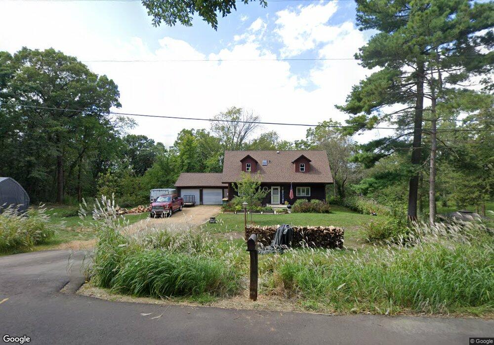
536 Marson Dr Hudson, WI 54016
Troy NeighborhoodEstimated Value: $410,900 - $658,000
--
Bed
--
Bath
--
Sq Ft
0.92
Acres
About This Home
This home is located at 536 Marson Dr, Hudson, WI 54016 and is currently estimated at $495,475. 536 Marson Dr is a home located in St. Croix County with nearby schools including River Crest Elementary School, Hudson Middle School, and Hudson High School.
Ownership History
Date
Name
Owned For
Owner Type
Purchase Details
Closed on
Feb 6, 2013
Sold by
Johnston Stephanie A
Bought by
Graetz Shawn J
Current Estimated Value
Home Financials for this Owner
Home Financials are based on the most recent Mortgage that was taken out on this home.
Original Mortgage
$117,000
Outstanding Balance
$81,448
Interest Rate
3.32%
Mortgage Type
New Conventional
Estimated Equity
$414,027
Purchase Details
Closed on
Feb 29, 2008
Sold by
Buss Sandy D and Johnson Stephanie A
Bought by
Graetz Shawn J
Home Financials for this Owner
Home Financials are based on the most recent Mortgage that was taken out on this home.
Original Mortgage
$109,200
Interest Rate
5.74%
Mortgage Type
Purchase Money Mortgage
Purchase Details
Closed on
Jul 27, 2006
Sold by
Johnston Thomas C
Bought by
Thomas C Johnston Trust
Purchase Details
Closed on
Feb 27, 2006
Sold by
Johnston Stephanie A
Bought by
Johnston Thomas C
Create a Home Valuation Report for This Property
The Home Valuation Report is an in-depth analysis detailing your home's value as well as a comparison with similar homes in the area
Home Values in the Area
Average Home Value in this Area
Purchase History
| Date | Buyer | Sale Price | Title Company |
|---|---|---|---|
| Graetz Shawn J | -- | River Valley Abstract & Titl | |
| Graetz Shawn J | $115,000 | St Croix County Abstract & T | |
| Thomas C Johnston Trust | -- | None Available | |
| Johnston Thomas C | -- | Stillwatrer Title |
Source: Public Records
Mortgage History
| Date | Status | Borrower | Loan Amount |
|---|---|---|---|
| Open | Graetz Shawn J | $117,000 | |
| Previous Owner | Graetz Shawn J | $109,200 |
Source: Public Records
Tax History Compared to Growth
Tax History
| Year | Tax Paid | Tax Assessment Tax Assessment Total Assessment is a certain percentage of the fair market value that is determined by local assessors to be the total taxable value of land and additions on the property. | Land | Improvement |
|---|---|---|---|---|
| 2024 | $33 | $316,400 | $72,800 | $243,600 |
| 2023 | $3,303 | $316,400 | $72,800 | $243,600 |
| 2022 | $3,309 | $316,400 | $72,800 | $243,600 |
| 2021 | $3,242 | $218,100 | $57,200 | $160,900 |
| 2020 | $3,284 | $218,100 | $57,200 | $160,900 |
| 2019 | $3,172 | $218,100 | $57,200 | $160,900 |
| 2018 | $3,074 | $218,100 | $57,200 | $160,900 |
| 2017 | $3,018 | $218,100 | $57,200 | $160,900 |
| 2016 | $3,018 | $224,700 | $57,200 | $167,500 |
| 2015 | $2,768 | $224,700 | $57,200 | $167,500 |
| 2014 | $2,673 | $224,700 | $57,200 | $167,500 |
| 2013 | $2,752 | $224,700 | $57,200 | $167,500 |
Source: Public Records
Map
Nearby Homes
- 50 Robin Ln
- 117 Heirloom Ave
- 81 Lockwood Ct
- 679 Deerwood Dr
- XXX Tower Rd
- 54 Tribute Ave
- Lot 25 Hanley Rd
- 665 Darnold Dr
- 715 Mount Curve Ct
- 671 Darnold Dr
- 718 Crest Curve
- 81 Bridgewater Trail
- 118 Quail Cir
- 261 W Canyon Dr
- 745 Mount Curve Ct
- 251 W Canyon Dr
- 82 Coach Light Dr
- 106 Bridgewater Trail
- 42 Stone Harbor Place
- 217 W Canyon Dr
- 532 Marson Dr
- 537 Marson Dr
- 571 Tower Rd
- 573 Tower Rd
- 530 Marson Dr
- 530 Frances Ave
- 538 Frances Ave
- 531 Marson Dr
- 574 Tower Rd
- 565 Tower Rd
- 527 Frances Ave
- 529 Old Highway 35 S
- 525 Marson Dr
- 537 Frances Ave
- 582 Tower Rd
- 588 Tower Rd
- 529A Old Highway 35
- 521 Old Highway 35 S
- 524 Marson Dr
- 559 Tower Rd