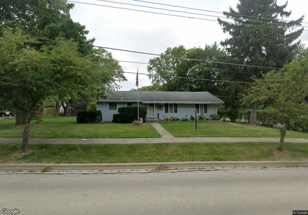
536 N 1st St Gurnee, IL 60031
Estimated Value: $221,000 - $288,000
--
Bed
1
Bath
1,327
Sq Ft
$193/Sq Ft
Est. Value
About This Home
This home is located at 536 N 1st St, Gurnee, IL 60031 and is currently estimated at $255,482, approximately $192 per square foot. 536 N 1st St is a home located in Lake County with nearby schools including Spaulding Elementary School, Viking Middle School, and Warren Township High School.
Ownership History
Date
Name
Owned For
Owner Type
Purchase Details
Closed on
Jan 16, 1998
Sold by
Grand Premier Trust & Investment Inc Na
Bought by
Echtenacher Kenneth B and Echtenacher Arlene G
Current Estimated Value
Home Financials for this Owner
Home Financials are based on the most recent Mortgage that was taken out on this home.
Original Mortgage
$77,300
Interest Rate
7.24%
Create a Home Valuation Report for This Property
The Home Valuation Report is an in-depth analysis detailing your home's value as well as a comparison with similar homes in the area
Home Values in the Area
Average Home Value in this Area
Purchase History
| Date | Buyer | Sale Price | Title Company |
|---|---|---|---|
| Echtenacher Kenneth B | -- | 1St American Title |
Source: Public Records
Mortgage History
| Date | Status | Borrower | Loan Amount |
|---|---|---|---|
| Closed | Echtenacher Kenneth B | $77,300 |
Source: Public Records
Tax History Compared to Growth
Tax History
| Year | Tax Paid | Tax Assessment Tax Assessment Total Assessment is a certain percentage of the fair market value that is determined by local assessors to be the total taxable value of land and additions on the property. | Land | Improvement |
|---|---|---|---|---|
| 2024 | $4,363 | $68,508 | $17,108 | $51,400 |
| 2023 | $4,548 | $60,541 | $15,118 | $45,423 |
| 2022 | $4,548 | $56,254 | $15,853 | $40,401 |
| 2021 | $3,859 | $51,426 | $14,493 | $36,933 |
| 2020 | $3,722 | $50,162 | $14,137 | $36,025 |
| 2019 | $3,617 | $48,706 | $13,727 | $34,979 |
| 2018 | $3,801 | $47,890 | $14,009 | $33,881 |
| 2017 | $4,030 | $46,518 | $13,608 | $32,910 |
| 2016 | $3,871 | $44,447 | $13,002 | $31,445 |
| 2015 | $3,749 | $42,154 | $12,331 | $29,823 |
| 2014 | $3,956 | $45,422 | $12,147 | $33,275 |
| 2012 | $3,757 | $45,770 | $12,240 | $33,530 |
Source: Public Records
Map
Nearby Homes
- 4176 Blackstone Ave
- 4074 Blackstone Ave
- 4471 Brighton Ct Unit 7
- 287 Kensington Ct Unit 4
- 287 Jennifer Ct Unit 12
- 3951 Blackstone Ave
- 3947 Blackstone Ave
- 93 Berkshire Ct Unit D
- 4124 Russell Ave
- 578 Pine Grove Ave
- 964 Magnolia Ave
- 389 Pine Grove Ave
- 951 Belle Plaine Ave
- 963 Belle Plaine Ave
- 450 Tanglewood Dr
- 1048 Belle Plaine Ave
- 468 Tanglewood Dr
- 732 Rogers Rd
- 424 Greenview Dr
- 334 Concord Square
- 4223 Ellis Ave
- 508 N 1st St
- 4224 Woodlawn Ave
- 533 N 1st St
- 564 N 1st St
- 515 N 1st St
- 561 N 1st St
- 4250 Woodlawn Ave
- 4170 Woodlawn Ave
- 578 N 1st St
- 4227 Woodlawn Ave
- 4227 Woodlawn Ave
- 484 N 1st St
- 485 N 1st St
- 4260 Woodlawn Ave
- 4156 Woodlawn Ave
- 4253 Woodlawn Ave
- 4167 Woodlawn Ave
- 4144 Woodlawn Ave
- 466 N 1st St