Estimated Value: $141,000 - $269,000
3
Beds
2
Baths
1,323
Sq Ft
$146/Sq Ft
Est. Value
About This Home
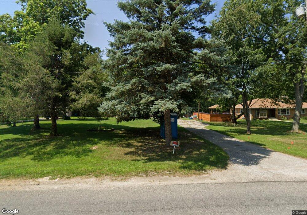
This home is located at 536 N Philip Rd, Niles, MI 49120 and is currently estimated at $193,550, approximately $146 per square foot. 536 N Philip Rd is a home located in Berrien County with nearby schools including Ballard Elementary School, Oak Manor Sixth Grade Center, and Ring Lardner Middle School.
Ownership History
Date
Name
Owned For
Owner Type
Purchase Details
Closed on
Apr 16, 2025
Sold by
Johnson Llene M
Bought by
Hubbard Eugene Norman and Duren Lista Ann
Current Estimated Value
Purchase Details
Closed on
Jul 10, 2017
Sold by
Nichols William H and Johnson Ilene M
Bought by
Johnson Ilene M
Purchase Details
Closed on
Jul 2, 1999
Purchase Details
Closed on
Jan 16, 1984
Purchase Details
Closed on
Mar 25, 1982
Purchase Details
Closed on
Sep 1, 1976
Create a Home Valuation Report for This Property
The Home Valuation Report is an in-depth analysis detailing your home's value as well as a comparison with similar homes in the area
Home Values in the Area
Average Home Value in this Area
Purchase History
| Date | Buyer | Sale Price | Title Company |
|---|---|---|---|
| Hubbard Eugene Norman | $135,000 | Chicago Title Of Michigan | |
| Johnson Ilene M | -- | Attorney | |
| -- | -- | -- | |
| -- | $39,000 | -- | |
| -- | $38,500 | -- | |
| -- | $34,500 | -- |
Source: Public Records
Tax History Compared to Growth
Tax History
| Year | Tax Paid | Tax Assessment Tax Assessment Total Assessment is a certain percentage of the fair market value that is determined by local assessors to be the total taxable value of land and additions on the property. | Land | Improvement |
|---|---|---|---|---|
| 2025 | $1,830 | $114,100 | $0 | $0 |
| 2024 | $676 | $95,100 | $0 | $0 |
| 2023 | $644 | $76,300 | $0 | $0 |
| 2022 | $613 | $69,500 | $0 | $0 |
| 2021 | $1,532 | $68,500 | $9,000 | $59,500 |
| 2020 | $1,909 | $62,500 | $0 | $0 |
| 2019 | $1,829 | $58,100 | $9,000 | $49,100 |
| 2018 | $1,414 | $58,100 | $0 | $0 |
| 2017 | $1,403 | $57,200 | $0 | $0 |
| 2016 | $1,366 | $53,400 | $0 | $0 |
| 2015 | $1,362 | $52,800 | $0 | $0 |
| 2014 | $534 | $52,400 | $0 | $0 |
Source: Public Records
Map
Nearby Homes
- 824 N Philip Rd
- 209 N Philip Rd
- 117 N Fairview Ave
- 1836 Platt St
- 219 Arlington Ln
- 218 Arlington Ln
- 1209 Morris Dr
- 143 Lexington Pointe Dr
- Integrity 1610 Plan at Longmeadow
- Elements 2700 Plan at Longmeadow
- 103 Lexington Pointe Dr
- 134 Turfway Park
- 8 Marmont St
- 537 Grant St
- 1639 Sioux Trail
- 110 Bridle Path Ln
- 124 S State St
- 133 Hummingbird Ln
- 98 River St
- 139 Poppy Ct
- 532 N Philip Rd
- 540 N Philip Rd
- 528 N Philip Rd
- 1701 Platt St
- 539 N Philip Rd
- 518 N Philip Rd
- 1703 Platt St
- 533 N Philip Rd
- 1705 Platt St
- 508 N Philip Rd
- 527 N Philip Rd
- 1734 Platt St
- 502 N Philip Rd
- 1709 Platt St
- 610 N Philip Rd
- 710 Beechwood Dr
- 1707 Platt St
- 1619 Lykins Ln
- 1612 Platt St
- 620 N Philip Rd