Estimated Value: $877,000 - $1,086,000
7
Beds
4
Baths
4,300
Sq Ft
$229/Sq Ft
Est. Value
About This Home
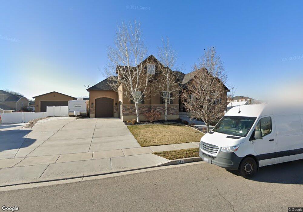
This home is located at 536 S 2500 W, Lehi, UT 84043 and is currently estimated at $982,783, approximately $228 per square foot. 536 S 2500 W is a home located in Utah County with nearby schools including Snow Springs Elementary, Willowcreek Middle School, and Lehi High School.
Ownership History
Date
Name
Owned For
Owner Type
Purchase Details
Closed on
Feb 14, 2013
Sold by
Hughes Ryan
Bought by
Bedier Jeremy and Bedier Aspen
Current Estimated Value
Home Financials for this Owner
Home Financials are based on the most recent Mortgage that was taken out on this home.
Original Mortgage
$308,000
Outstanding Balance
$214,111
Interest Rate
3.29%
Mortgage Type
New Conventional
Estimated Equity
$768,672
Purchase Details
Closed on
Dec 6, 2011
Sold by
Swadley William L and Swadley Brenda K
Bought by
Hughes Ryan
Home Financials for this Owner
Home Financials are based on the most recent Mortgage that was taken out on this home.
Original Mortgage
$295,000
Interest Rate
4.06%
Mortgage Type
Construction
Purchase Details
Closed on
Nov 25, 2009
Sold by
Bank Of American Fork
Bought by
Swadley William L and Swadley Brenda K
Create a Home Valuation Report for This Property
The Home Valuation Report is an in-depth analysis detailing your home's value as well as a comparison with similar homes in the area
Home Values in the Area
Average Home Value in this Area
Purchase History
| Date | Buyer | Sale Price | Title Company |
|---|---|---|---|
| Bedier Jeremy | -- | Keystone Title Ins Age | |
| Hughes Ryan | -- | First American American For | |
| Swadley William L | -- | Equity Title Insurance Agen |
Source: Public Records
Mortgage History
| Date | Status | Borrower | Loan Amount |
|---|---|---|---|
| Open | Bedier Jeremy | $308,000 | |
| Previous Owner | Hughes Ryan | $295,000 |
Source: Public Records
Tax History Compared to Growth
Tax History
| Year | Tax Paid | Tax Assessment Tax Assessment Total Assessment is a certain percentage of the fair market value that is determined by local assessors to be the total taxable value of land and additions on the property. | Land | Improvement |
|---|---|---|---|---|
| 2025 | $4,030 | $517,715 | $291,100 | $650,200 |
| 2024 | $4,030 | $471,625 | $0 | $0 |
| 2023 | $3,715 | $472,010 | $0 | $0 |
| 2022 | $3,570 | $439,725 | $0 | $0 |
| 2021 | $3,224 | $600,400 | $168,500 | $431,900 |
| 2020 | $3,040 | $559,600 | $156,000 | $403,600 |
| 2019 | $2,713 | $519,100 | $156,000 | $363,100 |
| 2018 | $2,538 | $459,100 | $143,400 | $315,700 |
| 2017 | $2,533 | $243,650 | $0 | $0 |
| 2016 | $2,585 | $230,670 | $0 | $0 |
| 2015 | $2,663 | $225,555 | $0 | $0 |
| 2014 | $2,485 | $209,275 | $0 | $0 |
Source: Public Records
Map
Nearby Homes
- 603 S 2500 W
- 811 S 2300 W
- 2190 W Cape Fox Way Unit 219
- 210 S Tamarak Cir
- 928 Gander Way
- 1048 E Scuttlebutt Ln
- 2817 W Willow Dr
- 202 S 2035 W
- The Roslyn Plan at Carla's Cove
- The Tracie Plan at Carla's Cove
- The Brooke Plan at Carla's Cove
- The Jackie Plan at Carla's Cove
- 41 N 2150 W
- 105 N 2430 W
- 2178 W Main St Unit D301
- 2162 W Main St Unit E303
- 122 N 2430 W Unit 1
- 1133 E Commodore Ln
- 1137 E Commodore Ln
- 1784 W Grays Place
- 537 S 2575 W
- 462 S 2500 W Unit 18
- 462 S 2500 W
- 584 S 2500 W Unit 16
- 535 S 2500 W Unit 10
- 535 S 2500 W
- 461 S 2575 W
- 583 S 2575 W
- 581 S 2500 W
- 457 S 2500 W
- 457 S 2500 W Unit 9
- 450 450 S
- 602 S 2500 W
- 544 S 2575 W Unit 3
- 601 S 2575 W Unit 22
- 2534 W 450 S
- 488 S 2575 W
- 439 S 2500 W
- 439 S 2500 W Unit 8
- 596 S 2575 W