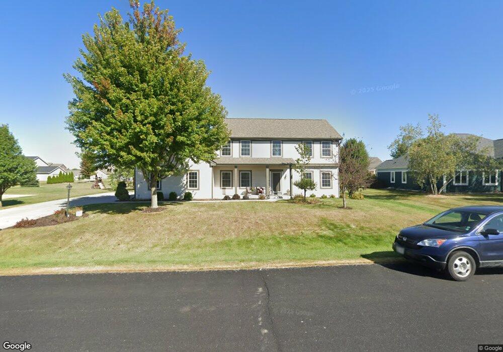
536 S Buth Rd Dousman, WI 53118
Estimated Value: $630,409 - $671,000
4
Beds
3
Baths
2,617
Sq Ft
$249/Sq Ft
Est. Value
About This Home
This home is located at 536 S Buth Rd, Dousman, WI 53118 and is currently estimated at $650,352, approximately $248 per square foot. 536 S Buth Rd is a home located in Waukesha County with nearby schools including Dousman Elementary School, Kettle Moraine Middle School, and Kettle Moraine High School.
Ownership History
Date
Name
Owned For
Owner Type
Purchase Details
Closed on
Sep 30, 2013
Sold by
Moulton Nicholas E and Moulton Lori A
Bought by
Hazelberg Peter and Hazelberg Margaret
Current Estimated Value
Home Financials for this Owner
Home Financials are based on the most recent Mortgage that was taken out on this home.
Original Mortgage
$246,000
Outstanding Balance
$184,850
Interest Rate
4.5%
Mortgage Type
New Conventional
Estimated Equity
$465,502
Purchase Details
Closed on
Jun 26, 2009
Sold by
Utica Lake Llc
Bought by
Moulton Nicholas E and Moulton Lori A
Home Financials for this Owner
Home Financials are based on the most recent Mortgage that was taken out on this home.
Original Mortgage
$282,250
Interest Rate
4.25%
Mortgage Type
Construction
Create a Home Valuation Report for This Property
The Home Valuation Report is an in-depth analysis detailing your home's value as well as a comparison with similar homes in the area
Home Values in the Area
Average Home Value in this Area
Purchase History
| Date | Buyer | Sale Price | Title Company |
|---|---|---|---|
| Hazelberg Peter | $308,000 | Title Member State Bar Of | |
| Moulton Nicholas E | $56,000 | None Available |
Source: Public Records
Mortgage History
| Date | Status | Borrower | Loan Amount |
|---|---|---|---|
| Open | Hazelberg Peter | $246,000 | |
| Previous Owner | Moulton Nicholas E | $282,250 |
Source: Public Records
Tax History Compared to Growth
Tax History
| Year | Tax Paid | Tax Assessment Tax Assessment Total Assessment is a certain percentage of the fair market value that is determined by local assessors to be the total taxable value of land and additions on the property. | Land | Improvement |
|---|---|---|---|---|
| 2024 | $6,687 | $502,000 | $135,000 | $367,000 |
| 2023 | $6,248 | $437,000 | $117,000 | $320,000 |
| 2022 | $6,396 | $409,000 | $99,000 | $310,000 |
| 2021 | $5,912 | $409,000 | $99,000 | $310,000 |
| 2020 | $6,199 | $409,000 | $99,000 | $310,000 |
| 2019 | $4,864 | $271,000 | $55,000 | $216,000 |
| 2018 | $4,709 | $271,000 | $55,000 | $216,000 |
| 2017 | $4,414 | $256,000 | $55,000 | $201,000 |
| 2016 | $4,295 | $256,000 | $55,000 | $201,000 |
| 2015 | $4,365 | $256,000 | $55,000 | $201,000 |
| 2014 | $4,192 | $256,000 | $55,000 | $201,000 |
| 2013 | $4,192 | $256,000 | $55,000 | $201,000 |
Source: Public Records
Map
Nearby Homes
- 616 N Buth Rd
- 149 Twin Creeks Dr
- Lt129 Twin Creeks Dr
- 596 Twin Creeks Dr
- 590 Twin Creeks Dr
- 599 Twin Creeks Dr
- 578 Twin Creeks Dr
- 584 Twin Creeks Dr
- The Rylee Plan at The Settlement at Utica Lake
- The Taylor Plan at The Settlement at Utica Lake
- The Lauren Plan at The Settlement at Utica Lake
- The Hannah Plan at The Settlement at Utica Lake
- The Brianna Plan at The Settlement at Utica Lake
- The Arielle Plan at The Settlement at Utica Lake
- Pcl2 County Road z
- 109 Johnston Dr Unit 111
- N62W35431 William Ct
- 144 Evergreen St
- 460 E Red Pine Cir
- Lt8 Wolf Dr