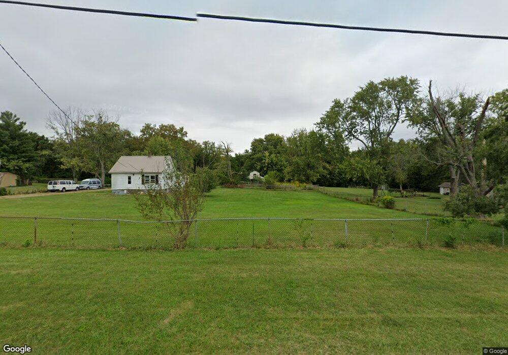
536 Tohill Rd Decatur, IL 62521
Estimated Value: $99,000 - $160,497
--
Bed
--
Bath
960
Sq Ft
$146/Sq Ft
Est. Value
About This Home
This home is located at 536 Tohill Rd, Decatur, IL 62521 and is currently estimated at $140,624, approximately $146 per square foot. 536 Tohill Rd is a home located in Macon County with nearby schools including Meridian Middle School, Meridian High School, and Holy Family Catholic School.
Ownership History
Date
Name
Owned For
Owner Type
Purchase Details
Closed on
Jul 31, 2024
Sold by
Ater Michael D
Bought by
Melton Melissa Katherine
Current Estimated Value
Home Financials for this Owner
Home Financials are based on the most recent Mortgage that was taken out on this home.
Original Mortgage
$78,900
Interest Rate
8.75%
Mortgage Type
Construction
Create a Home Valuation Report for This Property
The Home Valuation Report is an in-depth analysis detailing your home's value as well as a comparison with similar homes in the area
Home Values in the Area
Average Home Value in this Area
Purchase History
| Date | Buyer | Sale Price | Title Company |
|---|---|---|---|
| Melton Melissa Katherine | $50,000 | None Listed On Document |
Source: Public Records
Mortgage History
| Date | Status | Borrower | Loan Amount |
|---|---|---|---|
| Closed | Melton Melissa Katherine | $78,900 |
Source: Public Records
Tax History Compared to Growth
Tax History
| Year | Tax Paid | Tax Assessment Tax Assessment Total Assessment is a certain percentage of the fair market value that is determined by local assessors to be the total taxable value of land and additions on the property. | Land | Improvement |
|---|---|---|---|---|
| 2024 | $3,332 | $49,787 | $5,818 | $43,969 |
| 2023 | $3,083 | $44,729 | $5,818 | $38,911 |
| 2022 | $2,998 | $42,672 | $5,550 | $37,122 |
| 2021 | $2,902 | $40,595 | $5,280 | $35,315 |
| 2020 | $1,576 | $38,477 | $5,005 | $33,472 |
| 2019 | $1,576 | $38,477 | $5,005 | $33,472 |
| 2018 | $1,569 | $37,011 | $4,814 | $32,197 |
| 2017 | $1,552 | $36,666 | $4,769 | $31,897 |
| 2016 | $1,566 | $36,589 | $4,759 | $31,830 |
| 2015 | $1,550 | $35,523 | $4,620 | $30,903 |
| 2014 | $1,476 | $35,171 | $4,574 | $30,597 |
| 2013 | $1,516 | $35,171 | $4,574 | $30,597 |
Source: Public Records
Map
Nearby Homes
- 435 Dawson Rd
- 3020 S Laura St
- 2940 Crestwood Dr
- 102 Phillips Dr
- 2605 S Forrest Green Dr
- 98 Ridgeway Dr
- 0 Wildwood Ct
- 2626 S Forrest Green Dr
- 2628 S Forrest Green Dr
- 43 Ridgedale Dr
- 2913 S Danny Dr
- 20 Ridge Dr
- 19 Peggy Ann Dr
- 3483 Nancy Rd
- 3137 Southland Rd
- 411 Woodhill Dr
- 405 Hackberry Dr
- 23 La Salle Dr
- 28 Sandcreek Dr
- 320 Hackberry Place