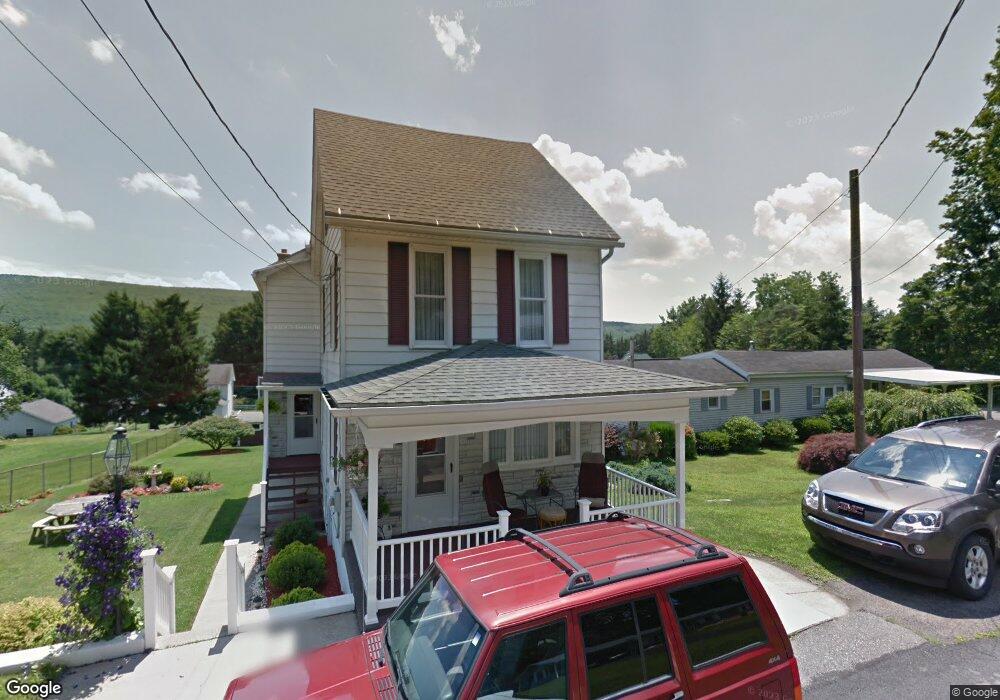
536 W 5th St Williamstown, PA 17098
Estimated Value: $160,000 - $207,000
2
Beds
1
Bath
1,076
Sq Ft
$171/Sq Ft
Est. Value
About This Home
This home is located at 536 W 5th St, Williamstown, PA 17098 and is currently estimated at $183,500, approximately $170 per square foot. 536 W 5th St is a home located in Dauphin County with nearby schools including Williams Valley Elementary School and Williams Valley Junior/Senior High School.
Ownership History
Date
Name
Owned For
Owner Type
Purchase Details
Closed on
Oct 12, 2021
Sold by
Archer Nicole E and Fetterhoff Nicole E
Bought by
Fetterhoff Nicole E
Current Estimated Value
Home Financials for this Owner
Home Financials are based on the most recent Mortgage that was taken out on this home.
Original Mortgage
$100,000
Outstanding Balance
$91,466
Interest Rate
3.01%
Mortgage Type
New Conventional
Estimated Equity
$92,034
Purchase Details
Closed on
Aug 14, 2015
Sold by
Adams Exr Joanne G and The Estate Of Anna E Rowe
Bought by
Archer Nicole E
Home Financials for this Owner
Home Financials are based on the most recent Mortgage that was taken out on this home.
Original Mortgage
$72,750
Interest Rate
4.08%
Mortgage Type
New Conventional
Create a Home Valuation Report for This Property
The Home Valuation Report is an in-depth analysis detailing your home's value as well as a comparison with similar homes in the area
Home Values in the Area
Average Home Value in this Area
Purchase History
| Date | Buyer | Sale Price | Title Company |
|---|---|---|---|
| Fetterhoff Nicole E | -- | None Available | |
| Archer Nicole E | $75,000 | -- |
Source: Public Records
Mortgage History
| Date | Status | Borrower | Loan Amount |
|---|---|---|---|
| Open | Fetterhoff Nicole E | $100,000 | |
| Closed | Archer Nicole E | $72,750 |
Source: Public Records
Tax History Compared to Growth
Tax History
| Year | Tax Paid | Tax Assessment Tax Assessment Total Assessment is a certain percentage of the fair market value that is determined by local assessors to be the total taxable value of land and additions on the property. | Land | Improvement |
|---|---|---|---|---|
| 2025 | $375 | $12,000 | $12,000 | $0 |
| 2024 | $343 | $12,000 | $12,000 | $0 |
| 2023 | $330 | $12,000 | $12,000 | $0 |
| 2022 | $317 | $12,000 | $12,000 | $0 |
| 2021 | $308 | $12,000 | $12,000 | $0 |
| 2020 | $308 | $12,000 | $12,000 | $0 |
| 2019 | $308 | $12,000 | $12,000 | $0 |
| 2018 | $308 | $26,300 | $12,000 | $14,300 |
| 2017 | $676 | $26,300 | $12,000 | $14,300 |
| 2016 | $0 | $26,300 | $12,000 | $14,300 |
| 2015 | -- | $26,300 | $12,000 | $14,300 |
| 2014 | -- | $26,300 | $12,000 | $14,300 |
Source: Public Records
Map
Nearby Homes
- 429 W Market St
- 416 W Market St
- 215 W Market St
- 127 and 129 E Market St
- 144 East St
- 111 E Market St
- 128 E Market St
- 210 E Broad St
- 311 Vine St
- 344 E Broad St
- 9701 United States Route 209
- 453 E Market St
- 457 E Market St
- 1254 W Broad St
- 599 E Market St
- 0 Maple St Unit PADA2051736
- 0 Maple St
- 8690 Pennsylvania 25
- 534 Pottsville St
- 134 W Wisconisco Ave