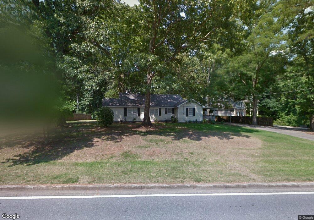
5360 Due West Rd Powder Springs, GA 30127
West Cobb NeighborhoodEstimated Value: $316,389 - $438,000
2
Beds
1
Bath
1,676
Sq Ft
$222/Sq Ft
Est. Value
About This Home
This home is located at 5360 Due West Rd, Powder Springs, GA 30127 and is currently estimated at $372,597, approximately $222 per square foot. 5360 Due West Rd is a home located in Cobb County with nearby schools including Ford Elementary School, Lost Mountain Middle School, and Harrison High School.
Ownership History
Date
Name
Owned For
Owner Type
Purchase Details
Closed on
Sep 29, 2006
Sold by
Roberts Dennis K
Bought by
Tatom Mary K
Current Estimated Value
Purchase Details
Closed on
Aug 26, 2005
Sold by
Mcbrayer Hollis
Bought by
Premier Prop Inc
Purchase Details
Closed on
Dec 3, 1999
Sold by
Harris James D and Harris Carolyn B
Bought by
Mcbrrayer Hollis
Home Financials for this Owner
Home Financials are based on the most recent Mortgage that was taken out on this home.
Original Mortgage
$124,000
Interest Rate
7.8%
Mortgage Type
New Conventional
Create a Home Valuation Report for This Property
The Home Valuation Report is an in-depth analysis detailing your home's value as well as a comparison with similar homes in the area
Home Values in the Area
Average Home Value in this Area
Purchase History
| Date | Buyer | Sale Price | Title Company |
|---|---|---|---|
| Tatom Mary K | $142,500 | -- | |
| Premier Prop Inc | $200,000 | -- | |
| Mcbrrayer Hollis | $155,000 | -- |
Source: Public Records
Mortgage History
| Date | Status | Borrower | Loan Amount |
|---|---|---|---|
| Previous Owner | Mcbrrayer Hollis | $124,000 |
Source: Public Records
Tax History Compared to Growth
Tax History
| Year | Tax Paid | Tax Assessment Tax Assessment Total Assessment is a certain percentage of the fair market value that is determined by local assessors to be the total taxable value of land and additions on the property. | Land | Improvement |
|---|---|---|---|---|
| 2025 | $2,712 | $90,008 | $44,272 | $45,736 |
| 2024 | $2,714 | $90,008 | $44,272 | $45,736 |
| 2023 | $2,394 | $79,388 | $41,272 | $38,116 |
| 2022 | $2,034 | $67,028 | $33,016 | $34,012 |
| 2021 | $2,034 | $67,028 | $33,016 | $34,012 |
| 2020 | $1,702 | $56,068 | $27,016 | $29,052 |
| 2019 | $1,702 | $56,068 | $27,016 | $29,052 |
| 2018 | $1,562 | $51,476 | $24,764 | $26,712 |
| 2017 | $1,480 | $51,476 | $24,764 | $26,712 |
| 2016 | $1,329 | $46,224 | $19,512 | $26,712 |
| 2015 | $1,231 | $41,788 | $18,760 | $23,028 |
| 2014 | $1,242 | $41,788 | $0 | $0 |
Source: Public Records
Map
Nearby Homes
- 265 Holland Rd
- 390 Scott Farm Dr
- 776 Amos Ln
- 632 Owl Creek Dr
- 826 Omaha Place
- 718 1st Cotton Dr
- The Sadie Plan at Livingstone Park
- The Carie Plan at Livingstone Park
- The Cameron Plan at Livingstone Park
- The Melissa Plan at Livingstone Park
- The Whitney Plan at Livingstone Park
- 403 Wild Iris Ln Unit 6
- 5567 Forest Edge Ln NW
- 725 Holland Rd
- 952 Thousand Oaks Bend NW Unit 6
- 154 Gold Leaf Trail
- 5570 Fords Crossing Ct NW
- 870 Fairwood Pointe NW
- 5900 Pavillion Dr
- 5400 Due West Rd
- 5356 Due West Rd
- 5306 Red Rock Trace
- 5193 Marsden Trace
- 5393 Due West Rd
- 5308 Red Rock Trace
- 5350 Due West Rd
- 5415 Due West Rd
- 506 Mars Hill Rd
- 5305 Red Rock Trace
- 5387 Due West Rd
- 510 Mars Hill Rd
- 5189 Marsden Trace
- 5194 Marsden Trace
- 5437 Due West Rd
- 5437 Due Rd W
- 5290 Due West Rd
- 5192 Marsden Trace
- 502 Mars Hill Rd
- 5199 Marsden Trace