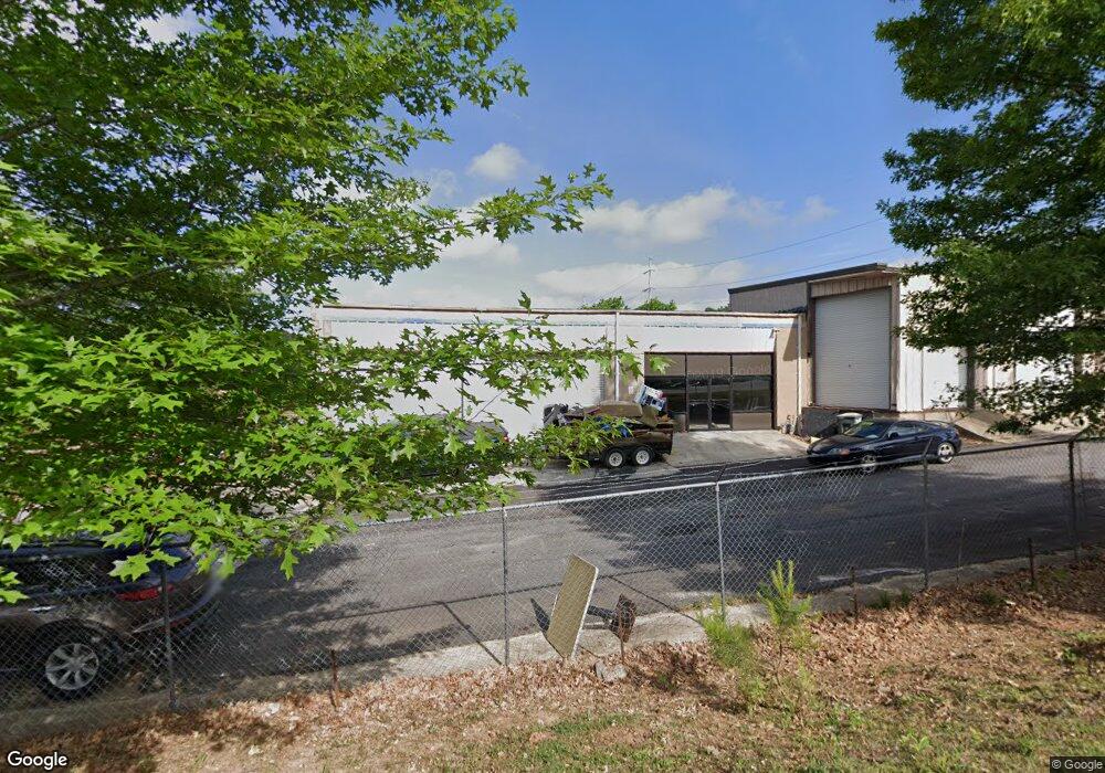
5361 Covington Hwy Decatur, GA 30035
Southwest DeKalb NeighborhoodEstimated Value: $667,086
--
Bed
--
Bath
9,471
Sq Ft
$70/Sq Ft
Est. Value
About This Home
This home is located at 5361 Covington Hwy, Decatur, GA 30035 and is currently estimated at $667,086, approximately $70 per square foot. 5361 Covington Hwy is a home located in DeKalb County with nearby schools including Canby Lane Elementary School, Mary McLeod Bethune Middle School, and Towers High School.
Ownership History
Date
Name
Owned For
Owner Type
Purchase Details
Closed on
Dec 21, 2017
Sold by
Young Duane
Bought by
Tycore Auto Svcs Inc
Current Estimated Value
Home Financials for this Owner
Home Financials are based on the most recent Mortgage that was taken out on this home.
Original Mortgage
$166,000
Interest Rate
3.92%
Mortgage Type
New Conventional
Purchase Details
Closed on
Dec 20, 2017
Sold by
Mckeever
Bought by
Young Duane
Home Financials for this Owner
Home Financials are based on the most recent Mortgage that was taken out on this home.
Original Mortgage
$166,000
Interest Rate
3.92%
Mortgage Type
New Conventional
Create a Home Valuation Report for This Property
The Home Valuation Report is an in-depth analysis detailing your home's value as well as a comparison with similar homes in the area
Home Values in the Area
Average Home Value in this Area
Purchase History
| Date | Buyer | Sale Price | Title Company |
|---|---|---|---|
| Tycore Auto Svcs Inc | -- | -- | |
| Young Duane | $295,000 | -- |
Source: Public Records
Mortgage History
| Date | Status | Borrower | Loan Amount |
|---|---|---|---|
| Closed | Tycore Auto Svcs Inc | $166,000 |
Source: Public Records
Tax History Compared to Growth
Tax History
| Year | Tax Paid | Tax Assessment Tax Assessment Total Assessment is a certain percentage of the fair market value that is determined by local assessors to be the total taxable value of land and additions on the property. | Land | Improvement |
|---|---|---|---|---|
| 2025 | $5,491 | $560,080 | $300,000 | $260,080 |
| 2024 | $5,421 | $115,240 | $61,720 | $53,520 |
| 2023 | $5,421 | $115,240 | $61,720 | $53,520 |
| 2022 | $5,245 | $115,240 | $61,720 | $53,520 |
| 2021 | $5,245 | $115,240 | $61,720 | $53,520 |
| 2020 | $5,245 | $115,240 | $61,720 | $53,520 |
| 2019 | $5,245 | $115,240 | $61,720 | $53,520 |
| 2018 | $4,707 | $115,240 | $61,720 | $53,520 |
| 2017 | $4,051 | $115,240 | $61,720 | $53,520 |
| 2016 | $5,545 | $115,240 | $61,720 | $53,520 |
| 2014 | $3,990 | $115,240 | $61,720 | $53,520 |
Source: Public Records
Map
Nearby Homes
- 2065 Resting Creek Dr
- 4612 Grand Central Pkwy
- 2014 Manhattan Pkwy
- 1830 Broadway St
- 1923 Manhattan Pkwy Unit 183
- 5181 Covington Hwy
- 5169 Covington Hwy
- 5159 Covington Hwy
- 5160 Covington Hwy Unit 18
- 5160 Covington Hwy
- 4579 Tudor Castle Dr
- 2109 Creekview Trail
- 1764 Big Valley Way Unit 3
- 5094 Covington Hwy
- 4827 Snap Creek Ln
- Pearson Plan at Young's Crossing
- 2428 Marsh Rabbit Bend
- 4889 Wedgewood Way
- 4626 Biffle Rd
- 2064 Crossing Rd
- 5355 Covington Hwy
- 2016 Resting Creek Dr
- 2010 Resting Creek Dr Unit 3
- 2022 Resting Creek Dr
- 2160 Lenox Ave
- 2078 Manhattan Pkwy
- 2078 Manhattan Pkwy Unit 2078
- 2076 Manhattan Pkwy
- 2080 Manhattan Pkwy
- 2082 Manhattan Pkwy
- 2084 Manhattan Pkwy
- 2086 Manhattan Pkwy
- 2158 Lenox Ave Unit 288
- 2088 Manhattan Pkwy
- 2032 Resting Creek Dr Unit 3
- 2156 Lenox Ave
- 2000 Resting Creek Dr
- 2154 Lenox Ave Unit 286
- 2154 Lenox Ave
- 2152 Lenox Ave Unit 285