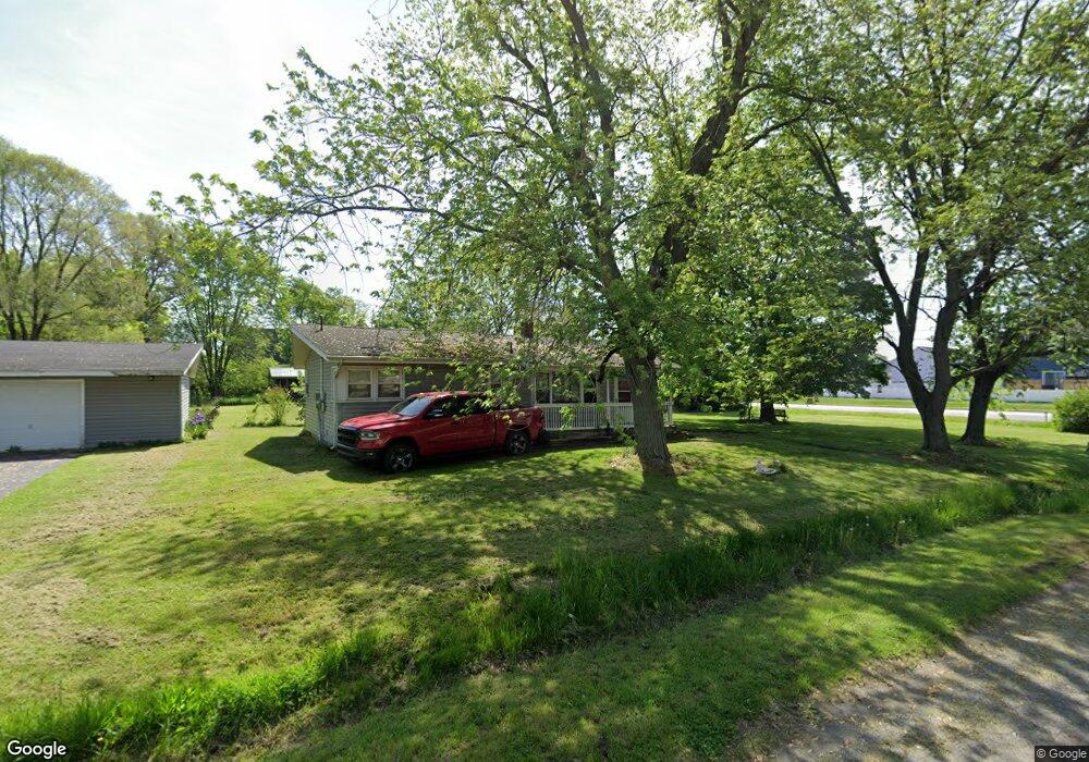
5362 La Hayne Rd Chesterton, IN 46304
Estimated Value: $176,000 - $235,000
3
Beds
1
Bath
1,040
Sq Ft
$204/Sq Ft
Est. Value
About This Home
This home is located at 5362 La Hayne Rd, Chesterton, IN 46304 and is currently estimated at $212,076, approximately $203 per square foot. 5362 La Hayne Rd is a home located in Porter County with nearby schools including Liberty Elementary School, Liberty Intermediate School, and Chesterton Middle School.
Ownership History
Date
Name
Owned For
Owner Type
Purchase Details
Closed on
Apr 4, 2025
Sold by
Lemaich Brent T
Bought by
Klee Ethan M and Klee Elyssa Lee
Current Estimated Value
Home Financials for this Owner
Home Financials are based on the most recent Mortgage that was taken out on this home.
Original Mortgage
$193,903
Outstanding Balance
$193,075
Interest Rate
6.85%
Mortgage Type
New Conventional
Estimated Equity
$19,001
Purchase Details
Closed on
Sep 19, 2024
Sold by
Haack Dennis K
Bought by
Lemaich Brent T
Create a Home Valuation Report for This Property
The Home Valuation Report is an in-depth analysis detailing your home's value as well as a comparison with similar homes in the area
Home Values in the Area
Average Home Value in this Area
Purchase History
| Date | Buyer | Sale Price | Title Company |
|---|---|---|---|
| Klee Ethan M | $199,900 | None Listed On Document | |
| Lemaich Brent T | -- | Meridian Title |
Source: Public Records
Mortgage History
| Date | Status | Borrower | Loan Amount |
|---|---|---|---|
| Open | Klee Ethan M | $193,903 |
Source: Public Records
Tax History Compared to Growth
Tax History
| Year | Tax Paid | Tax Assessment Tax Assessment Total Assessment is a certain percentage of the fair market value that is determined by local assessors to be the total taxable value of land and additions on the property. | Land | Improvement |
|---|---|---|---|---|
| 2024 | $1,272 | $161,800 | $25,000 | $136,800 |
| 2023 | $1,252 | $143,700 | $21,700 | $122,000 |
| 2022 | $1,405 | $148,600 | $21,700 | $126,900 |
| 2021 | $995 | $118,800 | $21,700 | $97,100 |
| 2020 | $874 | $109,600 | $21,700 | $87,900 |
| 2019 | $823 | $103,200 | $21,700 | $81,500 |
| 2018 | $765 | $99,300 | $21,700 | $77,600 |
| 2017 | $766 | $102,100 | $21,700 | $80,400 |
| 2016 | $742 | $102,500 | $21,800 | $80,700 |
| 2014 | $708 | $95,300 | $20,500 | $74,800 |
| 2013 | -- | $91,300 | $20,900 | $70,400 |
Source: Public Records
Map
Nearby Homes
- 2513 Springdale St
- 2141 Larchwood Ave
- 2131 Pepperbush Ave
- 0 St Rd 149 Unit NRA824925
- 1461 Eagle St
- 3585 Drivers Way
- 3525 Drivers Way
- TBD Lenburg Rd
- 0-TBD Lenburg Rd
- 237 Cessna Dr
- V/L U S 20
- 283 Melton Rd
- The Duneland Plan at Village in Burns Harbor
- 1151 Burns Blvd
- 2375 Arrow St
- 0 Burns Blvd
- 1138 Weaver Way
- 1136 Weaver Way
- 357 Melton Rd
- 1162 Chesterfield Ave
- 5302 Lahayne Rd
- 5302 La Hayne Rd
- 5252 La Hayne Rd
- 4050 Lahayne Rd
- 5312 La Hayne Rd
- 1842 Ritter St
- 5312 Lahayne Rd
- 4474 Meadowdale Ave
- 1817 Ritter St
- 4454 Meadowdale Ave
- 4514 Meadowdale Ave
- 1826 Ritter St
- 5322 La Hayne Rd
- 1801 Ritter St
- 2412 Ritter St
- 4534 Meadowdale Ave
- 5332 La Hayne Rd
- 1810 Ritter St
- 2405 Glendale St
- 2411 Ritter St