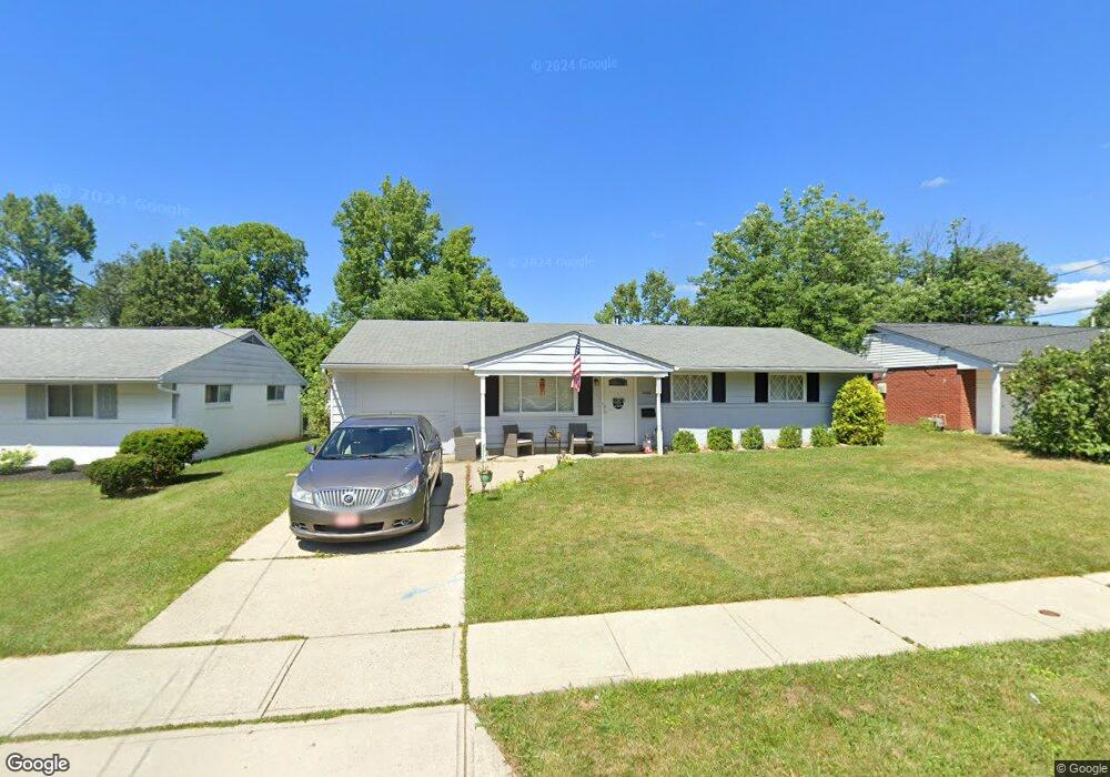
5362 Whitmore Dr Cincinnati, OH 45238
Delhi Hills NeighborhoodEstimated Value: $207,000 - $254,000
4
Beds
2
Baths
1,593
Sq Ft
$145/Sq Ft
Est. Value
About This Home
This home is located at 5362 Whitmore Dr, Cincinnati, OH 45238 and is currently estimated at $230,463, approximately $144 per square foot. 5362 Whitmore Dr is a home located in Hamilton County with nearby schools including C.O. Harrison Elementary School, Delhi Middle School, and Oak Hills High School.
Ownership History
Date
Name
Owned For
Owner Type
Purchase Details
Closed on
Aug 16, 2023
Sold by
Powell Jeffrey J
Bought by
Smith Heather G
Current Estimated Value
Home Financials for this Owner
Home Financials are based on the most recent Mortgage that was taken out on this home.
Original Mortgage
$6,440
Outstanding Balance
$233
Interest Rate
6.81%
Mortgage Type
New Conventional
Estimated Equity
$230,230
Create a Home Valuation Report for This Property
The Home Valuation Report is an in-depth analysis detailing your home's value as well as a comparison with similar homes in the area
Home Values in the Area
Average Home Value in this Area
Purchase History
| Date | Buyer | Sale Price | Title Company |
|---|---|---|---|
| Smith Heather G | $184,000 | Tandem Title |
Source: Public Records
Mortgage History
| Date | Status | Borrower | Loan Amount |
|---|---|---|---|
| Open | Smith Heather G | $6,440 | |
| Open | Smith Heather G | $180,667 |
Source: Public Records
Tax History
| Year | Tax Paid | Tax Assessment Tax Assessment Total Assessment is a certain percentage of the fair market value that is determined by local assessors to be the total taxable value of land and additions on the property. | Land | Improvement |
|---|---|---|---|---|
| 2025 | $3,448 | $57,957 | $10,052 | $47,905 |
| 2023 | $3,374 | $57,957 | $10,052 | $47,905 |
| 2022 | $2,549 | $38,892 | $9,303 | $29,589 |
| 2021 | $2,497 | $38,892 | $9,303 | $29,589 |
| 2020 | $2,532 | $38,892 | $9,303 | $29,589 |
| 2019 | $2,429 | $33,527 | $8,019 | $25,508 |
| 2018 | $2,431 | $33,527 | $8,019 | $25,508 |
| 2017 | $2,196 | $33,527 | $8,019 | $25,508 |
| 2016 | $1,831 | $27,965 | $7,616 | $20,349 |
| 2015 | $1,916 | $27,965 | $7,616 | $20,349 |
| 2014 | $1,915 | $27,965 | $7,616 | $20,349 |
| 2013 | $1,900 | $29,439 | $8,019 | $21,420 |
Source: Public Records
Map
Nearby Homes
- 298 Kinsman Ct
- 5062 Orangelawn Dr
- 410 Morrvue Dr
- 5467 Starcrest Dr
- 5474 Starcrest Dr
- 481 Viscount Dr
- 4904 Riverwatch Dr
- 4994 Troubador Ct
- 4979 Bonaventure Ct
- 5210 Old Oak Trail
- 5160 Old Oak Trail
- 4938 Mount Alverno Rd
- 5528 Timber Way Dr Unit 5528
- 4968 Francisview Dr
- 5140 Old Oak Trail
- 4924 Alvernovalley Ct
- 337 Greenwell Ave
- 548 Anderson Ferry Rd
- 5661 Alomar Dr
- 553 Starling Ct
- 5366 Whitmore Dr
- 5360 Whitmore Dr
- 5368 Whitmore Dr
- 5356 Whitmore Dr
- 257 Brookforest Dr
- 263 Brookforest Dr
- 259 Brookforest Dr
- 5374 Whitmore Dr
- 5363 Whitmore Dr
- 265 Brookforest Dr
- 5361 Whitmore Dr
- 5357 Whitmore Dr
- 5369 Whitmore Dr
- 5376 Whitmore Dr
- 269 Brookforest Dr
- 5373 Whitmore Dr
- 5354 Whitmore Dr
- 5355 Whitmore Dr
- 5355 Whitmore Dr
- 5375 Whitmore Dr
Your Personal Tour Guide
Ask me questions while you tour the home.