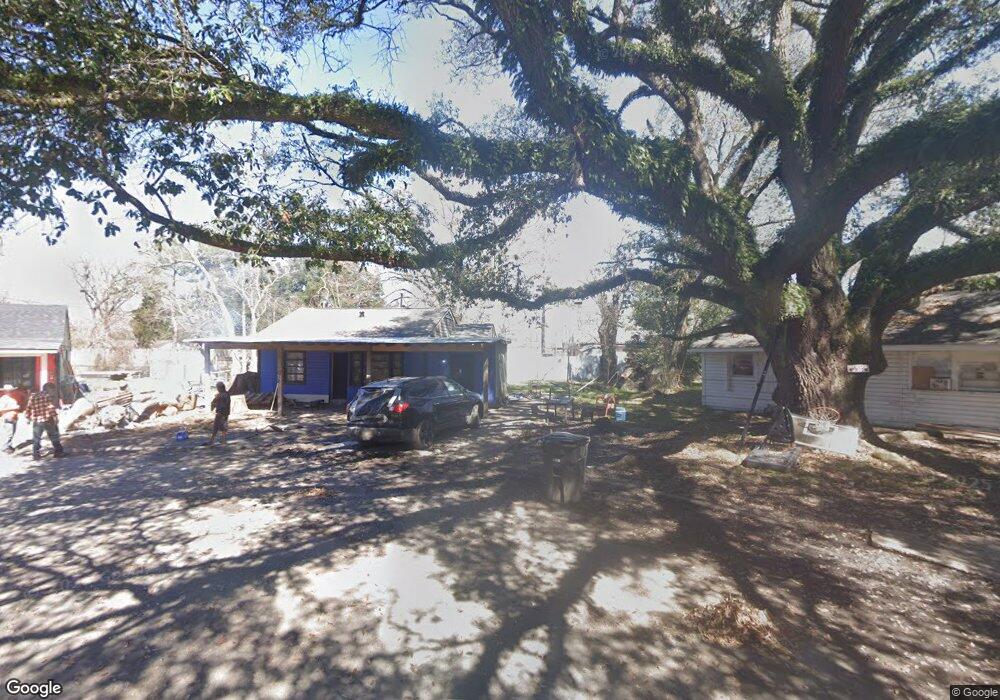
5363 N Saint Gerard Cir Baton Rouge, LA 70805
Mid City North NeighborhoodEstimated Value: $35,000 - $51,000
2
Beds
1
Bath
792
Sq Ft
$58/Sq Ft
Est. Value
About This Home
This home is located at 5363 N Saint Gerard Cir, Baton Rouge, LA 70805 and is currently estimated at $45,678, approximately $57 per square foot. 5363 N Saint Gerard Cir is a home located in East Baton Rouge Parish with nearby schools including Claiborne Elementary School, Brookstown Middle Magnet Academy, and Istrouma High School.
Ownership History
Date
Name
Owned For
Owner Type
Purchase Details
Closed on
Jul 2, 2008
Sold by
Sterling David W
Bought by
Joe Silvio Enterprises
Current Estimated Value
Purchase Details
Closed on
Aug 10, 1999
Sold by
Rent To Own Realty Inc
Bought by
Wheeler Rita Mae
Home Financials for this Owner
Home Financials are based on the most recent Mortgage that was taken out on this home.
Original Mortgage
$25,125
Interest Rate
7.71%
Create a Home Valuation Report for This Property
The Home Valuation Report is an in-depth analysis detailing your home's value as well as a comparison with similar homes in the area
Home Values in the Area
Average Home Value in this Area
Purchase History
| Date | Buyer | Sale Price | Title Company |
|---|---|---|---|
| Joe Silvio Enterprises | $11,000 | -- | |
| Wheeler Rita Mae | $33,500 | -- |
Source: Public Records
Mortgage History
| Date | Status | Borrower | Loan Amount |
|---|---|---|---|
| Previous Owner | Wheeler Rita Mae | $25,125 | |
| Closed | Wheeler Rita Mae | $8,375 |
Source: Public Records
Tax History Compared to Growth
Tax History
| Year | Tax Paid | Tax Assessment Tax Assessment Total Assessment is a certain percentage of the fair market value that is determined by local assessors to be the total taxable value of land and additions on the property. | Land | Improvement |
|---|---|---|---|---|
| 2024 | $484 | $4,133 | $370 | $3,763 |
| 2023 | $484 | $3,690 | $330 | $3,360 |
| 2022 | $441 | $3,690 | $330 | $3,360 |
| 2021 | $430 | $3,690 | $330 | $3,360 |
| 2020 | $428 | $3,690 | $330 | $3,360 |
| 2019 | $406 | $3,350 | $300 | $3,050 |
| 2018 | $401 | $3,350 | $300 | $3,050 |
| 2017 | $401 | $3,350 | $300 | $3,050 |
| 2016 | $391 | $3,350 | $300 | $3,050 |
| 2015 | $379 | $3,250 | $300 | $2,950 |
| 2014 | $378 | $3,250 | $300 | $2,950 |
| 2013 | -- | $3,250 | $300 | $2,950 |
Source: Public Records
Map
Nearby Homes
- 5332 Enterprise St
- 5169 Annette St
- 5218 Enterprise St
- 5176 Enterprise St
- 5136 Mcclelland Dr
- 5765 Beech St
- 5348 E Brookstown Dr
- 5035 Mcclelland Dr
- 5262 E Brookstown Dr
- 4887 Enterprise St
- 5265 Hollywood St
- 5373 Sycamore St
- 4778 Broadway St
- 5850 Grand Dr
- 6612 Merrydale Ave
- 5555 Silverleaf Ave
- 4831 Beech St
- 5233 Satinwood Dr
- 4655 Hollywood St
- 5290 Airline Hwy
- 5351 N Saint Gerard Cir
- 5360 N Saint Gerard Cir
- 5658 Saint Katherine Ave
- 5756 Saint Katherine Ave
- 5766 Saint Katherine Ave
- 5336 N Saint Gerard Cir
- 5649 Saint Gerard Ave
- 5346 Annette St
- 5332 Annette St
- 5347 Enterprise St
- 5358 Annette St
- 5353 Enterprise St
- 5637 Saint Gerard Ave
- 5324 Annette St
- 5705 Saint Gerard Ave
- 5636 Saint Katherine Ave
- 5725 Saint Katherine Ave
- 5365 Enterprise St
- 5713 Saint Katherine Ave
- 5749 Saint Katherine Ave