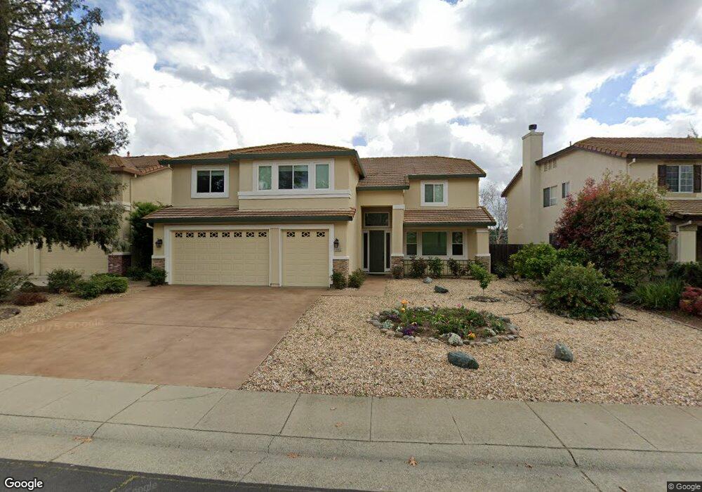
5363 Wesley Rd Rocklin, CA 95765
Stanford Ranch NeighborhoodEstimated Value: $704,000 - $1,025,000
5
Beds
3
Baths
4,004
Sq Ft
$228/Sq Ft
Est. Value
About This Home
This home is located at 5363 Wesley Rd, Rocklin, CA 95765 and is currently estimated at $914,565, approximately $228 per square foot. 5363 Wesley Rd is a home located in Placer County with nearby schools including Breen Elementary, Granite Oaks Middle, and Rocklin High.
Ownership History
Date
Name
Owned For
Owner Type
Purchase Details
Closed on
Oct 21, 2020
Sold by
Suarez Anthony and Suarez Olga Alexandrovna
Bought by
Suarez Anthony and Suarez Olga Alexandrovna
Current Estimated Value
Home Financials for this Owner
Home Financials are based on the most recent Mortgage that was taken out on this home.
Original Mortgage
$389,000
Outstanding Balance
$345,364
Interest Rate
2.8%
Mortgage Type
New Conventional
Estimated Equity
$569,201
Purchase Details
Closed on
Dec 7, 2015
Sold by
Suarez Anthony and Suarez Olga A
Bought by
The Surez 2015 Family Trust
Purchase Details
Closed on
May 1, 1998
Sold by
Lewis Homes Enterprises
Bought by
Suarez Anthony
Home Financials for this Owner
Home Financials are based on the most recent Mortgage that was taken out on this home.
Original Mortgage
$262,600
Interest Rate
7.13%
Create a Home Valuation Report for This Property
The Home Valuation Report is an in-depth analysis detailing your home's value as well as a comparison with similar homes in the area
Home Values in the Area
Average Home Value in this Area
Purchase History
We collect this data history from publicly available records. To have your information removed, we recommend requesting removal directly through your county’s website.
| Date | Buyer | Sale Price | Title Company |
|---|---|---|---|
| Suarez Anthony | -- | Unisource | |
| The Surez 2015 Family Trust | -- | None Available | |
| Suarez Anthony | $272,500 | Placer Title Company |
Source: Public Records
Mortgage History
We collect this data history from publicly available records. To have your information removed, we recommend requesting removal directly through your county’s website.
| Date | Status | Borrower | Loan Amount |
|---|---|---|---|
| Open | Suarez Anthony | $389,000 | |
| Closed | Suarez Anthony | $262,600 |
Source: Public Records
Tax History
| Year | Tax Paid | Tax Assessment Tax Assessment Total Assessment is a certain percentage of the fair market value that is determined by local assessors to be the total taxable value of land and additions on the property. | Land | Improvement |
|---|---|---|---|---|
| 2025 | $5,063 | $459,441 | $176,540 | $282,901 |
| 2023 | $5,063 | $441,602 | $169,686 | $271,916 |
| 2022 | $4,901 | $432,944 | $166,359 | $266,585 |
| 2021 | $4,848 | $424,456 | $163,098 | $261,358 |
| 2020 | $4,841 | $420,105 | $161,426 | $258,679 |
| 2019 | $5,775 | $411,868 | $158,261 | $253,607 |
| 2018 | $7,899 | $403,793 | $155,158 | $248,635 |
| 2017 | $7,875 | $395,876 | $152,116 | $243,760 |
| 2016 | $5,443 | $388,115 | $149,134 | $238,981 |
| 2015 | $5,362 | $382,286 | $146,894 | $235,392 |
| 2014 | $5,803 | $374,798 | $144,017 | $230,781 |
Source: Public Records
Map
Nearby Homes
- 2011 Caleb Ct
- 5503 Darby Rd
- 1801 Talon Rd
- 2308 Stefanie Ct
- 5636 Darby Rd
- 5641 Harvest Rd
- 5312 Delta Dr
- 2431 Carr Ct
- 5324 Brandon Dr
- 5310 Quane Ct
- 1431 Skibbereen Way
- 5624 Saratoga Cir
- 2712 Ashland Ct
- 2412 Galloping Trail Ct
- 2741 Fleet Cir
- 2408 Galloping Trail Ct
- 1402 Skibbereen Way
- 924 Lazy Trail Dr
- 5112 Stratton Ct
- 951 Anvil Cir
Your Personal Tour Guide
Ask me questions while you tour the home.