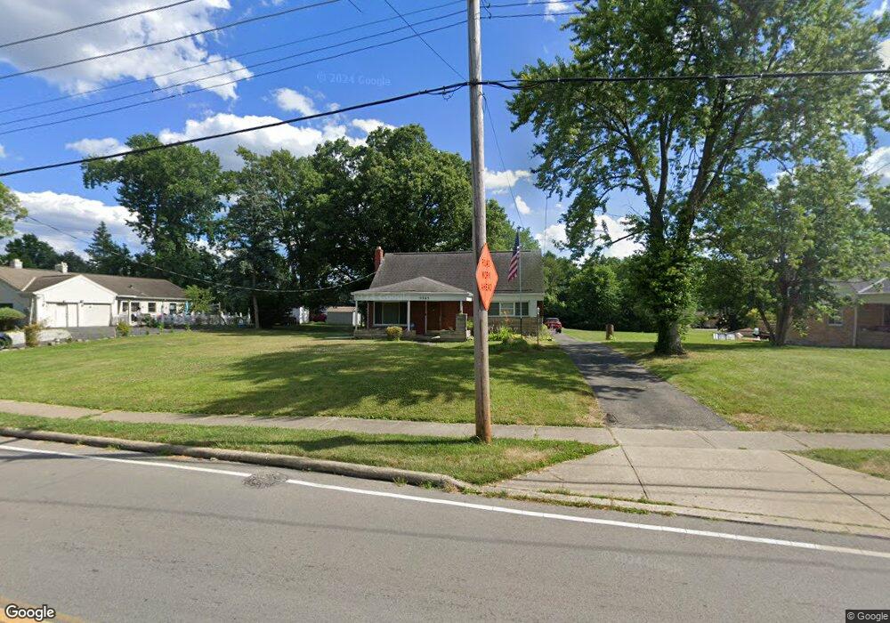
5365 Sidney Rd Cincinnati, OH 45238
Estimated Value: $221,000 - $281,000
3
Beds
1
Bath
1,856
Sq Ft
$133/Sq Ft
Est. Value
About This Home
This home is located at 5365 Sidney Rd, Cincinnati, OH 45238 and is currently estimated at $247,248, approximately $133 per square foot. 5365 Sidney Rd is a home located in Hamilton County with nearby schools including Covedale School, Gilbert A. Dater High School, and Western Hills High School.
Ownership History
Date
Name
Owned For
Owner Type
Purchase Details
Closed on
Oct 9, 2017
Sold by
Hennies Robert T
Bought by
Frimming Lindsey and The Robert T Hennies Keystone Preservati
Current Estimated Value
Purchase Details
Closed on
Nov 10, 2006
Sold by
Roehrig Kenneth P
Bought by
Hennies Robert T and Hennies Carla
Home Financials for this Owner
Home Financials are based on the most recent Mortgage that was taken out on this home.
Original Mortgage
$85,000
Interest Rate
6.41%
Mortgage Type
Purchase Money Mortgage
Purchase Details
Closed on
Aug 16, 2005
Sold by
Poth Rita L
Bought by
Roehrig Kenneth P
Create a Home Valuation Report for This Property
The Home Valuation Report is an in-depth analysis detailing your home's value as well as a comparison with similar homes in the area
Home Values in the Area
Average Home Value in this Area
Purchase History
| Date | Buyer | Sale Price | Title Company |
|---|---|---|---|
| Frimming Lindsey | -- | None Available | |
| Hennies Robert T | $108,600 | Springdale Title Agency Llc | |
| Roehrig Kenneth P | $130,000 | None Available |
Source: Public Records
Mortgage History
| Date | Status | Borrower | Loan Amount |
|---|---|---|---|
| Previous Owner | Hennies Robert T | $85,000 |
Source: Public Records
Tax History
| Year | Tax Paid | Tax Assessment Tax Assessment Total Assessment is a certain percentage of the fair market value that is determined by local assessors to be the total taxable value of land and additions on the property. | Land | Improvement |
|---|---|---|---|---|
| 2025 | $3,746 | $72,100 | $18,725 | $53,375 |
| 2024 | $3,649 | $72,100 | $18,725 | $53,375 |
| 2023 | $3,771 | $72,100 | $18,725 | $53,375 |
| 2022 | $3,247 | $45,217 | $14,994 | $30,223 |
| 2021 | $2,948 | $45,217 | $14,994 | $30,223 |
| 2020 | $2,990 | $45,217 | $14,994 | $30,223 |
| 2019 | $2,967 | $40,373 | $13,388 | $26,985 |
| 2018 | $2,973 | $40,373 | $13,388 | $26,985 |
| 2017 | $2,840 | $40,373 | $13,388 | $26,985 |
| 2016 | $2,788 | $38,900 | $13,773 | $25,127 |
| 2015 | $2,511 | $38,900 | $13,773 | $25,127 |
| 2014 | $2,529 | $38,900 | $13,773 | $25,127 |
| 2013 | $2,475 | $39,295 | $13,913 | $25,382 |
Source: Public Records
Map
Nearby Homes
- 1833 Leona Dr
- 5301 Leon Ct
- 1650 Colonial Dr
- 5461 Bellfield Ln
- 2195 Woodmere Ct
- 2299 Townhill Rd
- 3249 Brater Ave
- 5433 Cleves Warsaw Pike
- 5487 Belcross Ct
- 2026 Bellglade Terrace
- 5005 Western Hills Ave
- 5114 Cleves Warsaw Pike
- 5140 Willnet Dr
- 3141 W Tower Ave
- 3124 Veazey Ave
- 5690 Candlelite Terrace
- 5152 Highview Dr
- 1063 Anderson Ferry Rd
- 4925 Shirley Place
- 1137 Covedale Ave
- 5371 Sidney Rd
- 1871 Anderson Ferry Rd
- 1843 Anderson Ferry Rd
- 5377 Sidney Rd
- 5380 Sidney Rd
- 5383 Sidney Rd
- 1815 Anderson Ferry Rd
- 5350 Laured Place
- 5382 Sidney Rd
- 5356 Laured Place
- 1860 Anderson Ferry Rd
- 1880 Anderson Ferry Rd
- 1840 Anderson Ferry Rd
- 5389 Sidney Rd
- 1940 Faywood Dr
- 5353 Laured Place
- 1820 Anderson Ferry Rd
- 5360 Laured Place
- 1950 Faywood Dr
- 5390 Sidney Rd
Your Personal Tour Guide
Ask me questions while you tour the home.