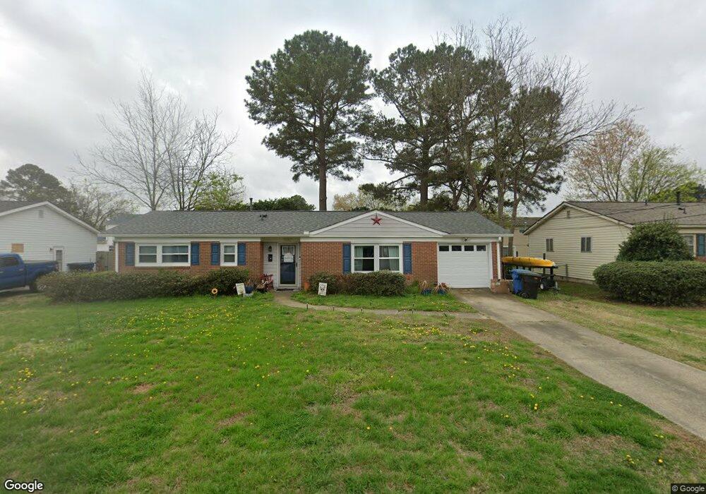
5367 Sir Barton Dr Virginia Beach, VA 23462
Estimated Value: $309,000 - $356,000
3
Beds
2
Baths
1,248
Sq Ft
$263/Sq Ft
Est. Value
About This Home
This home is located at 5367 Sir Barton Dr, Virginia Beach, VA 23462 and is currently estimated at $328,636, approximately $263 per square foot. 5367 Sir Barton Dr is a home located in Virginia Beach City with nearby schools including Arrowhead Elementary School, Larkspur Middle School, and Kempsville High School.
Ownership History
Date
Name
Owned For
Owner Type
Purchase Details
Closed on
Dec 29, 2020
Sold by
Barber Michael Steven and Barber Kenneth Robert
Bought by
Barber Jennifer Louise
Current Estimated Value
Home Financials for this Owner
Home Financials are based on the most recent Mortgage that was taken out on this home.
Original Mortgage
$175,000
Outstanding Balance
$156,627
Interest Rate
3%
Mortgage Type
New Conventional
Estimated Equity
$172,009
Create a Home Valuation Report for This Property
The Home Valuation Report is an in-depth analysis detailing your home's value as well as a comparison with similar homes in the area
Home Values in the Area
Average Home Value in this Area
Purchase History
| Date | Buyer | Sale Price | Title Company |
|---|---|---|---|
| Barber Jennifer Louise | -- | None Available |
Source: Public Records
Mortgage History
| Date | Status | Borrower | Loan Amount |
|---|---|---|---|
| Open | Barber Jennifer Louise | $175,000 |
Source: Public Records
Tax History Compared to Growth
Tax History
| Year | Tax Paid | Tax Assessment Tax Assessment Total Assessment is a certain percentage of the fair market value that is determined by local assessors to be the total taxable value of land and additions on the property. | Land | Improvement |
|---|---|---|---|---|
| 2025 | $2,432 | $270,200 | $136,000 | $134,200 |
| 2024 | $2,432 | $250,700 | $136,000 | $114,700 |
| 2023 | $2,238 | $226,100 | $125,000 | $101,100 |
| 2022 | $2,171 | $219,300 | $120,000 | $99,300 |
| 2021 | $2,073 | $209,400 | $112,000 | $97,400 |
| 2020 | $2,000 | $196,600 | $112,000 | $84,600 |
| 2019 | $1,957 | $190,800 | $110,000 | $80,800 |
| 2018 | $1,913 | $190,800 | $110,000 | $80,800 |
| 2017 | $1,913 | $190,800 | $110,000 | $80,800 |
| 2016 | $1,850 | $186,900 | $110,000 | $76,900 |
| 2015 | $1,859 | $187,800 | $110,000 | $77,800 |
| 2014 | $1,642 | $184,700 | $109,200 | $75,500 |
Source: Public Records
Map
Nearby Homes
- 325 Busher Rd
- 5424 Susquehanna Dr
- 405 Count Fleet Cir
- 5375 Palmyra Ct
- 5213 Rolleston Dr
- 700 Achilles Ct
- 137 S Parliament Dr
- 125 S Parliament Dr
- 685 Lord Dunmore Dr
- 670 Lord Dunmore Dr
- 5448 Todd St
- 5708 Normandy Ave
- 5729 Pontiac Rd
- 5025 Clairmont Ct
- 245 Mannings Ln
- 341 E Chickasaw Rd
- 5015 Dunderdale Ct
- 227 Mannings Ln
- 5002 Glen Canyon Dr
- 5017 Lansglen Ct
- 5371 Sir Barton Dr
- 5363 Sir Barton Dr
- 5336 Bosworth Rd
- 5332 Bosworth Rd
- 5340 Bosworth Rd
- 5366 Sir Barton Dr
- 5359 Sir Barton Dr
- 5375 Sir Barton Dr
- 5362 Sir Barton Dr
- 5370 Sir Barton Dr
- 5328 Bosworth Rd
- 5344 Bosworth Rd
- 5358 Sir Barton Dr
- 5374 Sir Barton Dr
- 5379 Sir Barton Dr
- 5355 Sir Barton Dr
- 5348 Bosworth Rd
- 5324 Bosworth Rd
- 5333 Bosworth Rd
- 5337 Bosworth Rd