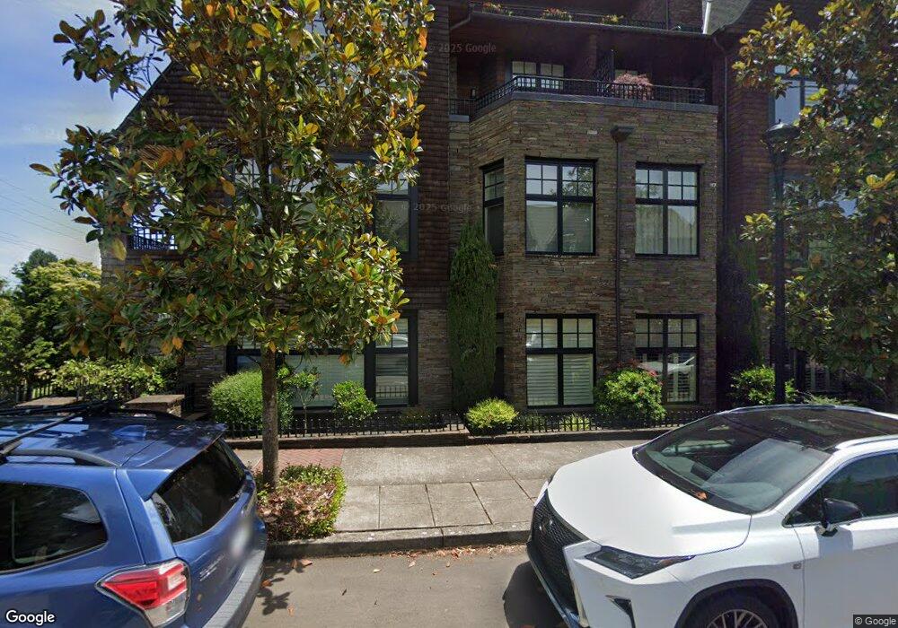
537 2nd St Unit 106 Lake Oswego, OR 97034
Evergreen NeighborhoodEstimated Value: $708,307 - $948,000
2
Beds
2
Baths
1,292
Sq Ft
$652/Sq Ft
Est. Value
About This Home
This home is located at 537 2nd St Unit 106, Lake Oswego, OR 97034 and is currently estimated at $842,436, approximately $652 per square foot. 537 2nd St Unit 106 is a home located in Clackamas County with nearby schools including Forest Hills Elementary School, Lake Oswego Junior High School, and Lake Oswego Senior High School.
Ownership History
Date
Name
Owned For
Owner Type
Purchase Details
Closed on
Feb 23, 2012
Sold by
Freeman Franklin P and Freeman Criswell B
Bought by
Parvaresh Shirley M
Current Estimated Value
Purchase Details
Closed on
Oct 14, 2008
Sold by
555 Second Street Inc
Bought by
Freeman Franklin P and Freemen Criswell B
Home Financials for this Owner
Home Financials are based on the most recent Mortgage that was taken out on this home.
Original Mortgage
$415,348
Interest Rate
6.31%
Mortgage Type
Unknown
Create a Home Valuation Report for This Property
The Home Valuation Report is an in-depth analysis detailing your home's value as well as a comparison with similar homes in the area
Home Values in the Area
Average Home Value in this Area
Purchase History
| Date | Buyer | Sale Price | Title Company |
|---|---|---|---|
| Parvaresh Shirley M | $440,000 | Wfg Title | |
| Freeman Franklin P | $519,185 | Fidelity Natl Title Co Of Or |
Source: Public Records
Mortgage History
| Date | Status | Borrower | Loan Amount |
|---|---|---|---|
| Previous Owner | Freeman Franklin P | $415,348 |
Source: Public Records
Tax History Compared to Growth
Tax History
| Year | Tax Paid | Tax Assessment Tax Assessment Total Assessment is a certain percentage of the fair market value that is determined by local assessors to be the total taxable value of land and additions on the property. | Land | Improvement |
|---|---|---|---|---|
| 2025 | $8,839 | $461,259 | -- | -- |
| 2024 | $8,603 | $447,825 | -- | -- |
| 2023 | $8,603 | $434,782 | $0 | $0 |
| 2022 | $8,103 | $422,119 | $0 | $0 |
| 2021 | $7,483 | $409,825 | $0 | $0 |
| 2020 | $7,295 | $397,889 | $0 | $0 |
| 2019 | $7,115 | $386,300 | $0 | $0 |
| 2018 | $6,766 | $375,049 | $0 | $0 |
| 2017 | $6,529 | $364,125 | $0 | $0 |
| 2016 | $5,943 | $353,519 | $0 | $0 |
| 2015 | $5,742 | $343,222 | $0 | $0 |
| 2014 | $5,422 | $333,225 | $0 | $0 |
Source: Public Records
Map
Nearby Homes
- 575 2nd St Unit 305
- 575 2nd St
- 587 2nd St Unit 403
- 557 2nd St Unit 205
- 557 2nd St
- 539 2nd St
- 559 2nd St
- 559 2nd St Unit 206
- 535 2nd St
- 577 2nd St
- 577 2nd St Unit 306
- 565 2nd St Unit 301
- 555 2nd St
- 585 2nd St Unit 404
- 529 2nd St Unit 103
- 529 2nd St
- 571 2nd St Unit 307
- 551 2nd St Unit 207
- 551 2nd St
- 553 2nd St Unit 208