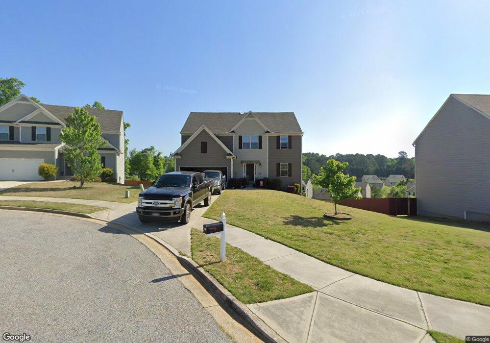
537 Dianne Ct Winder, GA 30680
Estimated Value: $374,944 - $413,000
5
Beds
3
Baths
2,769
Sq Ft
$141/Sq Ft
Est. Value
About This Home
This home is located at 537 Dianne Ct, Winder, GA 30680 and is currently estimated at $390,236, approximately $140 per square foot. 537 Dianne Ct is a home located in Barrow County with nearby schools including Kennedy Elementary School, Westside Middle School, and Apalachee High School.
Ownership History
Date
Name
Owned For
Owner Type
Purchase Details
Closed on
Jul 31, 2017
Sold by
Lgi Homes Georgia Llc
Bought by
Keith Lumpkin
Current Estimated Value
Home Financials for this Owner
Home Financials are based on the most recent Mortgage that was taken out on this home.
Original Mortgage
$220,825
Outstanding Balance
$188,049
Interest Rate
4.75%
Mortgage Type
FHA
Estimated Equity
$202,187
Purchase Details
Closed on
Jun 28, 2012
Sold by
Afb&T A Division Of Synovus B
Bought by
Sutherland Land Llc
Purchase Details
Closed on
Jun 30, 2011
Sold by
Mark I Developers Inc
Bought by
Afb&T A Division Of Synovus Bank
Purchase Details
Closed on
Apr 23, 2004
Sold by
Maynard Jerry M
Bought by
Mark I Developers Inc
Create a Home Valuation Report for This Property
The Home Valuation Report is an in-depth analysis detailing your home's value as well as a comparison with similar homes in the area
Home Values in the Area
Average Home Value in this Area
Purchase History
| Date | Buyer | Sale Price | Title Company |
|---|---|---|---|
| Keith Lumpkin | $224,900 | -- | |
| Lumpkins Keith | $224,900 | -- | |
| Sutherland Land Llc | $2,500 | -- | |
| Afb&T A Division Of Synovus Bank | -- | -- | |
| Mark I Developers Inc | $3,818,800 | -- |
Source: Public Records
Mortgage History
| Date | Status | Borrower | Loan Amount |
|---|---|---|---|
| Open | Lumpkins Keith | $220,825 | |
| Closed | Keith Lumpkin | $220,825 |
Source: Public Records
Tax History Compared to Growth
Tax History
| Year | Tax Paid | Tax Assessment Tax Assessment Total Assessment is a certain percentage of the fair market value that is determined by local assessors to be the total taxable value of land and additions on the property. | Land | Improvement |
|---|---|---|---|---|
| 2024 | $4,308 | $153,411 | $25,600 | $127,811 |
| 2023 | $4,295 | $153,411 | $25,600 | $127,811 |
| 2022 | $3,732 | $111,808 | $20,400 | $91,408 |
| 2021 | $3,562 | $100,128 | $16,000 | $84,128 |
| 2020 | $3,145 | $92,847 | $16,000 | $76,847 |
| 2019 | $3,069 | $89,206 | $16,000 | $73,206 |
| 2018 | $3,061 | $89,206 | $16,000 | $73,206 |
| 2017 | $286 | $9,600 | $9,600 | $0 |
| 2016 | $367 | $9,600 | $9,600 | $0 |
| 2015 | $368 | $9,600 | $9,600 | $0 |
| 2014 | $195 | $4,368 | $4,368 | $0 |
| 2013 | -- | $1,965 | $1,965 | $0 |
Source: Public Records
Map
Nearby Homes
- 536 Dianne Ct
- 1106 Sutherland Dr
- 1053 Sutherland Dr
- 1076 Sutherland Dr
- 812 Castilla Way
- 1048 Sutherland Dr
- 256 Oceanliner Dr
- 252 Oceanliner Dr
- 245 Oceanliner Dr
- 435 Watson Rd
- 29 Lighthouse Dr
- 0 Gordon Ct Unit 10634940
- 0 Gordon Ct Unit 7674399
- 0 Atlanta Hwy SE Unit 10371310
- 211 Brooks Ln
- 328 Advent Dr
- 182 Nativity Cove Unit 30
- 182 Nativity Cove
- 40 Huckleberry Ln
- 120 2nd St
- 535 Dianne Ct
- 539 Dianne Ct
- 1219 Dianne Dr Unit 63 C
- 1219 Dianne Dr
- 1217 Dianne Dr Unit 64 C
- 1217 Dianne Dr
- 541 Dianne Ct
- 533 Dianne Ct
- 1215 Dianne Dr Unit 65 C
- 1215 Dianne Dr
- 531 Dianne Ct
- W Dianne Dr
- 0 Dianne Dr Unit 8391874
- 0 Dianne Dr Unit 8311516
- 0 Dianne Dr Unit 8300575
- 0 Dianne Dr Unit 8432770
- 0 Dianne Dr Unit 8324729
- 0 Dianne Dr Unit 8284388
- 0 Dianne Dr Unit 8256717
- 0 Dianne Dr Unit 8256720