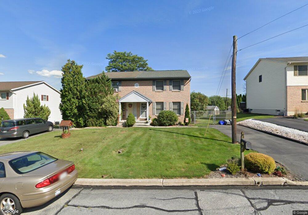
537 Pershing Blvd Reading, PA 19607
Liggett NeighborhoodEstimated Value: $262,000 - $303,317
3
Beds
2
Baths
1,452
Sq Ft
$193/Sq Ft
Est. Value
About This Home
This home is located at 537 Pershing Blvd, Reading, PA 19607 and is currently estimated at $280,329, approximately $193 per square foot. 537 Pershing Blvd is a home located in Berks County with nearby schools including Cumru Elementary School, Governor Mifflin Intermediate School, and Governor Mifflin Middle School.
Ownership History
Date
Name
Owned For
Owner Type
Purchase Details
Closed on
Jun 17, 2004
Sold by
Vankirk Edward E
Bought by
Fishkin Mark and Fishkin Diane
Current Estimated Value
Home Financials for this Owner
Home Financials are based on the most recent Mortgage that was taken out on this home.
Original Mortgage
$94,000
Outstanding Balance
$45,176
Interest Rate
6.3%
Mortgage Type
Purchase Money Mortgage
Estimated Equity
$235,153
Create a Home Valuation Report for This Property
The Home Valuation Report is an in-depth analysis detailing your home's value as well as a comparison with similar homes in the area
Home Values in the Area
Average Home Value in this Area
Purchase History
| Date | Buyer | Sale Price | Title Company |
|---|---|---|---|
| Fishkin Mark | $117,500 | -- |
Source: Public Records
Mortgage History
| Date | Status | Borrower | Loan Amount |
|---|---|---|---|
| Open | Fishkin Mark | $94,000 | |
| Closed | Fishkin Mark | $11,750 |
Source: Public Records
Tax History
| Year | Tax Paid | Tax Assessment Tax Assessment Total Assessment is a certain percentage of the fair market value that is determined by local assessors to be the total taxable value of land and additions on the property. | Land | Improvement |
|---|---|---|---|---|
| 2025 | $1,688 | $94,600 | $28,500 | $66,100 |
| 2024 | $4,353 | $94,600 | $28,500 | $66,100 |
| 2023 | $4,231 | $94,600 | $28,500 | $66,100 |
| 2022 | $4,125 | $94,600 | $28,500 | $66,100 |
| 2021 | $4,043 | $94,600 | $28,500 | $66,100 |
| 2020 | $4,043 | $94,600 | $28,500 | $66,100 |
| 2019 | $3,994 | $94,600 | $28,500 | $66,100 |
| 2018 | $3,922 | $94,600 | $28,500 | $66,100 |
| 2017 | $3,846 | $94,600 | $28,500 | $66,100 |
| 2016 | $1,408 | $94,600 | $28,500 | $66,100 |
| 2015 | $1,408 | $94,600 | $28,500 | $66,100 |
| 2014 | $1,408 | $94,600 | $28,500 | $66,100 |
Source: Public Records
Map
Nearby Homes
- 1432 Liggett Ave
- 1406 Farr Rd
- 1716 Liggett Ave
- 1375 Pershing Blvd Unit 201
- 1375 Pershing Blvd Unit 404
- 1519 Meadowlark Rd
- 1617 Meadowlark Rd
- 311 Lynoak Ave
- 1100 Wyomissing Blvd
- 1504 Old Mill Rd
- 100 Brookline Pz
- 225 Mcclellan St
- 1020 Meade St
- 526 Harding Ave
- 1108 Liberty Ave
- 405 State St
- 204 High Blvd
- 202 Museum Rd
- 964 New Holland Rd
- 1378 Kenhorst Blvd
- 535 Pershing Blvd
- 539 Pershing Blvd
- 533 Pershing Blvd
- 541 Pershing Blvd
- 412 Funston Ave
- 531 Pershing Blvd
- 410 Funston Ave
- 529 Pershing Blvd
- 406 Funston Ave
- 525 Pershing Blvd
- 427 Funston Ave
- 1463 Scott St
- 536 Pershing Blvd
- 523 Pershing Blvd
- 1505 Logan St
- 540 Pershing Blvd
- 532 Pershing Blvd
- 1459 Scott St
- 400 Funston Ave
- 423 Funston Ave
Your Personal Tour Guide
Ask me questions while you tour the home.