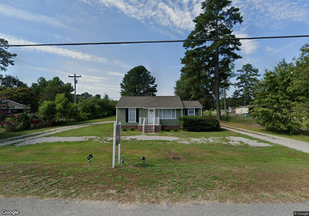
537 W Bobo Newsom Hwy Hartsville, SC 29550
Estimated Value: $145,105
3
Beds
2
Baths
720
Sq Ft
$202/Sq Ft
Est. Value
About This Home
This home is located at 537 W Bobo Newsom Hwy, Hartsville, SC 29550 and is currently estimated at $145,105, approximately $201 per square foot. 537 W Bobo Newsom Hwy is a home located in Darlington County with nearby schools including Darlington County Virtual Academy, Hartsville Middle School, and Hartsville High School.
Ownership History
Date
Name
Owned For
Owner Type
Purchase Details
Closed on
Jun 15, 2017
Sold by
Black Land And Timber Inc
Bought by
Life Adavantage Llc
Current Estimated Value
Home Financials for this Owner
Home Financials are based on the most recent Mortgage that was taken out on this home.
Original Mortgage
$139,200
Outstanding Balance
$115,785
Interest Rate
4.02%
Mortgage Type
Commercial
Estimated Equity
$29,320
Purchase Details
Closed on
Jun 5, 2014
Sold by
Bower Michael P
Bought by
Black Land & Timber Inc
Purchase Details
Closed on
Oct 17, 2012
Sold by
Bobo Newsome Partnership
Bought by
Bower Michael P
Create a Home Valuation Report for This Property
The Home Valuation Report is an in-depth analysis detailing your home's value as well as a comparison with similar homes in the area
Home Values in the Area
Average Home Value in this Area
Purchase History
| Date | Buyer | Sale Price | Title Company |
|---|---|---|---|
| Life Adavantage Llc | $87,000 | None Available | |
| Black Land & Timber Inc | $23,500 | -- | |
| Bower Michael P | $22,000 | -- |
Source: Public Records
Mortgage History
| Date | Status | Borrower | Loan Amount |
|---|---|---|---|
| Open | Life Adavantage Llc | $139,200 |
Source: Public Records
Tax History Compared to Growth
Tax History
| Year | Tax Paid | Tax Assessment Tax Assessment Total Assessment is a certain percentage of the fair market value that is determined by local assessors to be the total taxable value of land and additions on the property. | Land | Improvement |
|---|---|---|---|---|
| 2024 | $603 | $1,580 | $0 | $0 |
| 2023 | $247 | $1,480 | $0 | $0 |
| 2022 | $247 | $1,480 | $0 | $0 |
| 2021 | $247 | $1,480 | $0 | $0 |
| 2020 | $519 | $1,480 | $0 | $0 |
| 2019 | $519 | $1,480 | $0 | $0 |
| 2018 | $500 | $1,410 | $540 | $870 |
| 2017 | $482 | $1,410 | $540 | $870 |
| 2016 | $441 | $1,410 | $540 | $870 |
| 2013 | $478 | $1,260 | $540 | $720 |
Source: Public Records
Map
Nearby Homes
- TBD Larkfield Dr
- 305 Bayview Cir
- TBD Shaw Dr
- 925 Bayberry Cir
- 1319 14th St
- 1923 S 5th St
- 529 Plainview Dr
- TBD Maple Dr
- Lot 32 & 34 Willis Dr
- 412 E Bobo Newsom Hwy
- 1709 Willis Dr
- 1825 Hickorytree Dr
- TBD Washington and 14th St
- 463 Penn Cir
- 1608 S 5th St
- TBD Hickory Tree Dr
- TBD Wingate Dr
- 1013 Miller Terrace
- TBD Birch Dr
- 1203 Martin Luther King Dr
- 535 W Bobo Newsom Hwy
- 531 W Bobo Newsom Hwy
- 612 Birchleaf Dr
- 549 W Bobo Newsom Hwy
- 606 Birchleaf Dr
- 536 W Bobo Newsom Hwy
- 532 W Bobo Newsom Hwy
- 527 W Bobo Newsom Hwy
- 526 W Bobo Newsom Hwy
- 616 Birchleaf Dr
- 609 Birchleaf Dr
- 607 W Bobo Newsom Hwy
- 613 Birchleaf Dr
- 611 Birchleaf Dr
- 2005 Meadow Dr
- 607 Birchleaf Dr
- 603 Birchleaf Dr
- 2007 Meadow Dr
- 2007 Meadow Dr
- 522 W Bobo Newsom Hwy