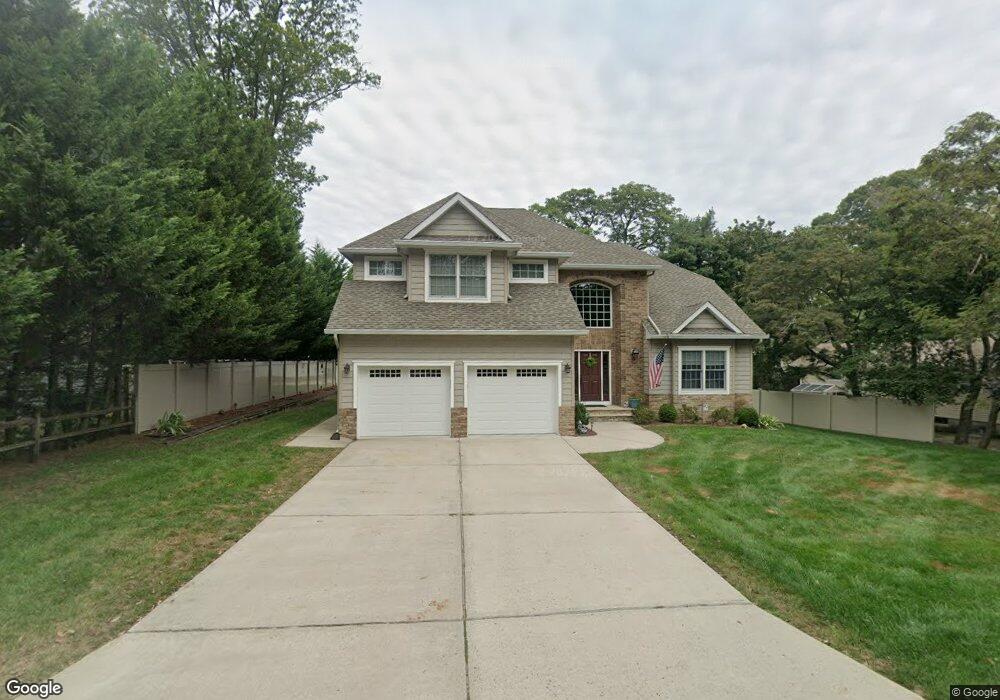
537 W Lincoln Ave Oakhurst, NJ 07755
Estimated Value: $862,000 - $1,497,000
4
Beds
2
Baths
3,182
Sq Ft
$395/Sq Ft
Est. Value
About This Home
This home is located at 537 W Lincoln Ave, Oakhurst, NJ 07755 and is currently estimated at $1,256,230, approximately $394 per square foot. 537 W Lincoln Ave is a home located in Monmouth County with nearby schools including Ocean Township High School, St. Mary of the Assumption School, and Bet Yaakov of the Jersey Shore.
Ownership History
Date
Name
Owned For
Owner Type
Purchase Details
Closed on
Jan 28, 2011
Sold by
Maggio Pasquale and Maggio Antimina
Bought by
Higgins Dana and Higgins Rosanna M
Current Estimated Value
Home Financials for this Owner
Home Financials are based on the most recent Mortgage that was taken out on this home.
Original Mortgage
$244,000
Outstanding Balance
$167,280
Interest Rate
4.82%
Mortgage Type
New Conventional
Estimated Equity
$1,088,950
Purchase Details
Closed on
Nov 21, 2007
Sold by
Allstate Realty Llc
Bought by
Maggio Pasquale and Maggio Antimina
Purchase Details
Closed on
Feb 15, 2006
Sold by
Ruth D Henley Estate
Bought by
Allstate Realty Llc
Create a Home Valuation Report for This Property
The Home Valuation Report is an in-depth analysis detailing your home's value as well as a comparison with similar homes in the area
Home Values in the Area
Average Home Value in this Area
Purchase History
| Date | Buyer | Sale Price | Title Company |
|---|---|---|---|
| Higgins Dana | $305,000 | Westcor Land Title Ins Co | |
| Maggio Pasquale | $225,000 | None Available | |
| Allstate Realty Llc | $115,000 | -- |
Source: Public Records
Mortgage History
| Date | Status | Borrower | Loan Amount |
|---|---|---|---|
| Open | Higgins Dana | $244,000 |
Source: Public Records
Tax History Compared to Growth
Tax History
| Year | Tax Paid | Tax Assessment Tax Assessment Total Assessment is a certain percentage of the fair market value that is determined by local assessors to be the total taxable value of land and additions on the property. | Land | Improvement |
|---|---|---|---|---|
| 2025 | $14,729 | $1,068,400 | $535,600 | $532,800 |
| 2024 | $15,302 | $1,032,900 | $505,900 | $527,000 |
| 2023 | $15,302 | $1,000,800 | $482,700 | $518,100 |
| 2022 | $14,370 | $839,100 | $340,300 | $498,800 |
| 2021 | $14,370 | $731,300 | $311,800 | $419,500 |
| 2020 | $14,612 | $733,900 | $319,400 | $414,500 |
| 2019 | $13,839 | $678,700 | $260,100 | $418,600 |
| 2018 | $12,600 | $601,700 | $198,300 | $403,400 |
| 2017 | $11,977 | $569,500 | $184,100 | $385,400 |
| 2016 | $12,599 | $538,900 | $172,200 | $366,700 |
| 2015 | $12,536 | $542,900 | $181,700 | $361,200 |
| 2014 | $11,916 | $523,100 | $181,700 | $341,400 |
Source: Public Records
Map
Nearby Homes
- 120 Whalepond Rd
- 6 Arlington St
- 156 Belmar Ave
- 452 W Park Ave
- 471 W Park Ave
- 8 Corey Dr
- 82 Larkin Place
- 2025 Lesser Pkwy
- 459 Harnell Ave
- 406 W Park Ave
- 197 Delaware Ave
- 221 Harrison Ave
- 216 Chatham Ave
- 18 Branch Rd
- 7 Wallace Ave
- 421 W Lincoln Ave
- 185 Pinecrest Rd
- 429 Lake Ave
- 227 Chatham Ave
- 1904 Waverly St
- 535 W Lincoln Ave
- 535 W Lincoln Ave Unit SUMMER
- 545 W Lincoln Ave
- 534 Apple Dr
- 533 W Lincoln Ave
- 553 W Lincoln Ave
- 532 Apple Dr
- 536 Apple Dr
- 538 W Lincoln Ave
- 536 W Lincoln Ave
- 531 W Lincoln Ave
- 2 Arlington St
- 3 Arlington St
- 114 Whalepond Rd
- 128 Whalepond Rd
- 555 W Lincoln Ave
- 529 Apple Dr
- 106 Pear St
- 130 Whalepond Rd
- 535 Trenton Ave