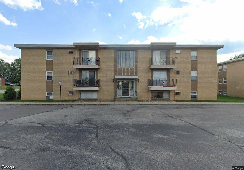
5370 Lee Rd Unit 7 Maple Heights, OH 44137
Estimated Value: $32,000 - $44,434
1
Bed
1
Bath
663
Sq Ft
$56/Sq Ft
Est. Value
About This Home
This home is located at 5370 Lee Rd Unit 7, Maple Heights, OH 44137 and is currently estimated at $37,145, approximately $56 per square foot. 5370 Lee Rd Unit 7 is a home located in Cuyahoga County with nearby schools including Abraham Lincoln Elementary School, Rockside/ J.F. Kennedy School, and Barack Obama School.
Ownership History
Date
Name
Owned For
Owner Type
Purchase Details
Closed on
Aug 10, 2025
Sold by
Maccannon Tammi L and Means Frederick
Bought by
Maccannon Ronald
Current Estimated Value
Purchase Details
Closed on
Jun 22, 2007
Sold by
Maccannon Ronald
Bought by
Maccannon Tammi L
Purchase Details
Closed on
Aug 16, 2006
Sold by
Harris Thomas J and Harris Barbara A
Bought by
Maccannon Ronald and Ivery Tammi
Purchase Details
Closed on
Nov 6, 1989
Bought by
Harris Thomas J
Purchase Details
Closed on
Dec 22, 1982
Bought by
Maple Carriage Partners
Purchase Details
Closed on
Jan 1, 1981
Bought by
Maple Vill Apts Co
Create a Home Valuation Report for This Property
The Home Valuation Report is an in-depth analysis detailing your home's value as well as a comparison with similar homes in the area
Home Values in the Area
Average Home Value in this Area
Purchase History
| Date | Buyer | Sale Price | Title Company |
|---|---|---|---|
| Maccannon Ronald | -- | Ohio Real Title | |
| Maccannon Tammi L | -- | Attorney | |
| Maccannon Ronald | $17,000 | Cuyahoga Valley Title Age | |
| Harris Thomas J | $16,500 | -- | |
| Maple Carriage Partners | -- | -- | |
| Maple Vill Apts Co | -- | -- |
Source: Public Records
Tax History Compared to Growth
Tax History
| Year | Tax Paid | Tax Assessment Tax Assessment Total Assessment is a certain percentage of the fair market value that is determined by local assessors to be the total taxable value of land and additions on the property. | Land | Improvement |
|---|---|---|---|---|
| 2024 | $665 | $6,370 | $630 | $5,740 |
| 2023 | $496 | $4,060 | $420 | $3,640 |
| 2022 | $494 | $4,060 | $420 | $3,640 |
| 2021 | $523 | $4,060 | $420 | $3,640 |
| 2020 | $557 | $4,030 | $420 | $3,610 |
| 2019 | $781 | $11,500 | $1,200 | $10,300 |
| 2018 | $545 | $4,030 | $420 | $3,610 |
| 2017 | $707 | $5,430 | $530 | $4,900 |
| 2016 | $676 | $5,430 | $530 | $4,900 |
| 2015 | $844 | $5,430 | $530 | $4,900 |
| 2014 | $768 | $6,800 | $670 | $6,130 |
Source: Public Records
Map
Nearby Homes
- 5247 Henry St
- 5210 Theodore St
- 15911 Friend Ave
- 5320 Clement Ave
- 17204 Maple Heights Blvd
- 5205 Stanley Ave
- 5606 Jefferson Ave
- 5208 Clement Ave
- 5212 Catherine St
- 5578 Dalewood Ave
- 5570 Dalewood Ave
- 5562 Dalewood Ave
- 5540 Dalewood Ave
- 15095 Granger Rd
- 5425 Grasmere Ave
- 5646 Adams Ave
- 5185 Clement Ave
- 15505 Benhoff Dr
- 5257 Philip Ave
- 5100 Greenhurst Dr
- 5370 Lee Rd Unit 5
- 5370 Lee Rd Unit 53708
- 5370 Lee Rd Unit 2
- 5370 Lee Rd Unit 9
- 5370 Lee Rd Unit 11
- 5370 Lee Rd
- 5370 Lee Rd Unit 12
- 5370 Lee Rd
- 5370 Lee Rd Unit 4
- 5370 Lee Rd Unit 3
- 5370 Lee Rd Unit 6
- 5370 Lee Rd Unit 102
- 5374 Lee Rd
- 5374 Lee Rd Unit 15
- 5374 Lee Rd Unit 19
- 5374 Lee Rd Unit 21
- 5374 Lee Rd Unit 14
- 5374 Lee Rd Unit 13
- 5374 Lee Rd
- 5374 Lee Rd