Estimated Value: $580,000 - $703,000
3
Beds
2
Baths
1,905
Sq Ft
$332/Sq Ft
Est. Value
About This Home
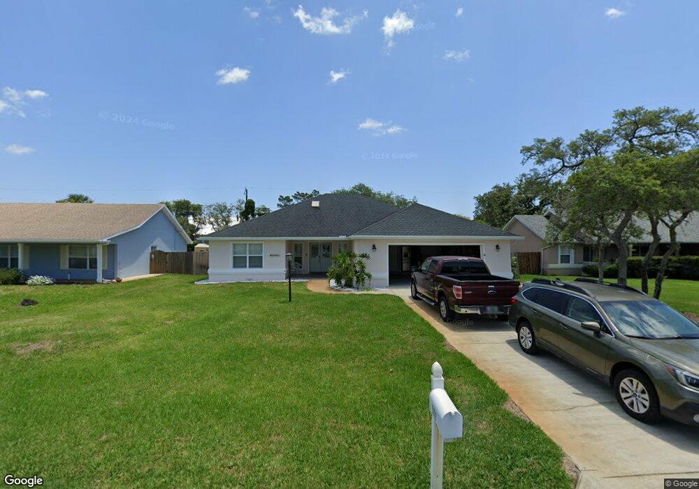
This home is located at 5372 5th St, St. Augustine, FL 32080 and is currently estimated at $633,411, approximately $332 per square foot. 5372 5th St is a home located in St. Johns County with nearby schools including W. Douglas Hartley Elementary School, Gamble Rogers Middle School, and Pedro Menendez High School.
Ownership History
Date
Name
Owned For
Owner Type
Purchase Details
Closed on
Jul 10, 2023
Sold by
Finn Gary W and Finn Sheri L
Bought by
Crayford Forrest J and Crayford Shannon C
Current Estimated Value
Purchase Details
Closed on
Oct 9, 2008
Sold by
Kiser Paul J and Kiser Shannon R
Bought by
Citibank Na
Purchase Details
Closed on
Sep 23, 2005
Sold by
Harshbarger Raymond J and Harshbarger Michele
Bought by
Kiser Paul J and Kiser Shannon R
Home Financials for this Owner
Home Financials are based on the most recent Mortgage that was taken out on this home.
Original Mortgage
$344,000
Interest Rate
7%
Mortgage Type
Stand Alone First
Purchase Details
Closed on
Apr 14, 2000
Sold by
Tadlock Richard J Judith A
Bought by
Harshbarger Raymond J and Harshbarger Michele
Home Financials for this Owner
Home Financials are based on the most recent Mortgage that was taken out on this home.
Original Mortgage
$56,000
Interest Rate
8.12%
Create a Home Valuation Report for This Property
The Home Valuation Report is an in-depth analysis detailing your home's value as well as a comparison with similar homes in the area
Home Values in the Area
Average Home Value in this Area
Purchase History
| Date | Buyer | Sale Price | Title Company |
|---|---|---|---|
| Crayford Forrest J | $555,000 | Landmark Title | |
| Citibank Na | -- | Attorney | |
| Kiser Paul J | $430,000 | Land Title Of America | |
| Harshbarger Raymond J | $187,000 | -- |
Source: Public Records
Mortgage History
| Date | Status | Borrower | Loan Amount |
|---|---|---|---|
| Previous Owner | Kiser Paul J | $344,000 | |
| Previous Owner | Harshbarger Raymond J | $56,000 |
Source: Public Records
Tax History
| Year | Tax Paid | Tax Assessment Tax Assessment Total Assessment is a certain percentage of the fair market value that is determined by local assessors to be the total taxable value of land and additions on the property. | Land | Improvement |
|---|---|---|---|---|
| 2025 | $3,080 | $616,614 | $145,383 | $471,231 |
| 2024 | $3,080 | $566,002 | $145,383 | $420,619 |
| 2023 | $3,080 | $260,988 | $0 | $0 |
| 2022 | $2,988 | $253,386 | $0 | $0 |
| 2021 | $2,966 | $246,006 | $0 | $0 |
| 2020 | $2,955 | $242,609 | $0 | $0 |
| 2019 | $3,007 | $237,154 | $0 | $0 |
| 2018 | $2,971 | $232,732 | $0 | $0 |
| 2017 | $1,976 | $159,954 | $0 | $0 |
| 2016 | $3,037 | $235,405 | $0 | $0 |
| 2015 | $3,082 | $233,769 | $0 | $0 |
| 2014 | $3,092 | $231,914 | $0 | $0 |
Source: Public Records
Map
Nearby Homes
- 311 Micklers Rd
- 327 Micklers Rd
- 240 Micklers Rd
- 5454 2nd St
- 5449 1st St
- 5475 Windantide Rd
- 5467 1st St
- 5461 A1a S
- 5467 A1a S
- 5343 Pelican Way (Lot 11 - North Side)
- 10 Hawaiian Blvd
- 5532 Sunset Landing Cir
- 5201 Medoras Ave
- 5336 Atlantic View
- 140 Pantano Cay Blvd Unit 1103
- 160 Pantano Cay Blvd Unit 3103
- 300 Riverside Blvd
- 5124 Osceola Ave
- 5512 Atlantic View
- 5068 A1a S
Your Personal Tour Guide
Ask me questions while you tour the home.