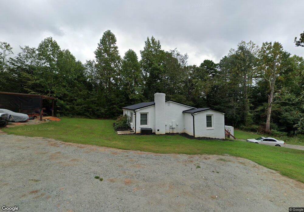
5372 Wilson Dale Way Iron Station, NC 28080
Estimated Value: $127,000 - $312,000
2
Beds
2
Baths
1,086
Sq Ft
$182/Sq Ft
Est. Value
About This Home
This home is located at 5372 Wilson Dale Way, Iron Station, NC 28080 and is currently estimated at $197,293, approximately $181 per square foot. 5372 Wilson Dale Way is a home located in Lincoln County with nearby schools including Iron Station Elementary School, East Lincoln Middle School, and East Lincoln High School.
Ownership History
Date
Name
Owned For
Owner Type
Purchase Details
Closed on
Mar 20, 2020
Sold by
Mcmanus Ruth Noel
Bought by
Kayser Shad and Kayser Jennifer
Current Estimated Value
Purchase Details
Closed on
Jun 24, 2015
Sold by
Austin Steven M
Bought by
Mcmanus Ruth Noel
Home Financials for this Owner
Home Financials are based on the most recent Mortgage that was taken out on this home.
Original Mortgage
$65,200
Interest Rate
4.25%
Mortgage Type
Adjustable Rate Mortgage/ARM
Purchase Details
Closed on
Jul 12, 2011
Sold by
Austin David A
Bought by
Austin Steven M
Create a Home Valuation Report for This Property
The Home Valuation Report is an in-depth analysis detailing your home's value as well as a comparison with similar homes in the area
Home Values in the Area
Average Home Value in this Area
Purchase History
| Date | Buyer | Sale Price | Title Company |
|---|---|---|---|
| Kayser Shad | $87,000 | None Available | |
| Mcmanus Ruth Noel | $64,500 | None Available | |
| Austin Steven M | $29,000 | None Available |
Source: Public Records
Mortgage History
| Date | Status | Borrower | Loan Amount |
|---|---|---|---|
| Previous Owner | Mcmanus Ruth Noel | $65,200 |
Source: Public Records
Tax History Compared to Growth
Tax History
| Year | Tax Paid | Tax Assessment Tax Assessment Total Assessment is a certain percentage of the fair market value that is determined by local assessors to be the total taxable value of land and additions on the property. | Land | Improvement |
|---|---|---|---|---|
| 2025 | $1,057 | $148,199 | $44,408 | $103,791 |
| 2024 | $1,037 | $148,199 | $44,408 | $103,791 |
| 2023 | $1,012 | $148,199 | $44,408 | $103,791 |
| 2022 | $740 | $84,933 | $30,538 | $54,395 |
| 2021 | $740 | $84,933 | $30,538 | $54,395 |
| 2020 | $608 | $84,933 | $30,538 | $54,395 |
| 2019 | $608 | $84,933 | $30,538 | $54,395 |
| 2018 | $656 | $76,277 | $29,038 | $47,239 |
| 2017 | $555 | $76,277 | $29,038 | $47,239 |
| 2016 | $555 | $76,277 | $29,038 | $47,239 |
| 2015 | $630 | $76,277 | $29,038 | $47,239 |
| 2014 | $409 | $46,119 | $29,038 | $17,081 |
Source: Public Records
Map
Nearby Homes
- 1789 Doe Ct
- 1785 Doe Ct
- 0 Oak Park Ct Unit 17
- 1713 Oak Park Ct
- 1615 Oak Park Ct
- 4859 Paysour Pond Rd
- 4435 Cornett Dr
- 0 Wolf Rd Unit 8
- 5039 Penn Rd
- 4394 Mountain Creek Rd
- Lot #42 Sardis Ct
- 6 Hager Mountain Ln
- 5756 Rumfelt Rd
- 5716 Dalmatian St
- 5748 Dalmatian St
- 5756 Dalmatian St
- 0 Lhasa Apso Ln Unit CAR4157960
- 0 Lhasa Apso Ln Unit CAR4157956
- 3323 Sadler Rd
- 0 Mariposa Rd Unit CAR4237549
- 5369 Wilson Dale Way
- 5411 Wilson Dale Way
- 5446 Wilson Dale Way
- 1206 Mount Zion Church Rd
- 1623 Collie Ln
- 1222 Mount Zion Church Rd
- 1282 Mount Zion Church Rd
- 5417 Wilson Dale Way
- 5335 Wilson Dale Way
- 5358 Wilson Dale Way
- 1148 Mount Zion Church Rd
- 1615 Collie Ln
- 5445 Wilson Dale Way
- 1705 Buckler Ln
- 5449 Wilson-Dale Way
- 5449 Wilson Dale Way
- 1217 Mount Zion Church Rd
- 1169 Mount Zion Church Rd
- 1106 Mount Zion Church Rd
- 1243 Mount Zion Church Rd