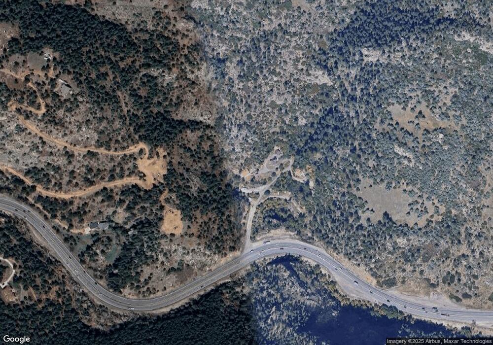
5375 Us Highway 285 Morrison, CO 80465
Estimated Value: $578,000 - $720,000
2
Beds
1
Bath
1,501
Sq Ft
$435/Sq Ft
Est. Value
About This Home
This home is located at 5375 Us Highway 285, Morrison, CO 80465 and is currently estimated at $653,006, approximately $435 per square foot. 5375 Us Highway 285 is a home located in Jefferson County with nearby schools including Red Rocks Elementary School, Carmody Middle School, and Bear Creek High School.
Ownership History
Date
Name
Owned For
Owner Type
Purchase Details
Closed on
Oct 1, 2021
Sold by
Price Robert K
Bought by
Kent Aaron
Current Estimated Value
Home Financials for this Owner
Home Financials are based on the most recent Mortgage that was taken out on this home.
Original Mortgage
$541,500
Outstanding Balance
$493,798
Interest Rate
2.8%
Mortgage Type
New Conventional
Estimated Equity
$159,209
Purchase Details
Closed on
Oct 31, 2003
Sold by
Schwien Kirk and Kanyuk Nancy
Bought by
Price Robert K
Home Financials for this Owner
Home Financials are based on the most recent Mortgage that was taken out on this home.
Original Mortgage
$208,000
Interest Rate
5.96%
Mortgage Type
Purchase Money Mortgage
Create a Home Valuation Report for This Property
The Home Valuation Report is an in-depth analysis detailing your home's value as well as a comparison with similar homes in the area
Home Values in the Area
Average Home Value in this Area
Purchase History
| Date | Buyer | Sale Price | Title Company |
|---|---|---|---|
| Kent Aaron | $570,000 | Chicago Title | |
| Price Robert K | $260,000 | -- |
Source: Public Records
Mortgage History
| Date | Status | Borrower | Loan Amount |
|---|---|---|---|
| Open | Kent Aaron | $541,500 | |
| Previous Owner | Price Robert K | $208,000 | |
| Closed | Price Robert K | $52,000 |
Source: Public Records
Tax History Compared to Growth
Tax History
| Year | Tax Paid | Tax Assessment Tax Assessment Total Assessment is a certain percentage of the fair market value that is determined by local assessors to be the total taxable value of land and additions on the property. | Land | Improvement |
|---|---|---|---|---|
| 2024 | $3,092 | $33,151 | $11,929 | $21,222 |
| 2023 | $3,092 | $33,151 | $11,929 | $21,222 |
| 2022 | $2,320 | $24,405 | $6,368 | $18,037 |
| 2021 | $2,351 | $25,107 | $6,551 | $18,556 |
| 2020 | $2,258 | $23,986 | $7,473 | $16,513 |
| 2019 | $2,228 | $23,986 | $7,473 | $16,513 |
| 2018 | $1,933 | $20,217 | $4,948 | $15,269 |
| 2017 | $1,761 | $20,217 | $4,948 | $15,269 |
| 2016 | $1,621 | $17,428 | $4,334 | $13,094 |
| 2015 | $1,449 | $17,428 | $4,334 | $13,094 |
| 2014 | $1,449 | $14,573 | $3,962 | $10,611 |
Source: Public Records
Map
Nearby Homes
- 5162 Raven Gulch Rd
- 0 Raven Gulch Rd Unit I-3
- 22196 Boar Head Rd
- 5732 Santa Clara Rd
- 5411 Parmalee Gulch Rd
- 5211 Parmalee Gulch Rd
- 5296 Cherokee Rd
- 5150 S Parmalee Gulch Rd
- 4398 Cameyo Rd
- 5253 Giant Gulch Rd
- 20682 Falcon Wing Rd
- 17121 Snow Creek Ln
- 16979 Lost Winding Rd
- 17106 Lost Horse Ln
- 6530 Ridgeview Dr
- 16989 Long Winding Rd
- 16939 Long Winding Rd
- 17186 Lost Horse Ln
- 16601 Red Cliff Cir
- 5272 Adahi Rd
- 5365 Us Highway 285
- 5355 Us Highway 285
- 5445 Us Highway 285
- 5405 Us Highway 285
- 19705 Raven Crest Rd
- 5500 Us Highway 285
- 5425 Us Highway 285
- 5485 Us Highway 285
- 5495 Us Highway 285
- 5928 S Turkey Creek Rd
- 5289 S Algonquin Rd
- 5438 Seminole Rd
- 5449 Seminole Rd
- 5439 Seminole Rd
- 20564 Seminole Rd
- 1760 Waterford Ln
- 20554 Seminole Rd
- 0 S Settlers Dr Unit 4783655
- 0 S Settlers Dr Unit 6376379
- 20656 Seminole Rd
